The 4T Trail: Portland’s Most Unique Urban Hike
Want to hike the 4T Trail in Portland, but not sure what to expect or how to do it? You’re in the right place! We had the same experience, which is why we set out to tackle the trail and write a detailed guide to help you plan your urban hike.
The 4T trail is a unique way to explore Portland. The 4 “T’s” are Trail, tram, trolley (really it’s a streetcar, but that doesn’t fit the theme I guess) and train (it’s more like a tram, but that was already used once). In addition to 4 miles of hiking trails, you’ll combine three forms of public transportation – the Portland Streetcar, the Portland Aerial Tram, and the MAX Light Rail – to form a giant loop around the city.
Now, if we’re being honest, this is not our favorite hike in Portland (if you’re curious what is, head over to our guide to the best hikes in Portland to read more). However, we do think that it’s worth doing because of its unique take on exploring the city, and you’ll get to experience some spectacular views along the way.
In this guide, we’ll start with some logistics – where to start, what direction to go in, how much it costs, etc. – before moving into a play-by-play based on our experience hiking the 4T trail in July 2022.
The intention is to give you some tips and tricks and help you figure out what you’re getting yourself into so that you have the best possible experience traversing Portland on the 4T trail.
Sound good to you? Let’s get into it.
Important Note: The Portland Aerial Tram does not operate on Sundays! Since the tram is an integral part of this loop, we’d recommend NOT doing this trail on a Sunday. Also, on Saturdays, the tram operates until 5:00pm (it goes until 9:30pm on weekdays). More information here.
Disclaimer: Some of the links in this post, like hotel and vacation rental links, are affiliate links, meaning at no additional cost to you we make a little bit of money if you click through and book. That being said, we would absolutely never recommend something to you that we don’t stand behind 100%.
Frequently Asked Questions About the 4T Trail
Before we get into exactly what to expect on the trail, here are a few things to know as you’re planning your urban adventure.
Which Direction Should You Hike It?
We have a fairly strong opinion on this one – we think you should do this trail counter clockwise for a couple of reasons.
First, we think it’s much more pleasant to start your trail section with a hike uphill when you’re fresh, and finish with the (mostly) downhill hike to OHSU. Though, there is a short uphill section right before you arrive at OHSU.
Second, if you do it counterclockwise starting at the Oregon Zoo (which is where you should start if you’re driving), you’ll likely be able to use the same ticket for the streetcar AND the MAX journey (as long as you do them both within 2.5 hours, which is totally doable).
However, it’s worth noting that this isn’t the case if you’re starting in downtown Portland because you won’t be able to complete the MAX and streetcar sections in 2.5 hours, which is the max amount of time a single ticket is valid.
One thing to note – it is no longer free to ride the aerial tram from top to bottom – it costs $5.65 for a round trip ticket, whichever direction you ride it in (there’s no one-way ticket sold, which makes sense when you consider it was built as a form of public transportation to get up to OHSU).
Where to Start and End?
There are nearly infinite places that you could start and end this hike, and it mostly depends on how you’re getting to the starting point. So we’ll break this down into sections about driving and public transportation / on foot.
If You’re Driving to the Start
If you’re driving, we have two options for you. It basically comes down to whether you want an easier parking situation that you have to pay for, or a more limited parking situation that’s free.
Starting at the Oregon Zoo
The first option is to start at the Oregon Zoo, which is a relatively easy place to park, and means you’ll be doing the “Trail” part of the 4T trail first (which is how we prefer to do it). It also happens to be right outside the MAX station in Washington Park, which means you won’t have too much of a journey on the back end.
Parking at the Oregon Zoo will cost you $2 an hour, or $8 for the entire day (plus a $0.10 service fee). It’s free before 9:30am though, so if you get an early start you’ll be able to save a few dollars on parking.
When it comes to paying for parking, you have two options. One is to pay at one of the machines in the parking lot – you’ll need your spot number. Two, and the more advantageous option, is to pay via the Parking Kitty app, which is Portland’s official parking app (which is still funny to us).
Why do we recommend the Parking Kitty app for this particular trail? Because it’s more flexible – you can add time from your phone if you spend more time along the trail than you expected.
If you do decide to pay at the machine, you’ll probably want to go ahead and pay $8 for the whole day so you don’t get into a situation where you run out of time and risk a hefty ticket.
Starting at the Marquam Trail Trailhead
This is a riskier option because it’s a small parking lot that is often full, and has the disadvantage of meaning that you’ll be ending your journey with the bulk of the trail portion. However, it’s free, so if you’re looking to save a few dollars on parking, this is a solid option.
It’s here on Google Maps, and from the parking lot you head up the Shelter Loop Trail for a hot second, and then take your first left onto the Connor Trail, which takes you up to OHSU and the Portland Aerial Tram.
If you decide on this option, we’d recommend getting here pretty early. If the lot is full, you can always drive over to the Oregon Zoo and start from there instead.
If You’re Walking / Taking Public Transportation to the Start
If you don’t have a car, it makes the most sense to start with the MAX ride out to Washington Park.
This does mean that this trail is likely going to cost an extra $2.50, since you won’t be completing the streetcar and MAX sections within 2.5 hours.
You’ll want to buy a TriMet One Day Pass from the machine on the MAX platform, which covers both the MAX and Portland Streetcar sections of the trip.
How Much Does it Cost to Hike the 4T Trail?
There are three costs to consider here, and the total is going to depend on the specifics of how you’re doing it.
Those costs are the Aerial Tram, the MAX / Streetcar, and parking.
Aerial Tram: As of May of 2022, it costs $5.65 to ride the aerial tram. They only sell roundtrip tickets (no discount for only going in one direction), and it is no longer free to ride the tram from top to bottom.
The MAX / Streetcar: There are a couple of different options here, and again, the total cost depends on how you’re doing the loop. A single ticket – good for 2.5 hours from the time of purchase on both the MAX and Portland Streetcar – costs $2.50. If you’re doing the hike starting from the Oregon Zoo, the Streetcar and MAX will happen one after another, which means you’ll be able to use a single ticket to cover both. At the ticket machine, you do need to select the ticket that is good for both the Streetcar and TriMet, which is the organization that operates the buses and MAX Light Rail. If you are starting from downtown Portland, you won’t be able to complete both the Streetcar and MAX legs within 2.5 hours, so you’ll want to buy a day pass for the Streetcar + TriMet system, which will cost $5.
Parking: If you’re driving to the start of the hike and took our advice on parking above, you’ll either pay somewhere between $6 and $8 to park at the Oregon Zoo, or park at the Marquam Trailhead for free (here on Google Maps).
Here’s the total cost, depending on how you’re doing it.
- Driving + Parking at Marquam Trailhead: $5.65 (aerial tram) + $2.50 (Streetcar + MAX) = $8.15 per person.
- Starting in Downtown Portland: $5.65 (aerial tram) + $5 (Streetcar + MAX day pass) = $10.65 per person.
- Parking + Starting at the Oregon Zoo: $5.65 (aerial tram) + $2.50 (Streetcar + MAX) = $8.15 per person, plus $8.10 total for parking.
How Long is the “Trail” (Hiking) Portion?
If you follow this as written below, it’s a hair under 4.5 miles of hiking, with some solid climbs and descents in there.
We’d rate it as a moderate section of trail. There are some parts where you’ll be hiking along the road (or, in one case, on the onramp to the freeway), but most of it is along nice hiking trails.
How Long Will it Take?
We should preface this with the fact that we’re fast hikers by most people’s standards.
That being said, the entire loop took us around four hours. When we were downtown, we stopped for leisurely coffee at Coava for a solid 15-20 minutes.
Plan on an entire half day or so, more if you want to stop in downtown Portland for lunch, coffee, shopping, or whatever else. We’d suggest getting off the Streetcar a few stops early to visit the PSU Farmers Market if it’s a Saturday!
Hiking the 4T Trail in Portland: A Play-by-Play Guide
Now, we’ll get into exactly what to expect when you’re hiking the trail. We found very little information on the internet as we were planning our urban adventure, so we wanted to make sure we put together a thorough guide to help you figure out what this trail is all about.
It should be noted that we’re starting this from the Oregon Zoo (because that’s what we did), but as long as you’re hiking counterclockwise (you should!), the sections are in the correct order regardless of where you start.
Leg 1: Oregon Zoo to Council Crest Park (Trail)
If, like us, you’re starting your journey from the Oregon Zoo, you’ll get the toughest section of trail out of the way first thing.
Before the climb starts, you’ll head out of the zoo parking lot heading south on SW Canyon Road (pro-tip for the entire route: follow the 4T trail signs!), and cross over the freeway – Highway 26 – to the other side.
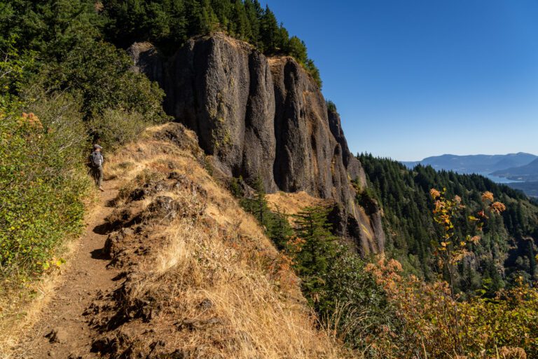
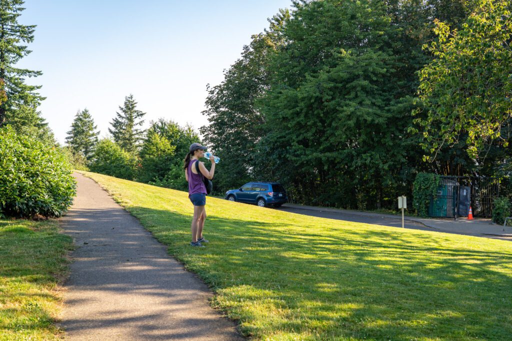
Hang a left, and walk along the onramp like you’re getting onto the freeway. On your right, heading up into the forest, is the Marquam trail. It’s a really odd location, but it is what it is.
Like I said, this is the hardest section of the trail. You’ll climb through the forest, surrounded by trees and, annoyingly, sounds from the busy freeway. Eventually, the trail turns south, and you’ll start to leave the freeway noise behind as you begin to see houses at the top of the gully you’re walking through.
The trail spits you out onto SW Patton Road, and you want to head right. From there, you’ll see a Chevron station.
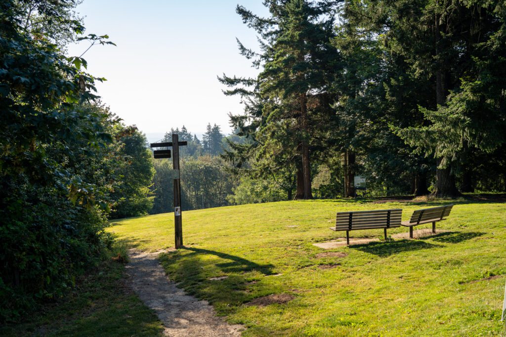
Follow signs for the 4T trail and turn left here on SW Talbot Road (at the Chevron), which you’ll follow for a bit before reaching a fork in the road. Take the trail into the woods straight ahead – not any of the paved roads – and start up the Council Crest Trail to the summit, which is another quarter of a mile or so of climbing.
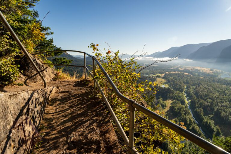
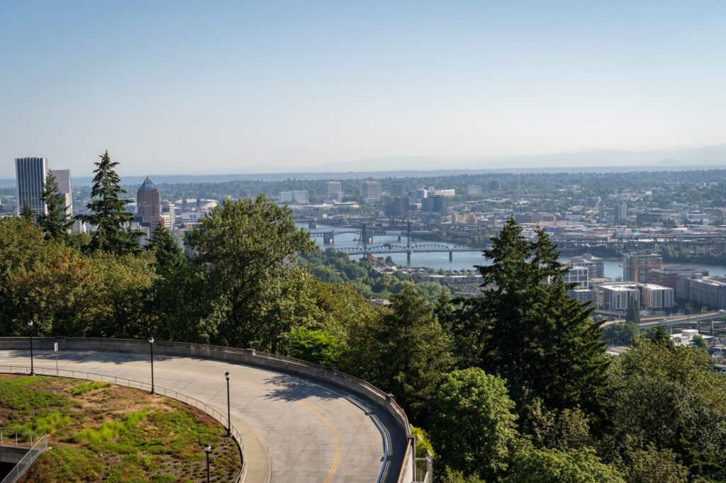
Et voila! You’ve both completed the hardest part of the hike AND reached one of our favorite views in Portland!
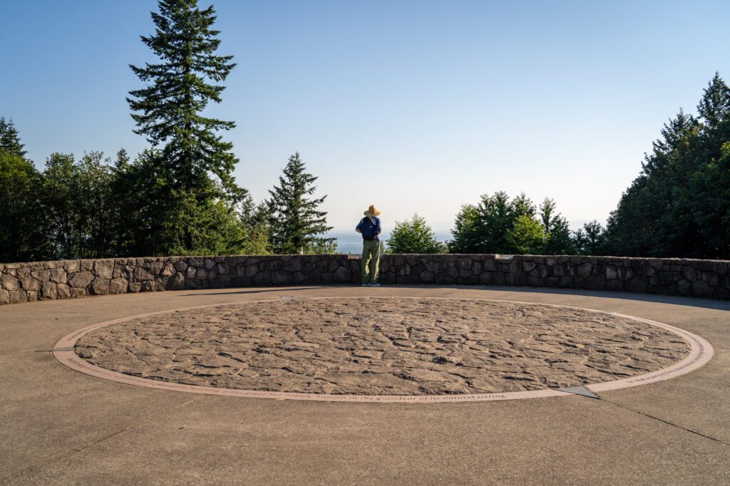
You’ll notice the red and white tower – which you can see from the zoo where you start the hike – and the steel water tower here. But the highlight is undoubtedly the views to the north and east.
On a good day you can see at least three peaks – St. Helens, Adams, and Hood – from the top (and occasionally five, with Rainier and Jefferson joining the fun).
When we actually did this hike, it was very, very hazy, so no mountains in sight. Also, if you’re here early in the day, you’ll be looking directly into the sun if you’re looking east towards Mount Hood.
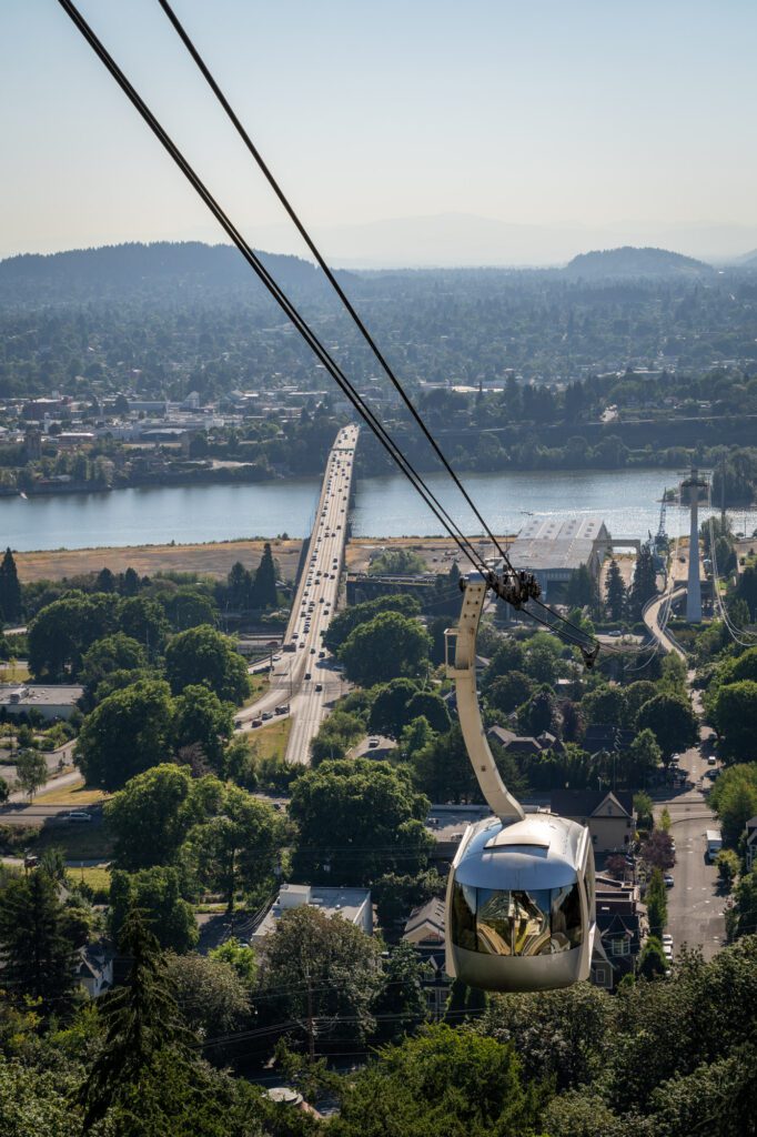
Leg 2: Council Crest to OHSU + Aerial Tram (Trail + Tram)
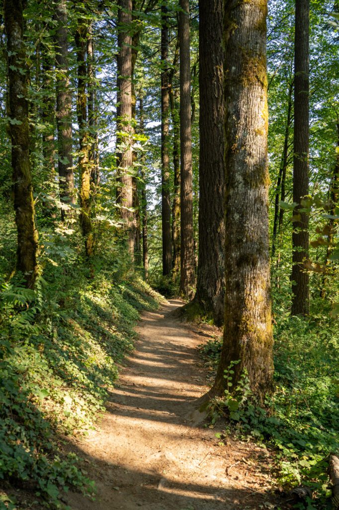
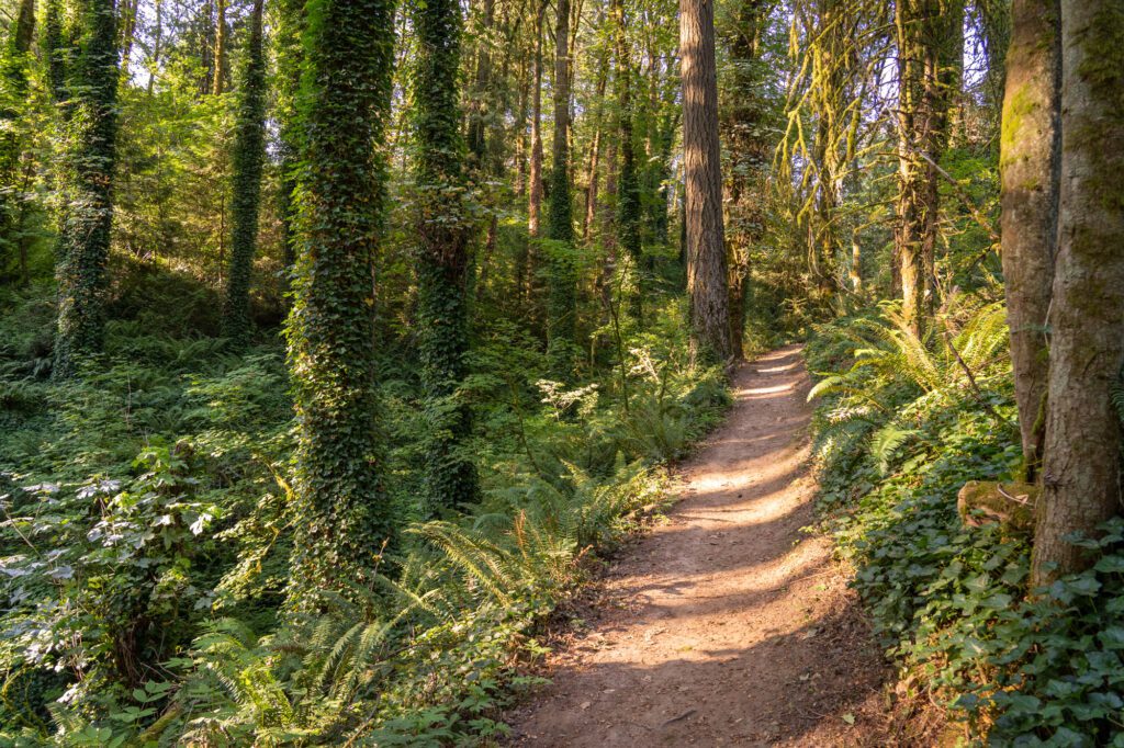
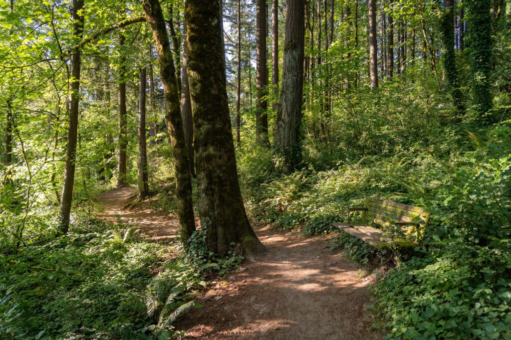
From Council Crest, you’ll hike down, down, down the Marquam Trail to the Marquam Trailhead, and then tackle a quick uphill section that ends at the Oregon Health & Science University (OHSU) campus, which is where you’ll find the aerial tram.
The trail descends through a dense, ferny forest. You’re essentially traversing a gully between the upscale neighborhoods up in the hills southwest of downtown Portland.
From Council Crest, find the view of Mount Hood, which is where you’ll see signage for the Marquam Trail. Follow the Marquam trail (and signs for the 4T trail), cross both SW Greenway Avenue and then SW Fairmount Boulevard in relatively quick succession, and enter the forest.
For what it’s worth, this was our favorite section of the hike.
You’ll hike through Marquam Nature Park, and eventually reach the trailhead / parking area, where there’s a bathroom. There are also bathrooms you can use at OHSU, if you’re able to wait and want to avoid a potentially pretty gross pit toilet.
From there, you’ll hop on the Shelter Loop Trail for a hot second, then take the first left to get on the Connor Trail. It’s 0.6 miles of climbing up to the OHSU campus, where you’ll find the aerial tram stop.
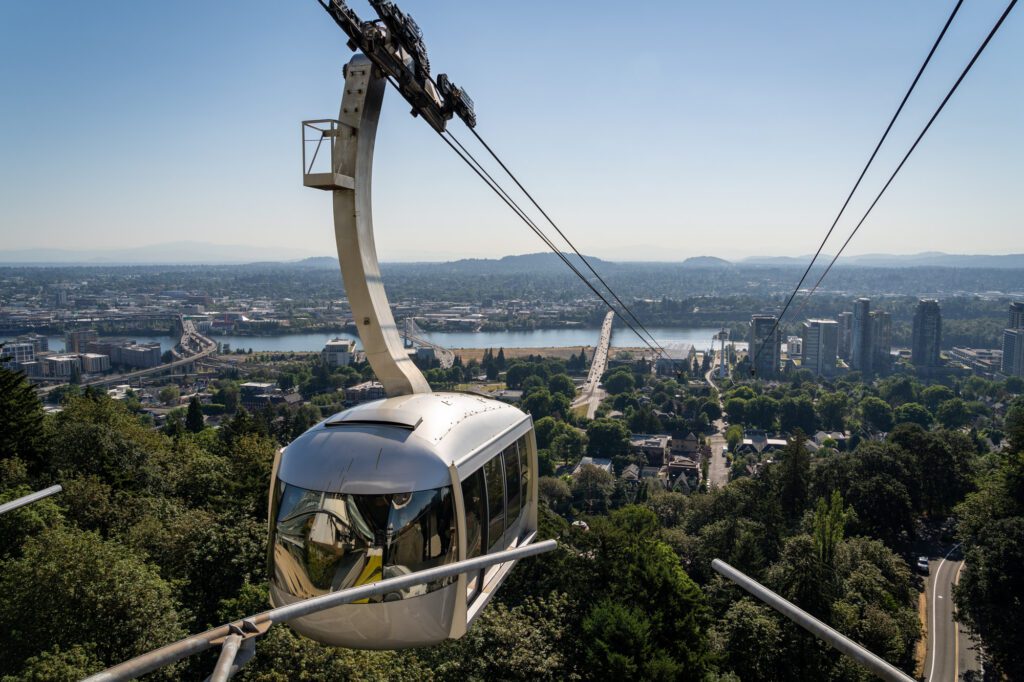
The aerial tram is a legitimate form of public transportation, particularly for OHSU patients and employees. 80%+ of riders are affiliated with OHSU.
However, as you’ll soon learn, it’s also a fun three minute ride, and the views from the top platform are pretty spectacular.
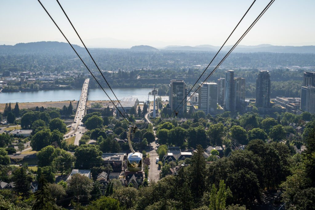
To buy tickets as a tourist, you’ll walk out onto the platform and turn left to find the ticketing machines. They’re pretty simple – you want a round trip ticket (they don’t sell one way tickets), which will cost $5.65. It’ll spit out a ticket with a QR code on it, which you’ll scan at the entry gates and wait for a car to arrive. They come every 5-10 minutes or so.
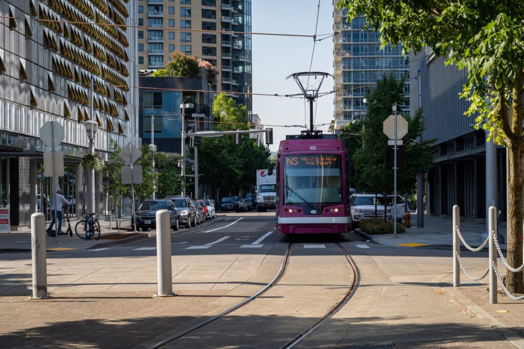
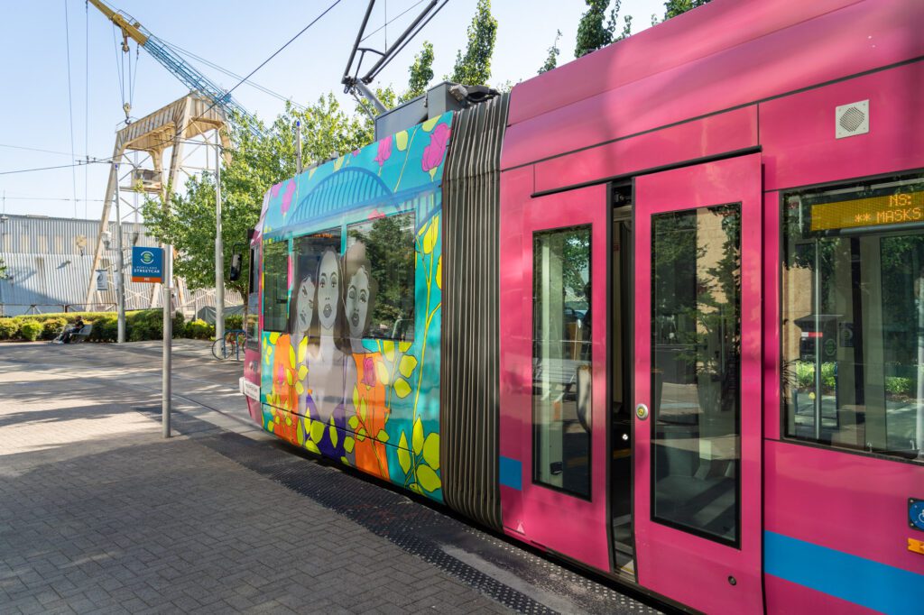
Leg 3: South Waterfront to Downtown (Portland Streetcar)

Once you’ve reached the base of the Aerial Tram, it’s time for the Portland Streetcar.
DO NOT LISTEN TO GOOGLE MAPS HERE. There’s a Streetcar stop right at the base of the tram – about 50 feet south (here on, ironically, Google Maps). For whatever reason, Google can’t figure out that instead of walking north to the next stop from the base of the tram, you could just hop on here.
You want the NS line, heading north towards downtown.


We’d recommend getting off the Streetcar at the Art Museum stop, and walking through downtown from there to the MAX line at 10th and Morrison. Walk along SW Broadway, and along the way you’ll pass the famous Portland sign on the Arlene Schnitzer Concert Hall and Pioneer Courthouse Square.
There are a few places to consider stopping for coffee or food along this section:
- Blue Star Donuts: There’s a Blue Star, Portland’s bougiest donut (and also one of its tastiest) in the South Waterfront area, just a couple of blocks south of the Aerial Tram base at the bottom. If you’re craving a well-earned snack after a morning of hiking, this is a good option!
- The PSU Farmers Market: If you happen to be doing this early on a Saturday, we highly, highly recommend getting off the Streetcar at SW Park & Market to go to the best farmers market in Portland. It’s MASSIVE, and has a bunch of great food vendors in addition to a staggering bounty of farm-fresh produce. Saturdays only, 8:30am – 2:00pm (starts at 9:00am in the winter / early spring).
- Coava Coffee: One of our favorite coffee shops in Portland! Whether you’re into single origin beans brewed to order, or you just want a solid latte or cappuccino, Coava is a great place to go. We actually stopped here for coffee along our route!
- Fried Egg I’m in Love: A Portland food cart staple known for their creatively-named breakfast sandwiches (the “Yolko Ono” is the flagship sandwich, with pesto, egg, sausage, and toasted sourdough), there’s almost always a line at the location on Pioneer Courthouse Square.
Leg 4: Downtown to the Oregon Zoo (MAX Light Rail)
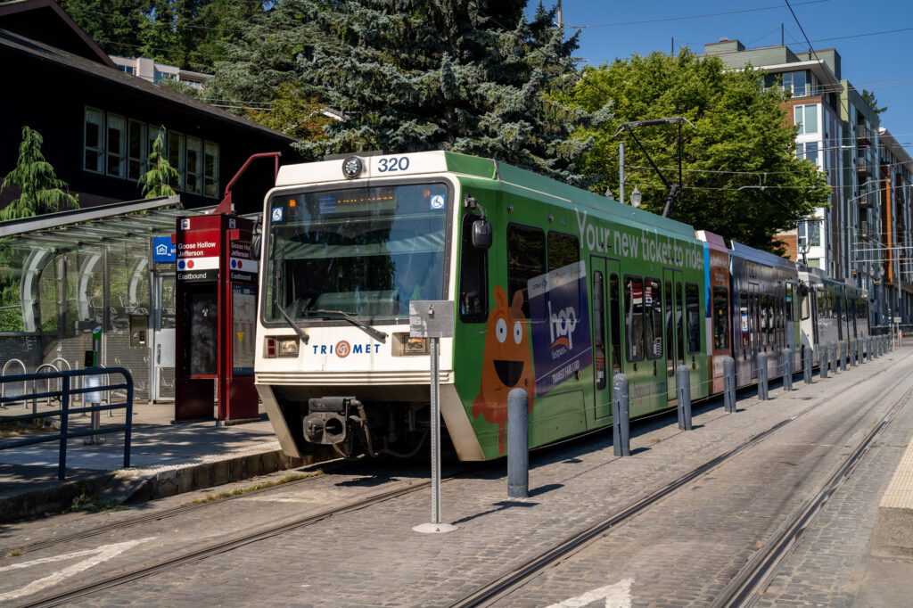
This one is easy! After you’re done downtown (you could also stop here for a few hours and do the whole Powell’s thing if you wanted) catch the MAX from 10th and Morrisson (here on Google Maps) heading west towards Beaverton. You can take either the Red Line, or the Blue Line. Basically whichever shows up first.
If your Streetcar ticket is still valid (you need to complete the ride within the 2.5 hour timeframe), then you’re good to go! Otherwise, you’ll need to buy a single ride ticket (one per rider) at the fare machine on the platform BEFORE you board the tram. Tickets ARE NOT sold onboard the trams.
Get off at the Washington Park stop, and follow signs for the Oregon Zoo. The tunnel that the MAX runs through – called the Robertson Tunnel – is DEEP. The station at Washington Park is 259 feet below the ground, which makes it the deepest subway station in the country, and the fifth deepest in the world.
Needless to say, there are no stairs here. You’ll need to take the elevator to get to the street level.
YOU MIGHT ALSO LIKE
- PORTLAND: How to Plan an Amazing Portland Itinerary (1, 2, or 3 Days)
- PORTLAND: How to Spend One Incredible Day in Portland, Oregon
- PORTLAND: This is Where to Stay in Portland According to 2 Locals
- PORTLAND: A Perfect Weekend Itinerary for Portland, Oregon
- PORTLAND: 21 Incredible Hikes near Portland: A Complete Guide to Hiking in Portland
- PORTLAND: 7 Amazing Day Trips from Portland, Oregon
- PORTLAND: Where to Find the Best Coffee in Portland (According to a Local Coffee Enthusiast)