The Incredible Sleeping Beauty Trail: A Complete Trail Guide
This trail is nothing short of amazing, and the view of Mount Adams at the top of the steep climb is the best vista of the mountain that we’ve ever personally taken in. If this trail was within 45 minutes of either Portland or the I-5 corridor, it would be packed every single weekend in the summertime. But the extra driving distance from Portland means that it’s relatively less busy than closer trails with similar payoffs.
That’s not to say it’s not a popular hike, just that the scale is different from hikes at Mount Hood or in the Columbia River Gorge, which often average hundreds of hikers per weekend in the summer.
We think the extra bit of driving to get here is worth it, though it’s an even better option if you’re spending some time in Hood River (and it makes our list of the best hikes near Hood River), because you’ll have cut the drive time in half.
We want to make this clear up front – this is a very steep hike. You’ll climb 1,350 feet over the course of 1.2 miles to get to the views we’re talking about. But we think it’s worth it, and we’d absolutely do it again.
In this guide, we’ll go through everything we think you need to know before you tackle the Sleeping Beauty Trail. We’ll start with the basic trail details, cover some things to know before you get to the trailhead (like what pass you need), and talk about getting to the trailhead.
Then, after a brief trail report based on our experience (with plenty of pictures), you’ll be ready to get out there yourself!
Disclaimer: Some of the links in this post, like hotel and vacation rental links, are affiliate links, meaning at no additional cost to you we make a little bit of money if you click through and book. That being said, we would absolutely never recommend something to you that we don’t stand behind 100%.
Sleeping Beauty: Hike Details
- Length: 2.4 miles
- Elevation Gain: 1,350 feet
- Trail Type: Out and Back
- Season: Summer – Fall (July – October)
- Difficulty: Difficult
- Trailhead Location: Sleeping Beauty Trailhead
- Dog Friendly: Yes, on a leash
- Pass Required: NW Forest Pass (or America the Beautiful Pass)
Things to Know Before You Hike Sleeping Beauty Mountain
Here are a few things to keep in mind before your hike.
This trail is in the Mount Adams Ranger District within Gifford Pinchot National Forest, which means you’re going to need to display a federal recreation pass at the trailhead. You’ll either need a Northwest Forest Pass or an America the Beautiful Pass. There are no facilities to purchase a day pass at the trailhead, though you can get a Northwest Forest Pass at the Mount Adams Ranger Station in Trout Lake (only open Mon-Sat, 8:00am-12:00pm and 1:00pm-4:30pm).
There is no bathroom at the trailhead. Go before you arrive! Again, the ranger station is a good option for that too.
This hike is steep and rocky in places. There are two pieces of equipment that are going to be your best friend here – a good pair of hiking boots (Alysha has a pair of Columbia Newton Ridge boots that she loves and highly recommends, especially for the price) and a pair of trekking poles (we both have these poles from REI). Believe us – you’ll be glad you have them for the steep ascent and descent!
Get an early start to have this trail to yourself. Because of where this trail is located, it gets less traffic than other hikes with similar views closer to either the I-5 corridor or the Gorge. And that traffic tends to come a little later, too, since it takes 90 minutes to get here from the nearest urban center (Portland). We started at 9:30am and had the trail all to ourselves (we saw two people on the way up, and about ten on the way down). We even sat up at the top for half an hour, and nobody joined us.
Getting to the Trailhead
This hike is a little far from pretty much everything. It’s out past Trout Lake on the Washington side of the Gorge at the foot of Mount Adams.
Coming from Portland or the Gorge, you’ll need to get yourself over to Highway 141, which runs up through the town of White Salmon. It’s a pretty drive, especially as you get out into the more rural areas where you’ll start to get some nice views of Adams.
You’ll pass through Trout Lake, which has a grocery store with some good lunch options, and a taco truck that was recommended to us by the place we stayed in White Salmon, and follow 141 out of town.
If you have questions, you’ll pass the Mount Adams ranger station right after you leave town.
From there, you’ll hop on Trout Creek Road and then the forest roads begin. In general, the forest roads were well maintained and free of major potholed sections (with one exception, noted below), but I wouldn’t be surprised if it’s muddy and has downed trees earlier in the season.
There are two things to note here about the road up to the trailhead.
The first is that there’s one piece of the drive on the forest road where the road splits and it’s a little confusing which direction you’re supposed to go. Here’s the bend in the road we’re talking about. Stay right, and continue on forest road 8810! For what it’s worth, Google Maps navigated us to the trailhead without issue.
The second thing to know is that immediately before reaching the trailhead, the road gets a little rough. It’s a very short section, but it’s potholed and washed out, and will be a little bumpy. That being said, we saw a Honda Civic and a BMW (brave!) at the trailhead, so it should be fine for most passenger cars.
The Sleeping Beauty Trail: A Quick Trail Report + Pictures
This hike is BRUTAL. You might be looking at the relatively short distance and say “yeah, no problem!” But let us tell you that climbing nearly 1,400 feet in just over a mile is absolutely not a “no problem” situation.
For reference, anything over about 500 feet gained per mile is pretty intense, and this hike clocks in at 1,166 feet of elevation gain per mile.
However, all that said, the effort is absolutely worth it. We just want to make sure you know what you’re getting yourself into.
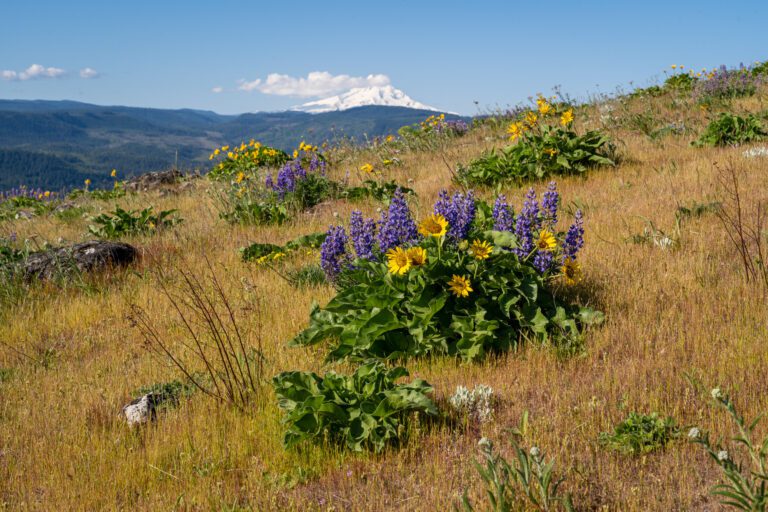
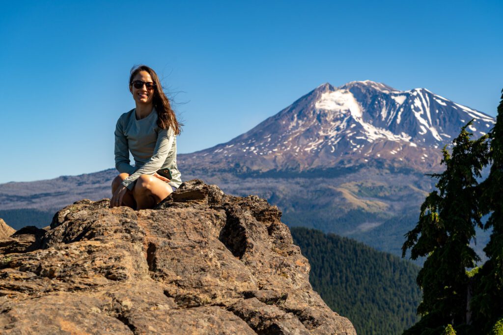
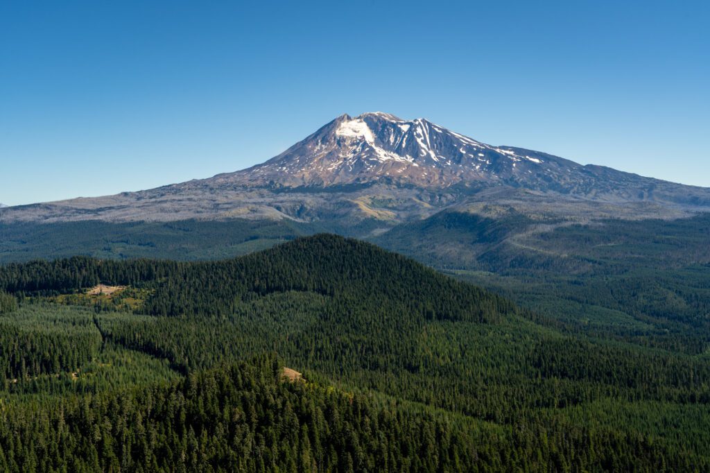
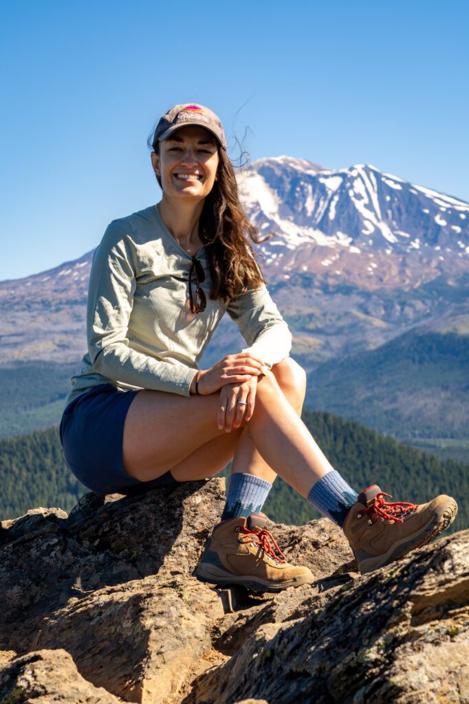
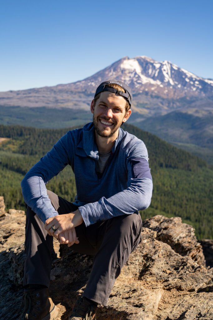
From the rocky outcropping at the top of that climb, you’ll have an absolutely spectacular view – at least on a clear day – of the four prominent peaks in this stretch of the Cascades, including an up-close-and-personal view of Mount Adams. Plus, a nice view of the Trout Lake Valley sprawling out to the southeast.
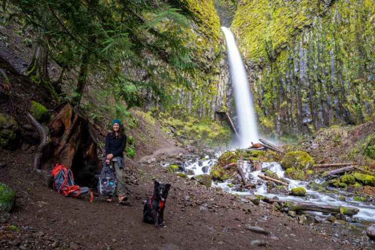
We were lucky enough to sit up there for about half an hour, and we had the view all to ourselves. Unfortunately, we did not see any mountain goats while we were up there, but we learned that they sometimes make an appearance on the rocky terrain at the top.
Now, let’s talk about the trail.
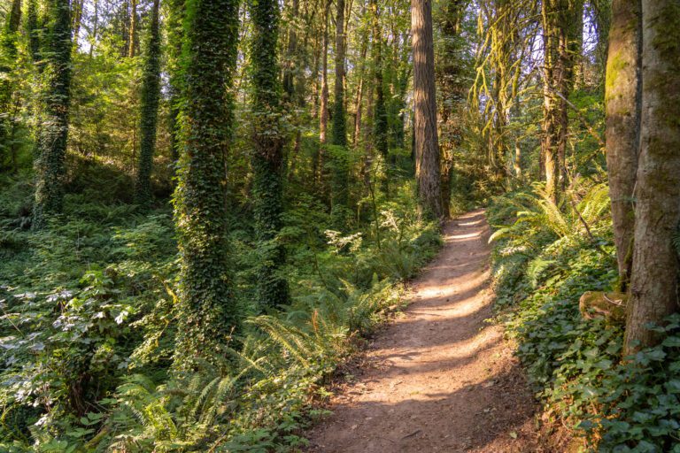
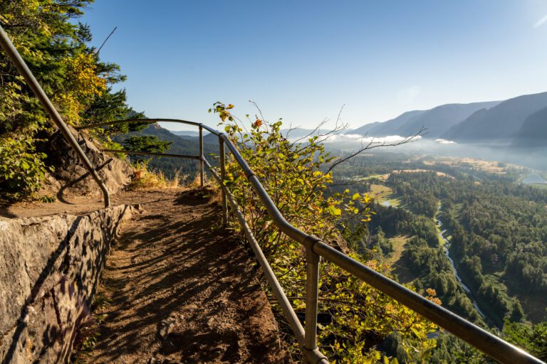
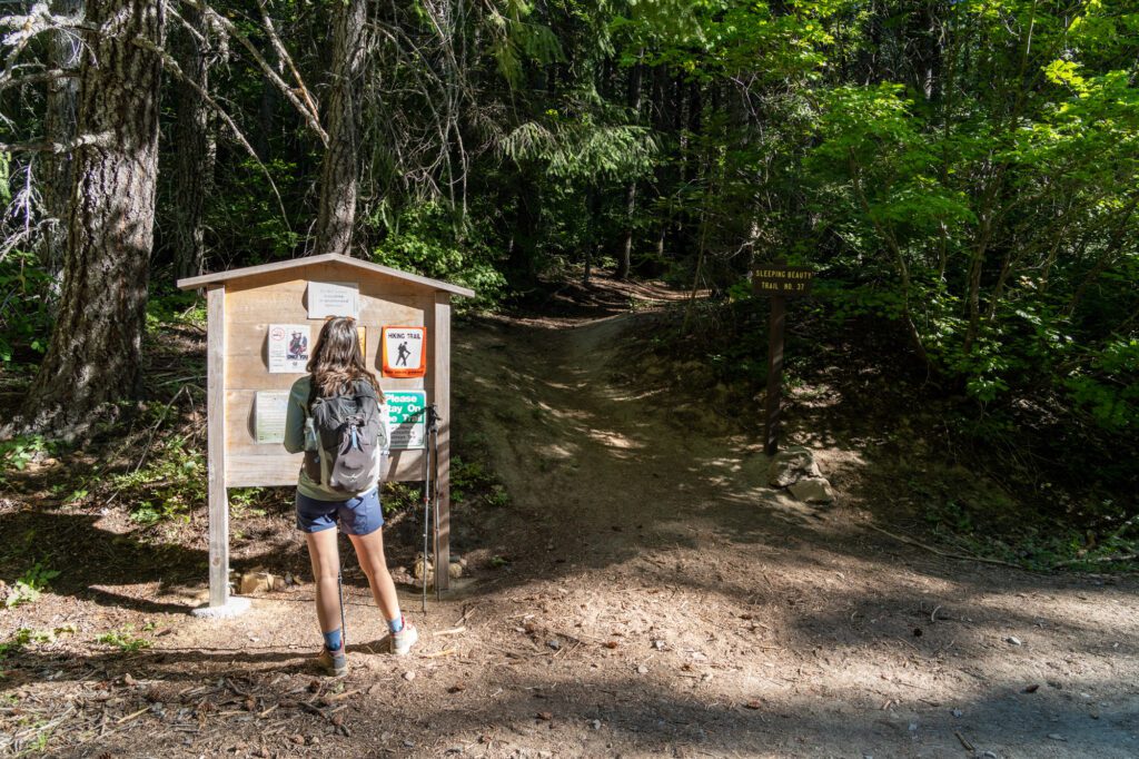
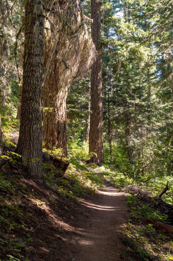
Immediately as you leave the parking area at the trailhead, the trail enters the forest and begins to climb rather aggressively. And, to be completely honest, that’s the story for the entire first mile of the hike, which is a steep climb through the forest. There are no switchbacks, which means it’s a steep grade.

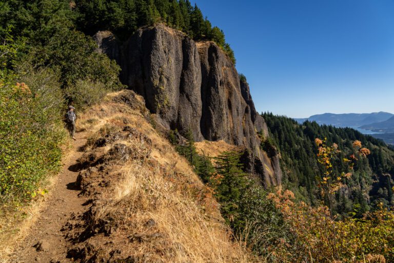
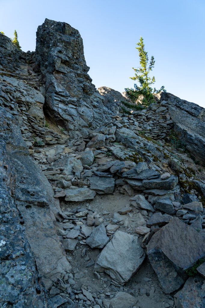
At the 1 mile mark, you’ll emerge from the forest and get your first real taste of what’s waiting for you at the top. To be completely honest, we thought this WAS the top, and spent a minute or two huffing and puffing, desperately trying to catch our breath as we enjoyed the view.
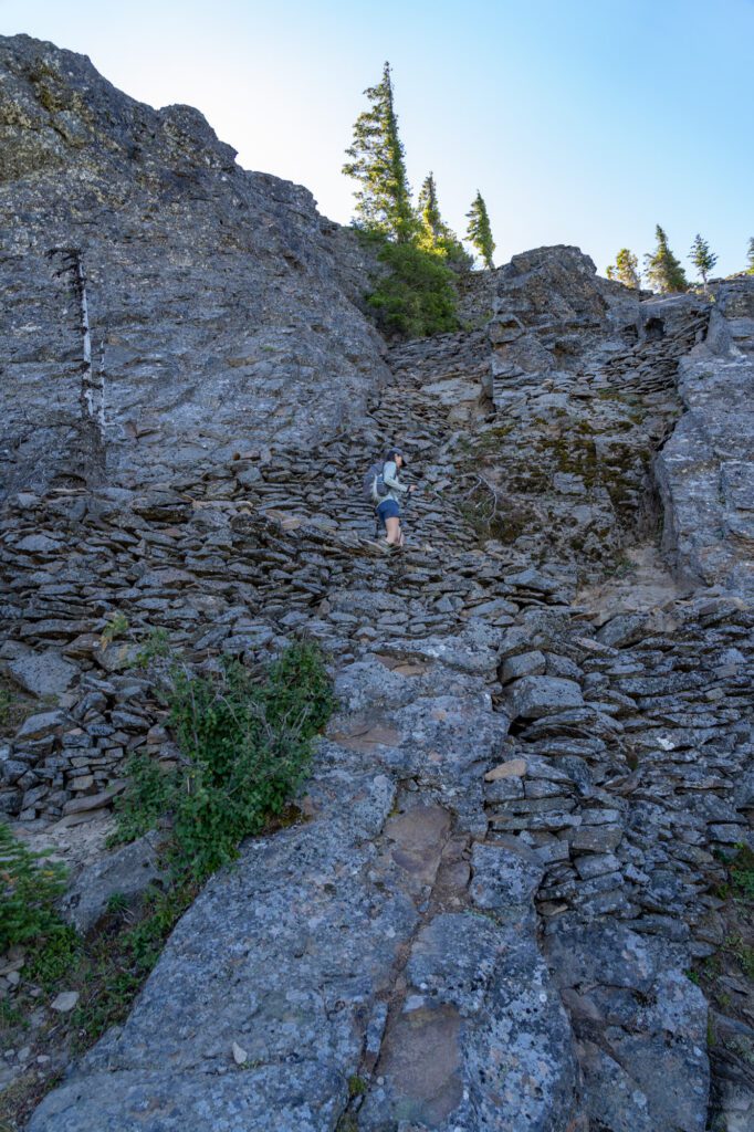
However, this view, while great, is not as good as it gets. Behind you, you’ll find a rocky outcropping with a steep set of switchbacks waiting for you.
It feels very quick compared to the first mile of the hike, and when you reach the top, you’ll have that amazing view waiting for you. The best view is to the left when you get to the top, we think.
Let’s do a 360 degree look at what awaits you.
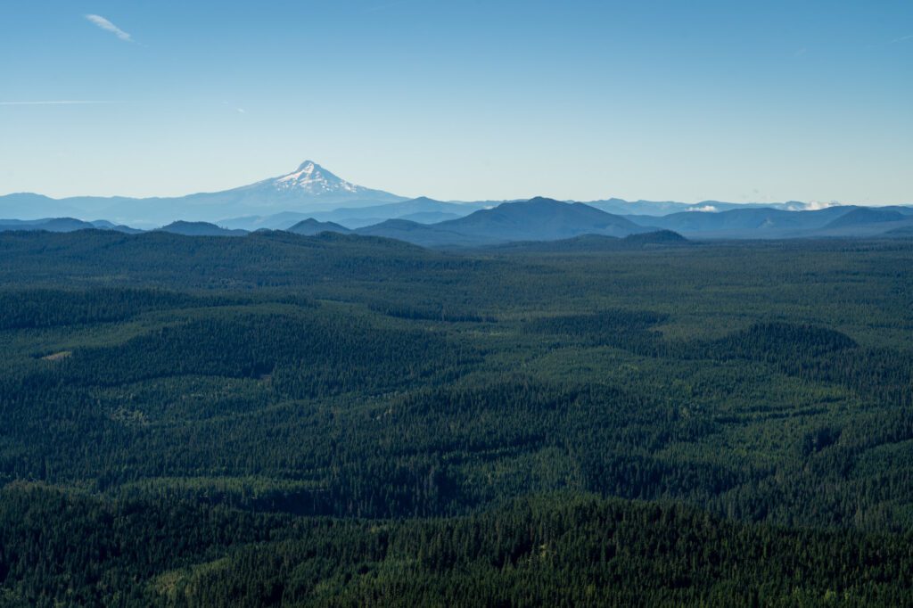
To the south is the Trout Lake Valley. You can see the road you came in on, a neverending stretch of forest, and Mount Hood in the distance.
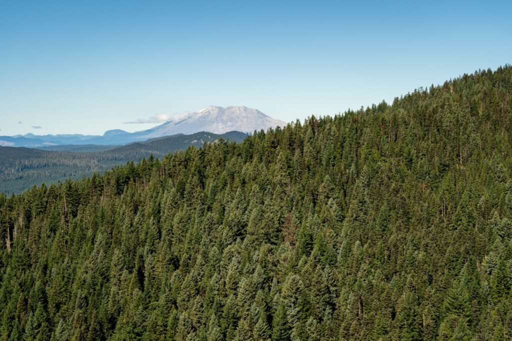
To the west is a partially obscured view of Mount St. Helens behind a ridge. And the site of an old fire lookout, which was removed 50 years ago. You can still see pieces of the foundation, though, like the concrete feet.
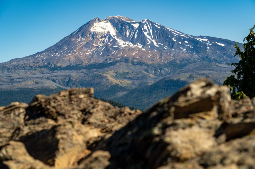
To the north is another partially obscured view – this time of Mount Rainier – and the main attraction, a spectacular view of Mount Adam’s southern face. If you look closely, you can see a meadow at the base of Adams that looks like perfect black bear and elk territory.
From there, you’ll head back down the trail the way you came. It’s a quick, steep descent back to the trailhead, and this is the part where those hiking poles are going to come in handy to save your knees.