Hiking the Coyote Wall Trail: Everything You Need to Know
We’ve become a little bit obsessed with the Washington side of the Columbia River Gorge (which, while technically not in Oregon, is close enough to fit under the purview of this site). While it is full of great hikes with sweeping views up and down the Gorge like Dog Mountain and Hamilton Mountain, it also happens to be THE place to go to see wildflowers in the spring and early summer.
The Coyote Wall Trail – which is further into the Gorge than the more popular Columbia River Gorge hikes but is worth the journey – has both.
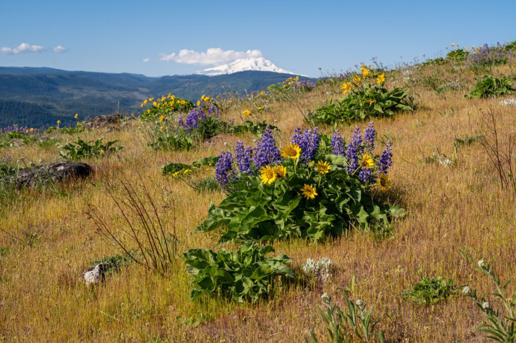
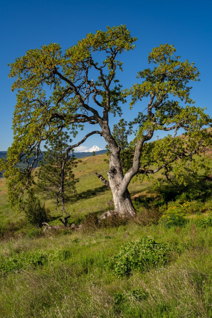
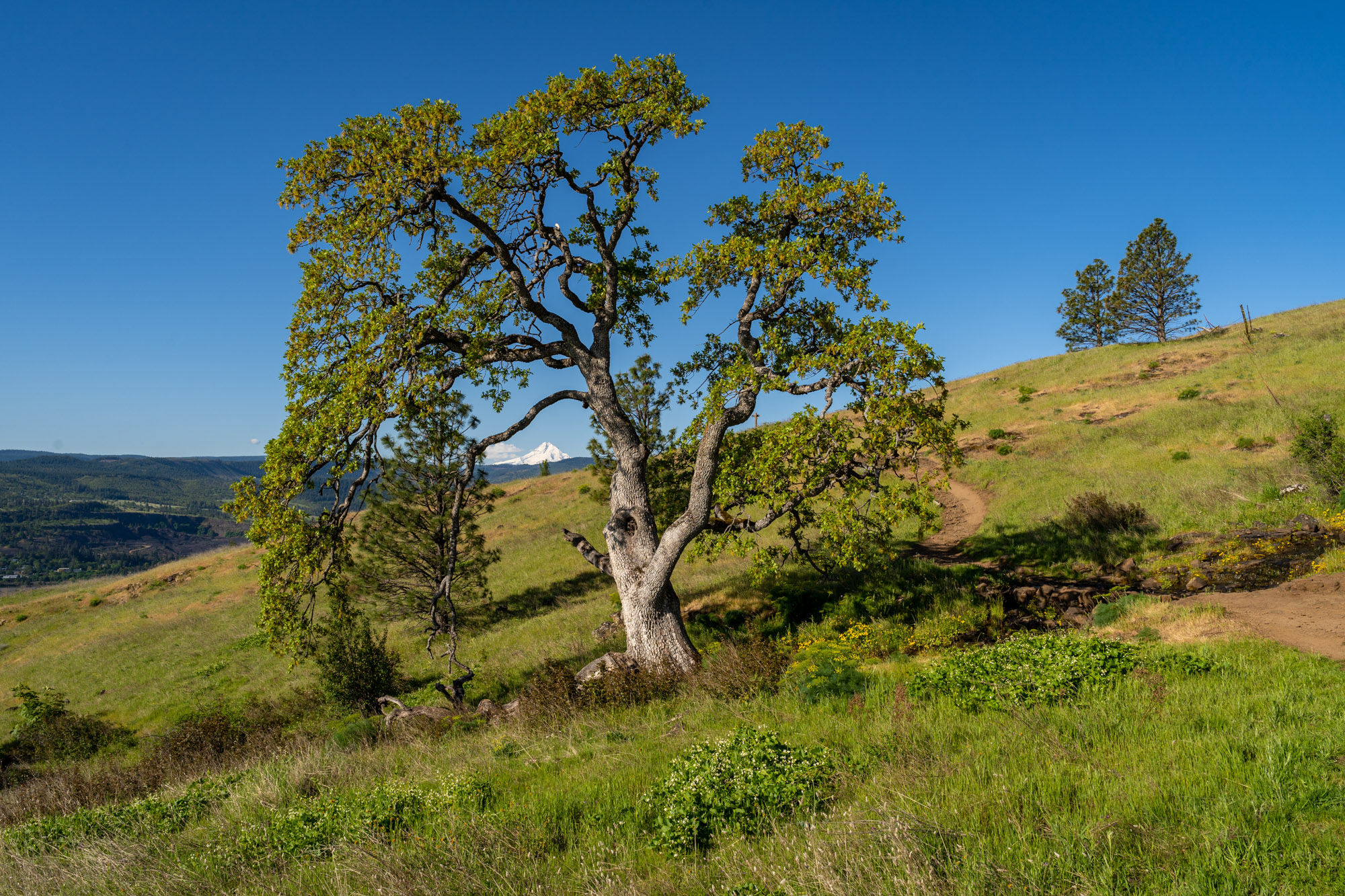
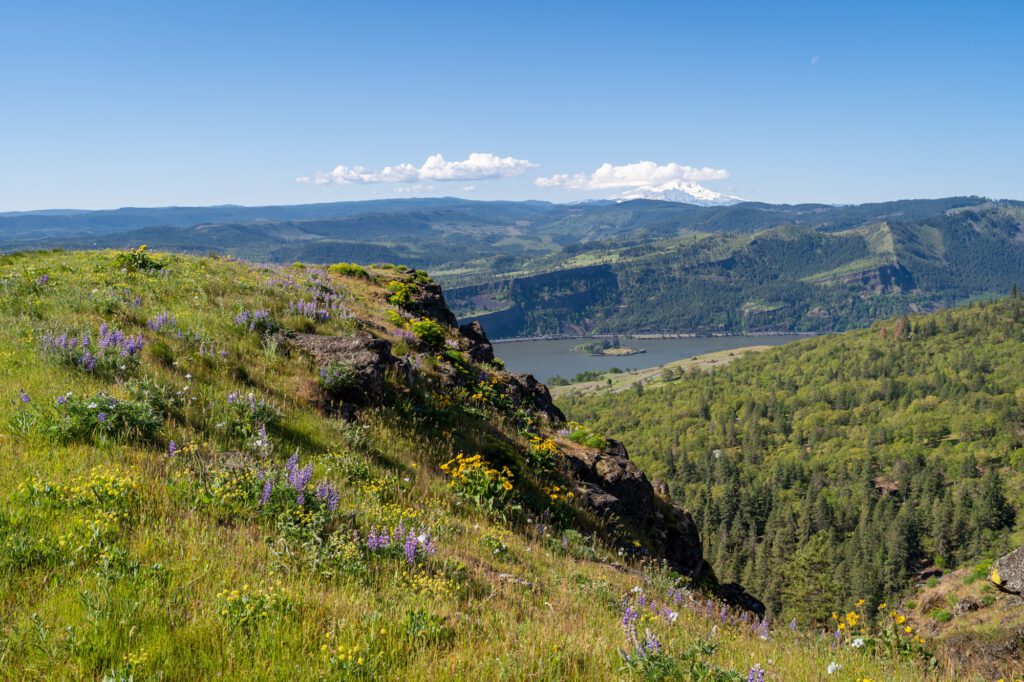
This trail takes you up to the top of a massive rocky spine with great views of the Gorge and Mount Hood. We first hiked this trail in the spring of 2023, which was a spectacular year for early wildflowers (better late than never!) like balsamroot and lupine.
Once we ascended to the ridge of the spine of Coyote Wall, the fields of yellow and purple were unlike any display of wildflowers we have ever experienced in person.
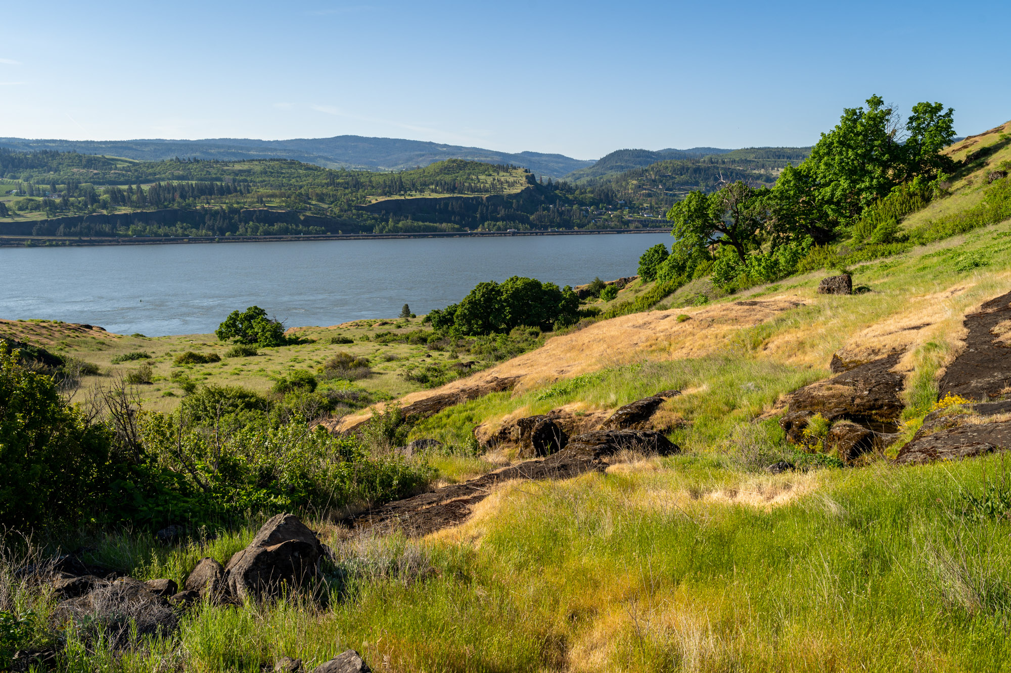
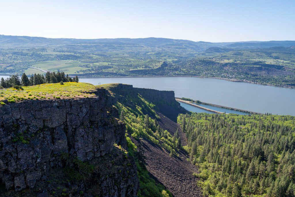
We didn’t really comprehend how cool the geology of Coyote Wall is until we were driving on the other side of the Gorge the next morning to Memaloose Hills.
We were admiring the views of the Gorge when Alysha said something like “wait, is that Coyote Wall?” and pointed to the massive rock formation running from the floor of the Gorge a couple of thousand feet up.
When you’re out there, it doesn’t seem that big (which is probably a good thing), but from afar, it’s pretty impressive.
In this guide, we’re going to do our best to give you everything you need to know to get out and hike the Coyote Wall Trail yourself. We’ll cover logistics, like parking, which direction to go, and what to know before you’re out there, and then do a quick trail guide based on our experience hiking it.
Sound good? Let’s get into it.
Disclaimer: Some of the links in this post, like hotel and vacation rental links, are affiliate links, meaning at no additional cost to you we make a little bit of money if you click through and book. That being said, we would absolutely never recommend something to you that we don’t stand behind 100%.
Coyote Wall: Trail Details
- Length: 6.2 miles
- Elevation Gain: 2,050 ft.
- Season: Mid March – November
- Trail Type: Out and Back OR Loop
- Difficulty: Moderate
- Trailhead Location: Coyote Wall Trailhead
- Dog Friendly: Yes, leash required Dec 1 – June 30
- Pass Required: None
The Route (Out and Back vs. Loop Trail)
This hike is essentially a reverse lollipop – there are two routes to get up to the ridge where the views and the wildflowers are, and then you’ll follow a trail along that ridge before descending back to the floor of the Gorge.
There is a whole network of trails up around Coyote Wall, but there are two main routes for this hike that we’re going to talk about: the out and back version that takes you up the Little Maui Trail, and the loop that goes up the Little Moab Trail and back down the Little Maui Trail.
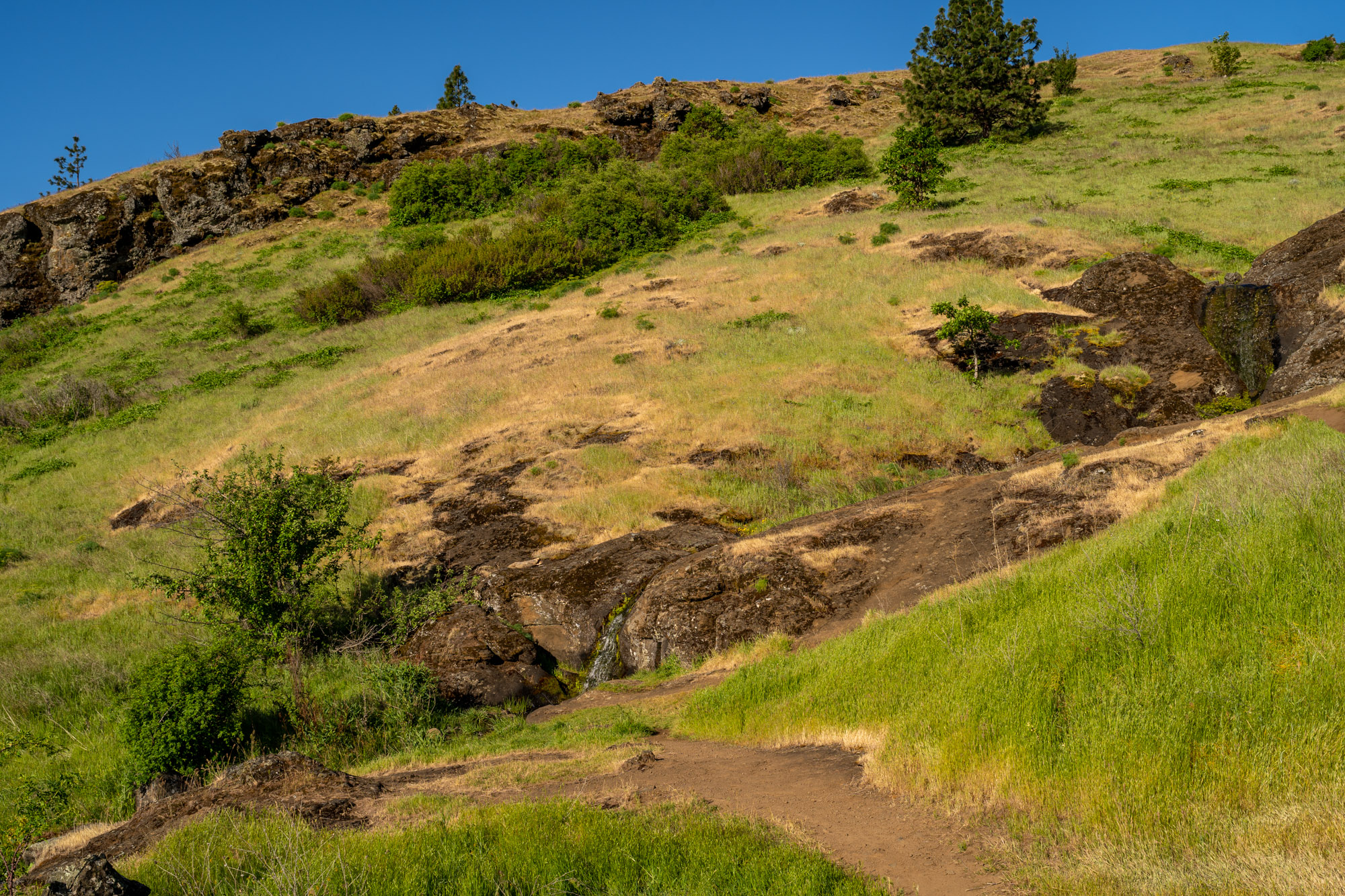
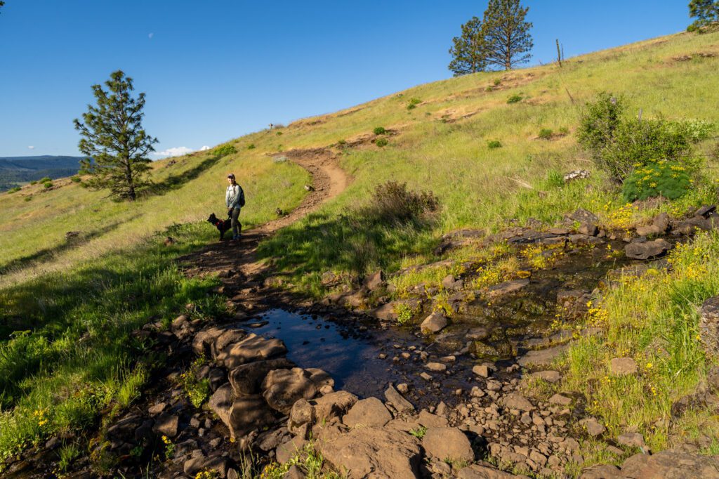
The Little Maui Trail, which is the route we took both up and down, is a lovely little meander through tall grass and wildflowers that ascends gradually to the trail junction, with a waterfall and a little stream (in the spring, anyway) along the way.
The Little Moab Trail is a steeper, rockier ascent. It’s more direct, but it does hug the cliffs and there are narrow sections that probably aren’t great for people who are scared of heights.
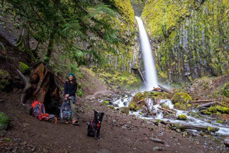
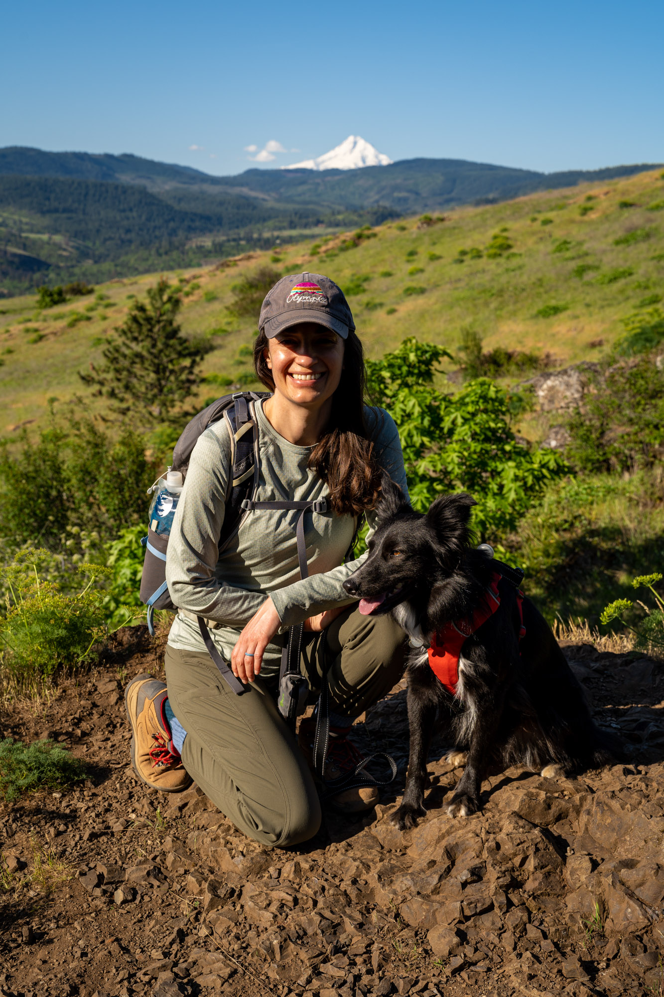
We took the longer route because we had our dog, Lupine, with us, and didn’t like the sound of a narrow trail along the cliffs.
However, without the dog, we’d probably have chosen the loop, going up the Little Moab Trail (we prefer steep ascents to steep descents) and down the Little Maui Trail.
If you are going to do the loop, we’d recommend tackling the loop clockwise and going up the Little Moab Trail rather than trying to come down the somewhat steep, somewhat rocky trail on the way down.
Getting to the Trailhead
The trailhead for this hike is right off of Highway 14 (also known as Lewis and Clark Highway) that runs along the Washington side of the Gorge. It’s about 8-9 miles east of the town of Bingen (on the other side of the Columbia River from Hood River).
If you’re coming from Portland, you have two options for getting out to the Coyote Wall Trailhead; I-84 on the Oregon side, or Highway 14 on the Washington side (or some combination of the two).
Here’s the deal – 84 is faster, but you have to pay a toll and it’s a less peaceful drive thanks to the plethora of semi-trucks.
Highway 14 is slower, but if you cross over in Portland, you skip the toll, and it’s a more pleasant drive (we think).
If you’re coming from Hood River, Portland, or somewhere else on the Oregon side of the Columbia River Gorge, remember that you’re either going to have to pay a $2 toll to cross the Bridge of the Gods or the Hood River Bridge, or cross over closer to Portland (likely Highway 205) if you want to cross for free.
Parking at the Trailhead
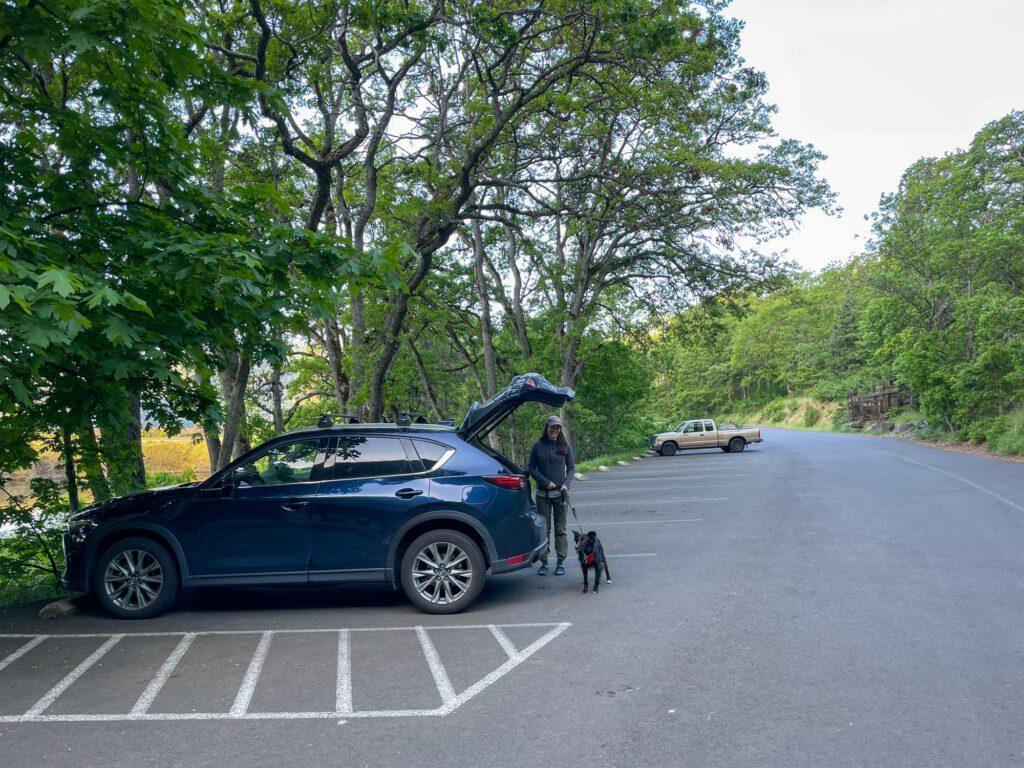
There are 24 parking spots at the Coyote Wall Trailhead (yes we counted), with a few more spots on the road just outside the parking lot. We would avoid parking along Highway 14.
This is a very popular trail with both hikers and mountain bikers, so you’re going to want to get an early start. Particularly on weekends in the spring and summer.
FYI: There is a bathroom at the trailhead.
Things to Know Before You Hit the Trail
Parking passes. This is one of the trails in the Gorge that doesn’t require a parking pass! It’s part of the Columbia River Gorge National Scenic Area, and no trail passes are required to park at the trailhead.
Sun exposure. This trail is extremely exposed. There is almost zero shade from beginning to end, which can be problematic for both humans and dogs. Bring plenty of water, sunscreen, and a hat.
Watch out for mountain bikers. This is a shared trail with mountain bikers, who aren’t always super careful as they’re coming down the trail. Keep an eye and an ear out as you’re hiking.
Dogs are allowed on this trail. Dogs must be on leash December 1 – June 30 to protect nesting birds. Yes, that means your dog, even though they’re the best pup ever. It’s also generally a good idea to keep them on a leash because of ticks and rattlesnakes.
Ticks are common in the spring and summer. Check yourself and your dogs for ticks after the hike.
Rattlesnakes are fairly common sightings. Nothing to be concerned about – hundreds of people hike this trail every weekend. Keep an eye on where your feet are, and give any snakes you spot plenty of space (and keep your dogs away). They’re equally scared of you, so they’ll likely slither off if given the chance.
Hiking the Coyote Wall Trail: A Complete Guide
And now, onto the trail report from our most recent hike on this trail in the late spring.
We’re going to talk through the out and back version along the Little Maui Trail, which is the version we did.
We covered how to make it a slightly shorter loop above and, as a reminder, we’d do that loop clockwise if you can (going up the steeper, rocky section).
We arrived early on a Thursday in May, and were the first car in the parking lot at 7:30am.
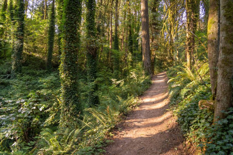
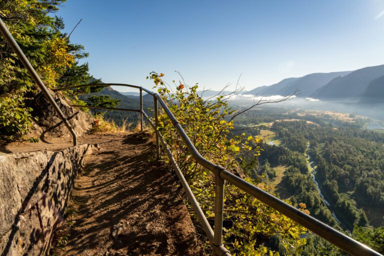
The hike starts with a short walk along the base of the rock walls with huge rocks lining the wide, paved walking path that clearly fell from the ridges high above. A little unnerving.
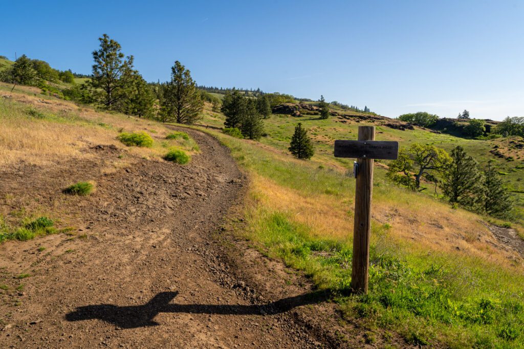
After just under a half mile, you’ll see a wooden fence and path on your left, which marks the real start of the fun.
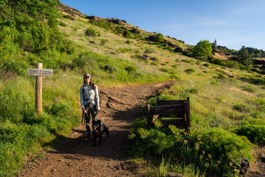
From here, you’re going to head right and follow signs for the Little Maui Trail #4425 (if you’re doing the Coyote Wall Loop Trail, you’d head left here and follow signs for the Little Moab Trail).
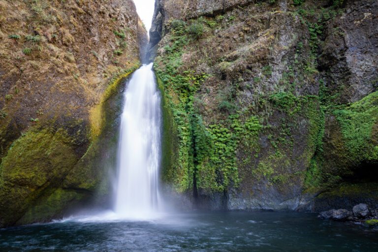
At almost exactly 1 mile into the hike, you’ll hit Little Maui Falls, which is an odd thing to see in such a dry landscape.
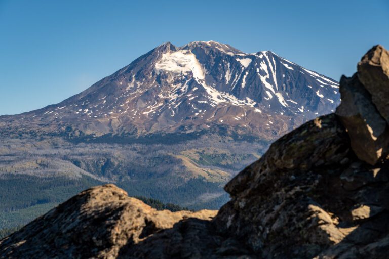
There are some great views of the Gorge, random photogenic oak trees, and peek-a-boo views of Mount Hood’s snow capped peak along the way.
After another half mile of climbing (1.6 miles total with 600 feet of elevation gain), the trail turns left (west) and you’ll cross another little stream (perfect for hot pups) and hop on Old Ranch Road, a wide, flat trail, which you’ll follow for 0.2 miles to the junction with the Coyote Wall Trail.
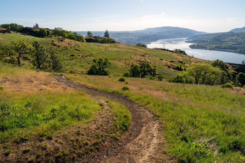
Congratulations! At this point, you’ve made it to the rim of the rock formation known as Coyote Wall, but there’s still some climbing to do.
Now, when we did this hike, there were almost zero wildflowers up to this point. Nada. Zip. Zilch.
However, as soon as we made it to the rim of Coyote Wall, BOOM WILDFLOWERS EVERYWHERE.
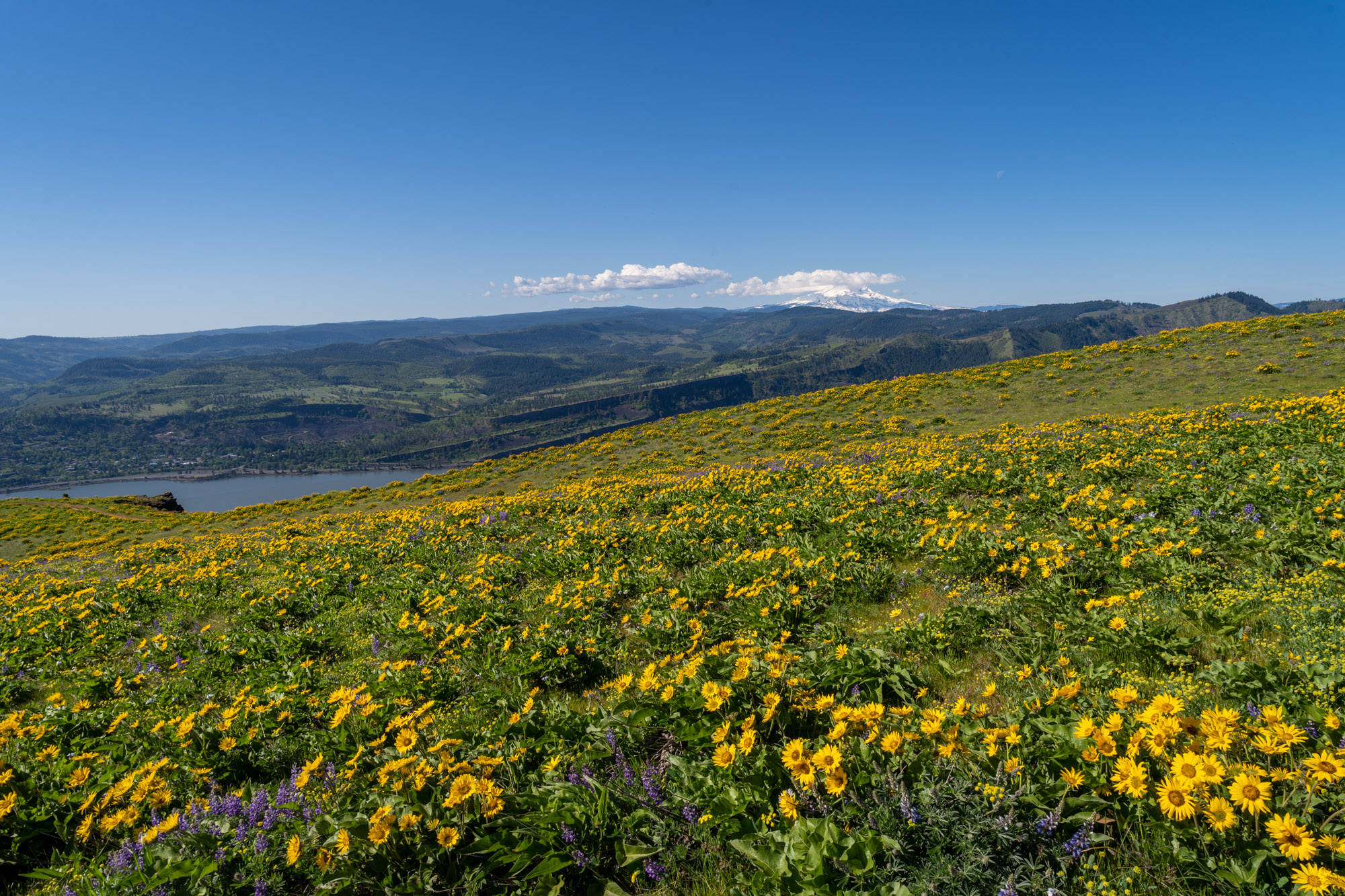
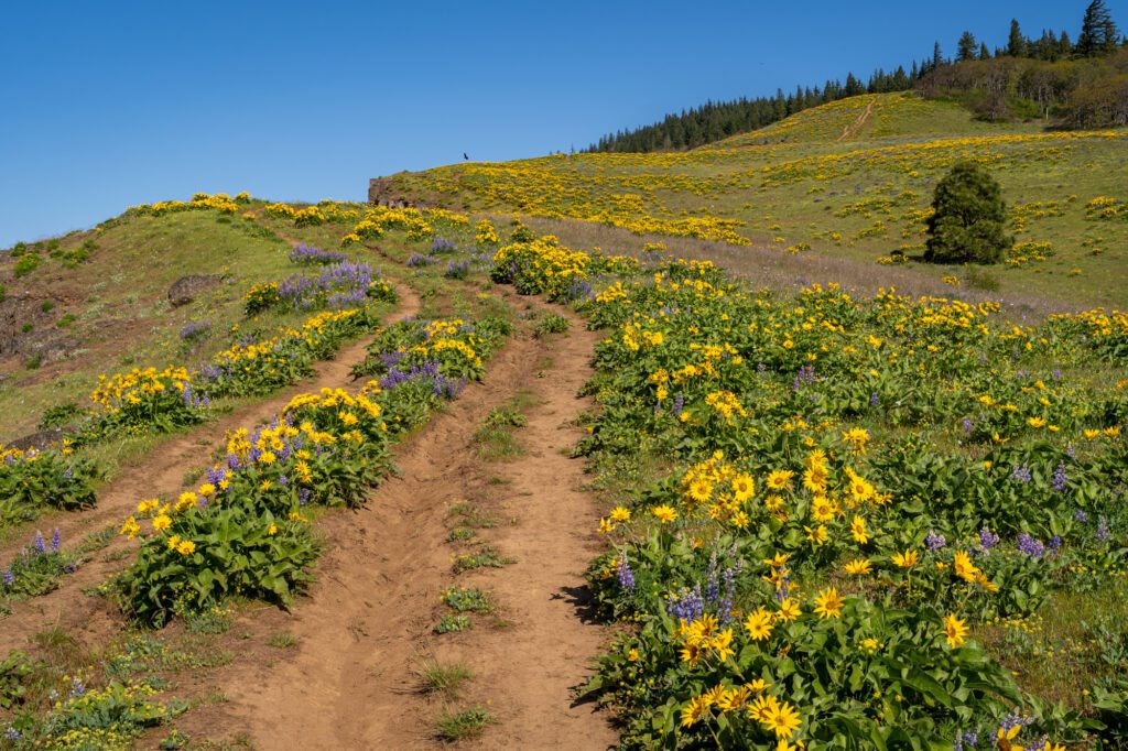
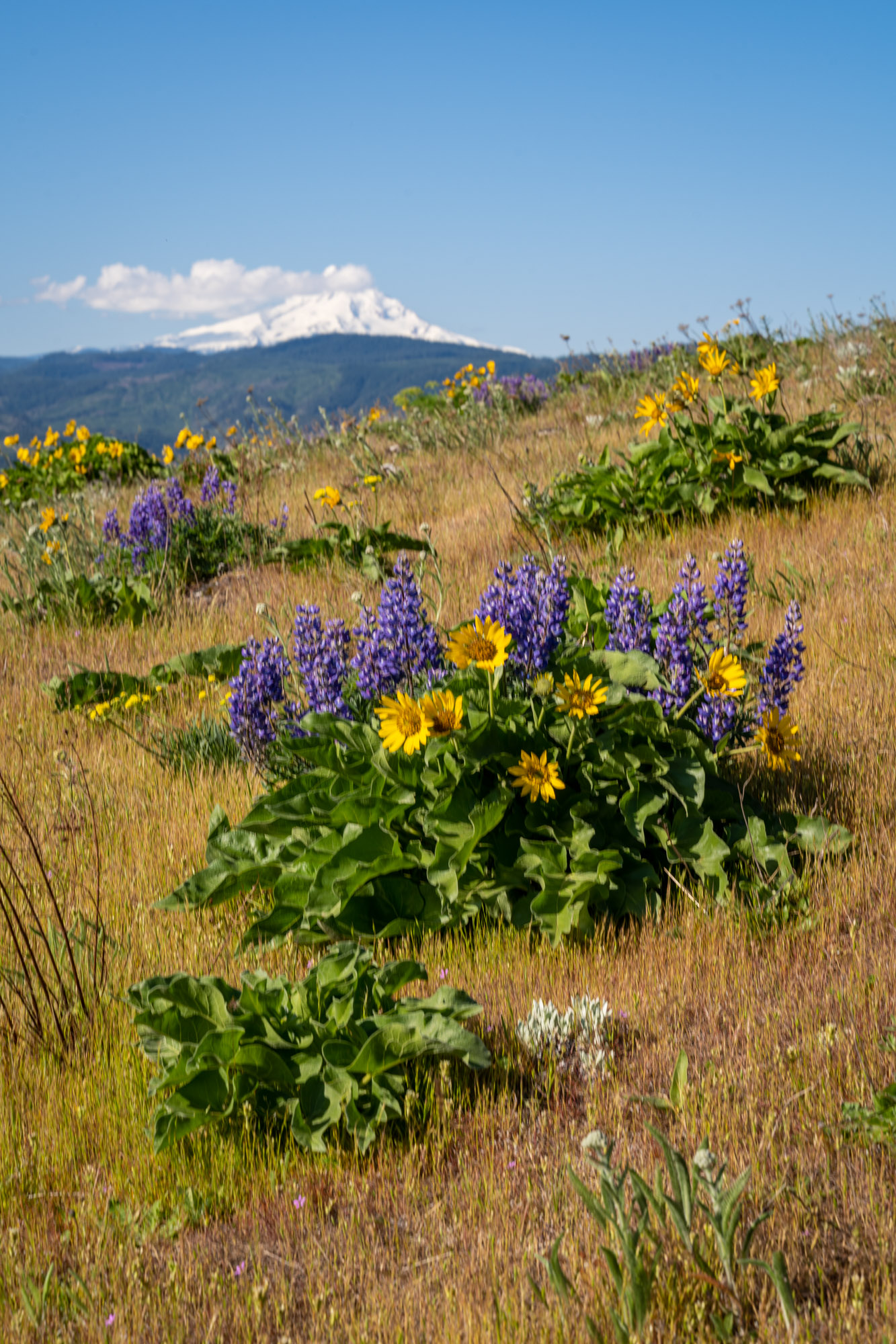
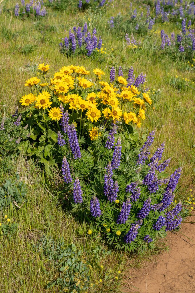
Spectacular, and as we climbed, it only got more impressive, especially when combined with the ever-improving views of Mount Hood, the Gorge, and the wall itself from above.
The trail continues for another 1.5 miles from that trail junction, eventually ending at Atwood Road.
There’s a mini lollipop up at the top that requires a little bit of walking on Atwood Road, but it’s a little hard to follow and not well signed, so we’d probably skip that bit.
If you’re going to go all the way up to Atwood Road, we’d hug the rim of the wall and stay left, which is a more pleasant hike.
There are some nice views from the trail that runs parallel to Atwood Road (we couldn’t figure out the name of the trail), but we’d say that the junction with the Traverse Trail #4427 is probably a good turnaround point for most people.
Head left at that junction for roughly 0.1 miles for a good view, and then turn around and head back the way you came.