Hiking the Stunning Wahclella Falls Trail: A Complete Guide
In a land full of towering waterfalls like the Columbia River Gorge, how do you choose which one to visit? We decided to tackle the Wahclella Falls Trail on our way back from a weekend away at Hood River, as we were driving back to Portland along I-84 on the Oregon side of the Gorge, and were blown away by the combination of beauty and relatively low effort on this hike.
It immediately jumped onto our list of our favorite Columbia River Gorge hikes after we did it the first time, and we’ve been out there multiple times since with visitors from out of town to show them the majestic beauty that exists within an hour of Portland.
In Alysha’s words on a recent (different) hike when she was describing this waterfall hike – “I think that one might be my favorite.”
Overall, the hike up to Wahclella Falls is an excellent choice if you’re looking for an easy hike up to a gorgeous waterfall in the Columbia River Gorge.
In this guide, we’re going to cover everything we think you need to know to hike to Wahclella Falls. We’ll start with logistics – like where to park – and then get into a full trail report based on our own experiences on the trail.
Sound good to you? Let’s get into it.
Disclaimer: Some of the links in this post, like hotel and vacation rental links, are affiliate links, meaning at no additional cost to you we make a little bit of money if you click through and book. That being said, we would absolutely never recommend something to you that we don’t stand behind 100%.
Wahclella Falls: Trail Details
- Length: 2 miles
- Elevation Gain: 225 feet
- Season: Year round
- Trail Type: Lollipop
- Difficulty: Easy
- Trailhead Location
- Dog Friendly: Yes – On a Leash
- Pass Required: Northwest Forest Pass (or America the Beautiful Pass) or $5 cash at trailhead for day pass
Which Route to Take Up to Wahclella Falls?
We’ll keep this brief, because at just two miles round trip, there’s really not THAT much to say here.
Essentially, there are two ways to do this hike – as an out and back, and as a lollipop. You’ll make the choice at just over a mile into the trail.
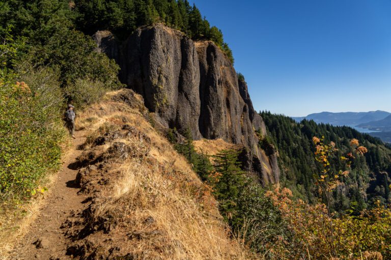
We think you should definitely do the lollipop. Which means that the next question is what direction to go on the lollipop section. You can either take the upper trail, which approaches the falls from above, or the lower trail, which descends to the level of the water and approaches it from below.
We think you should tackle the lollipop counterclockwise, which means approaching the falls from below, basically at the level of Tanner Creek. Then, you’ll loop back along the high route, which has some nice views of the canyon walls.
Getting to the Trailhead for Wahclella Falls
The Wahclella Falls trailhead is 4.5 miles west of Cascade Locks, or 9 miles east of Multnomah Falls.
For such a popular trail, it’s a tiny parking lot, with room for MAYBE 10 cars. It was full when we arrived around 9:30 am, and still full when we left an hour or so later.
There are more parking spots on the road that forks up and to the right as you leave the parking lot (roughly here).
There are port-a-potties at the trailhead, and there were envelopes to pay for a Northwest Forest Pass day use permit when we were there (bring $5 cash!).
The Hike up to Wahclella Falls: A Quick Trail Report + Pictures
Normally, for longer hikes (like the McNeil Point Trail or Hamilton Mountain, for example) we’ll break up the hike into smaller chunks and talk about what to expect on each stretch of trail.
In this case, the hike is too short to do that, so we’ll give you the entire thing in one section.
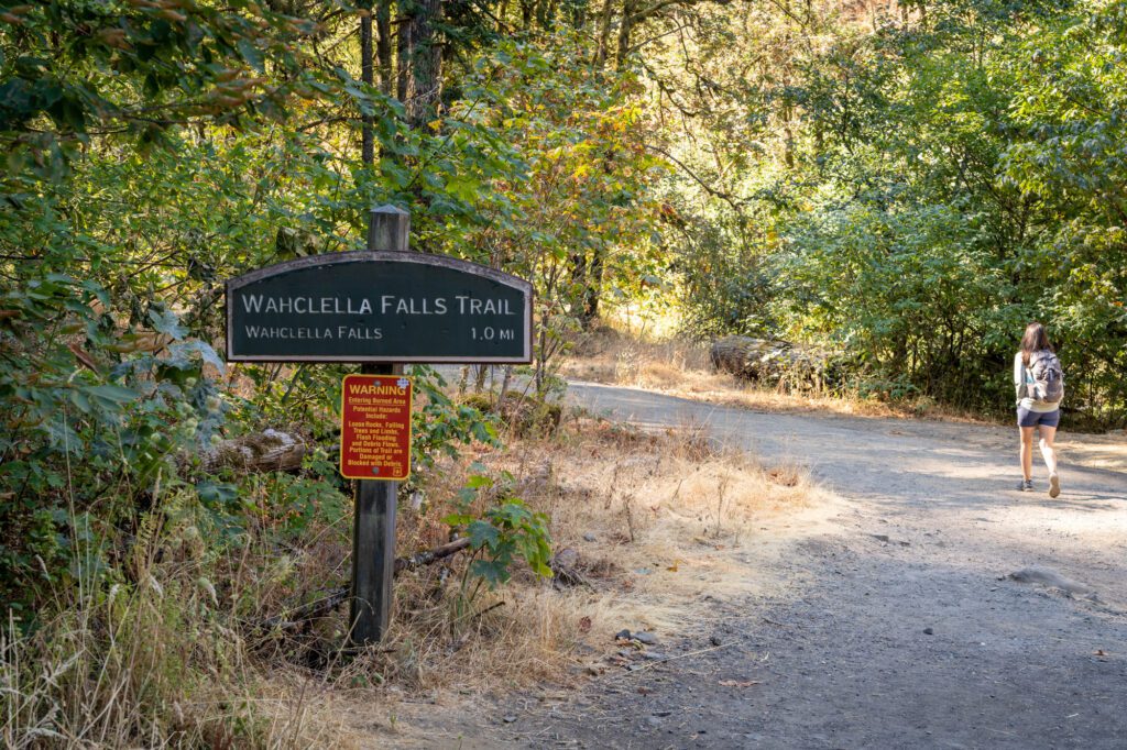
The trail begins with an uninspiring stretch along a wide, dusty road that gives the Forest Service access to the dam a little ways up the trail. This first stretch of trail is wide, almost completely flat, and follows Tanner Creek closely.
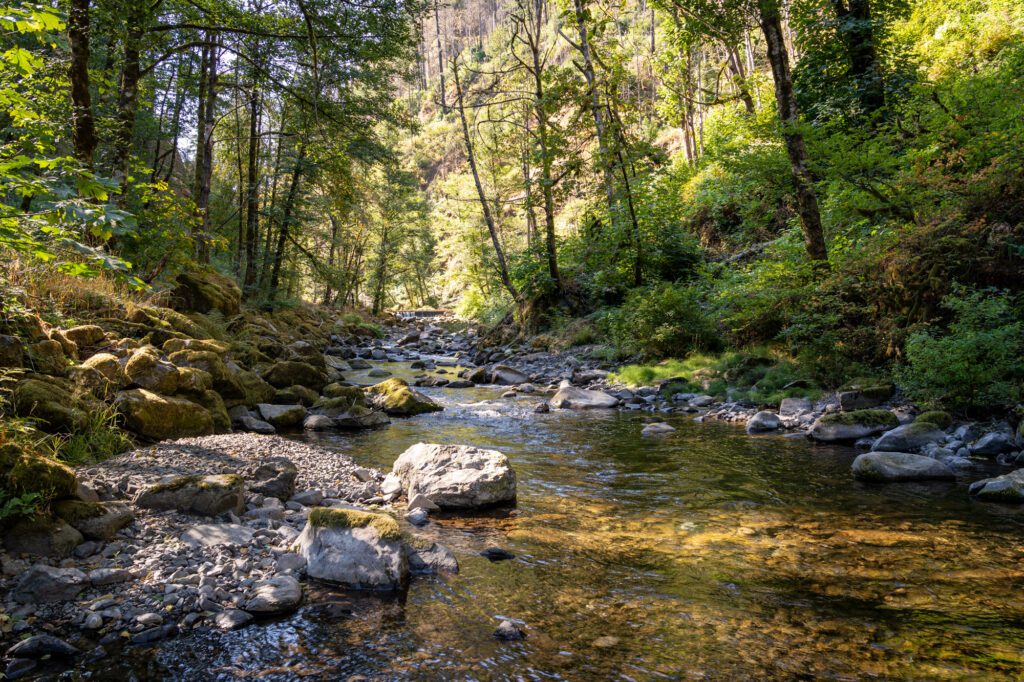
You’ll reach the dam at about 0.3 miles in, and this is where the trail narrows and starts its gradual uphill grade to the junction for the lollipop section. This is the steepest part of the hike.
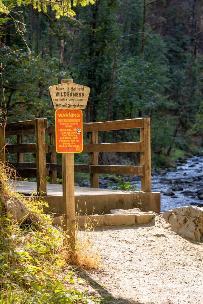
You’ll pass a sign that proclaims that you’re entering the Mark O. Hatfield Wilderness (who was a former governor of Oregon), a slice of wilderness within the Columbia River Gorge National Scenic Area, and immediately cross a wooden footbridge.
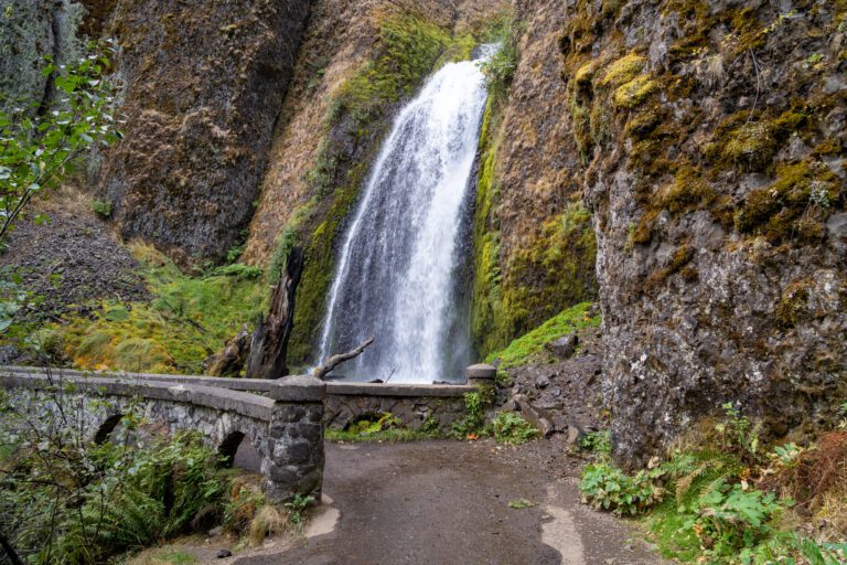
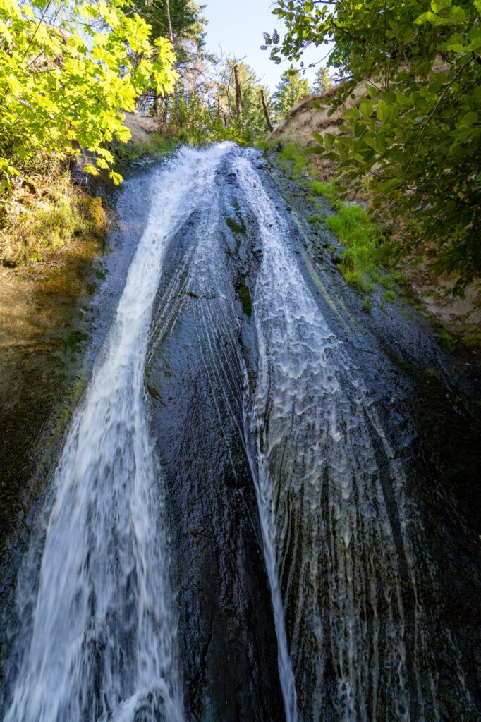
To your left is a seasonal waterfall – Munra Falls – cascading down the sloped rocks.
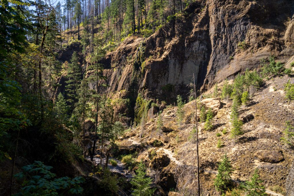
As you get deeper into the canyon, you’ll start to see evidence of the 2017 Eagle Creek Fire that affected this stretch of the Columbia River Gorge, especially in the tree line at the top of the canyon walls. Many of the nearby trails were closed for years as a result of the damage from that fire, which was caused by humans.
At 0.6 miles into the hike, you’ll reach the junction for the lollipop section of the trail. If you’re following our advice, head right and descend down to the wooden footbridge and cross over to the other side of Tanner Creek.
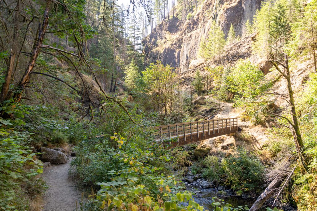
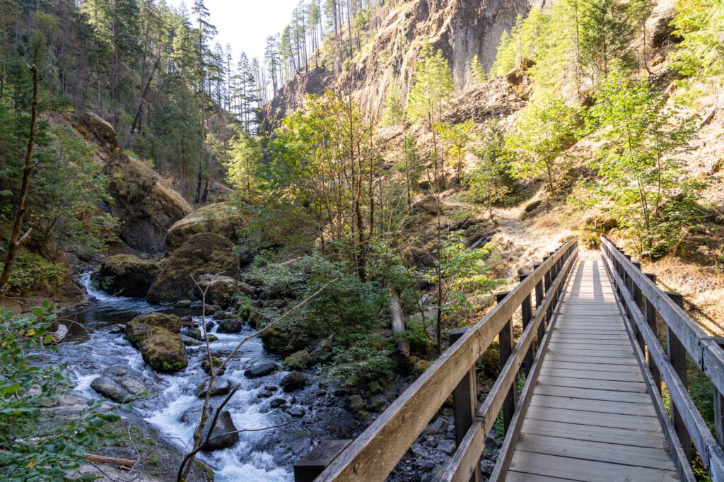
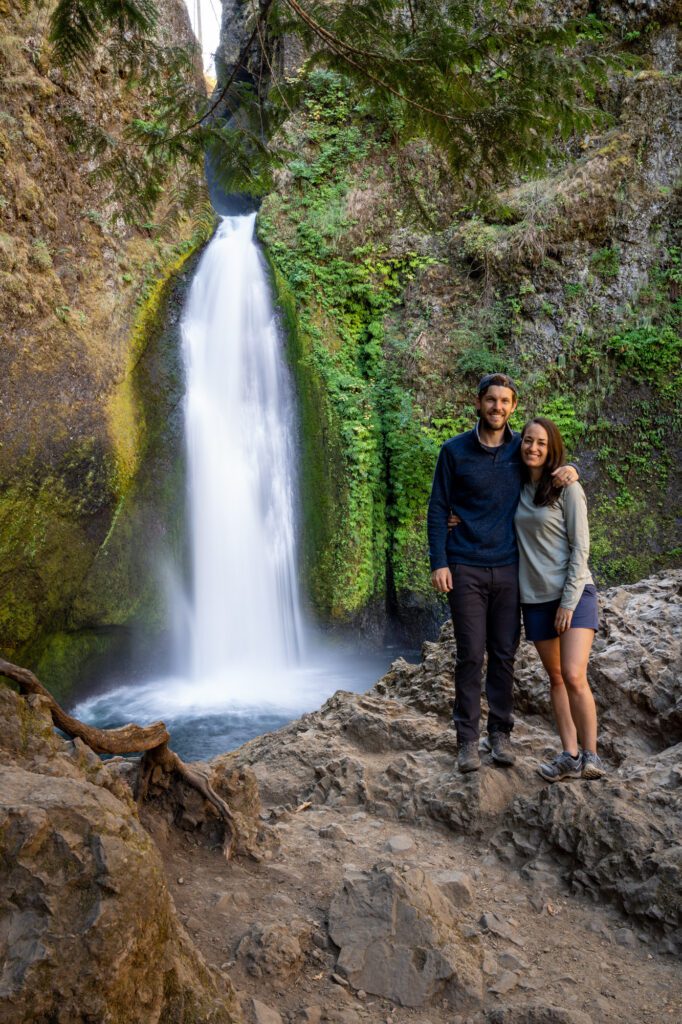
You’ll follow the trail along the base of the canyon walls, cross another wooden footbridge, and arrive at the base of Wahclella Falls at 0.2 miles. You’ll get your first sight of the falls as you approach the second footbridge.
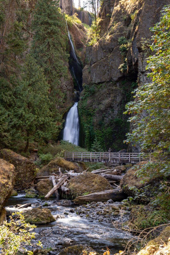
Wahclella Falls is two-tiered, but you can really only see the bottom tier of the falls as the upper falls is hidden behind a cliff if you’re viewing it from below. The lower falls tumbles 60 feet off of the ledge into the pool below.
We like the lush greenery growing on the walls around the falls, which adds to the sheer natural beauty here.

When you’re done picking your jaw up off the trail, head up the hill behind you and follow the upper trail back to the place where the trail forks. It’s a steady downhill walk back to the car from there.