The Hike to Pittock Mansion: A Complete Trail Guide
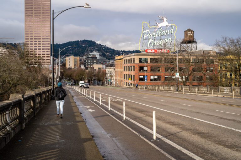
One of our favorite things about Portland is its green spaces, particularly the parks on the western edge of the city. There are not very many places where huge swaths of desirable land within city limits have been set aside and protected, and Portland has several of them in its western hills. These parks, which include Washington Park and Forest Park along with smaller Macleay Park, are a haven for Portlanders looking to get a little greenery in their lives.
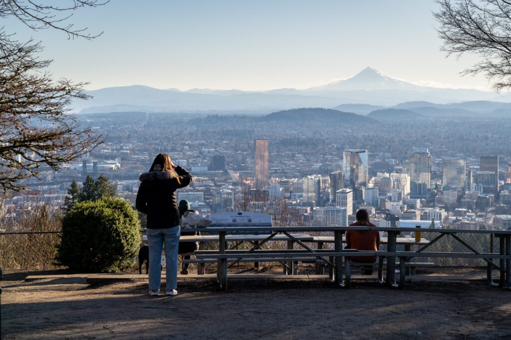
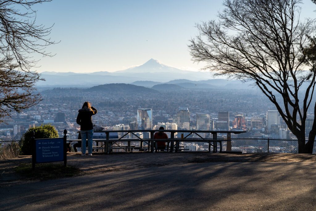
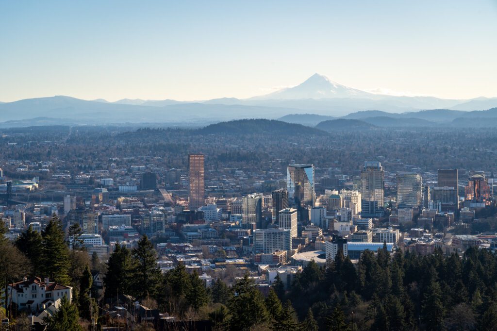
The hike to Pittock Mansion is one of our favorite hikes in Portland, and is probably the best bang-for-your-buck hike in the city limits in terms of the ratio of effort to views. From the Victorian-era mansion perched on the hill, you have a fantastic view of downtown Portland. On a clear day, you’ll also be able to take in the majesty of Mount Hood’s snowy peak towering over downtown Portland’s skyline.
It’s one of our favorite views in Portland, and the hike takes you through a dense, fern-laden forest on the way up to the view.
In this guide, we’ll take you through everything we think you need to know about the Pittock Mansion hike, including the various routes you could take, where to park, and a quick trail guide.
Disclaimer: Some of the links in this post, like hotel and vacation rental links, are affiliate links, meaning at no additional cost to you we make a little bit of money if you click through and book. That being said, we would absolutely never recommend something to you that we don’t stand behind 100%.
Lower Macleay Park to Pittock Mansion Trail Details
We’re going to cover the version of this hike that starts from Lower Macleay Park (here on Google Maps), heads up to Pittock Mansion, and returns back the way you came. There are multiple other ways to do this hike, which we’ll cover in the “Alternative Routes” section below.
- Length: 5 miles
- Elevation Gain: 900 ft.
- Season: Year round
- Trail Type: Out and Back (though you can make it a loop, which is slightly longer)
- Difficulty: Easy / Moderate
- Trailhead Location
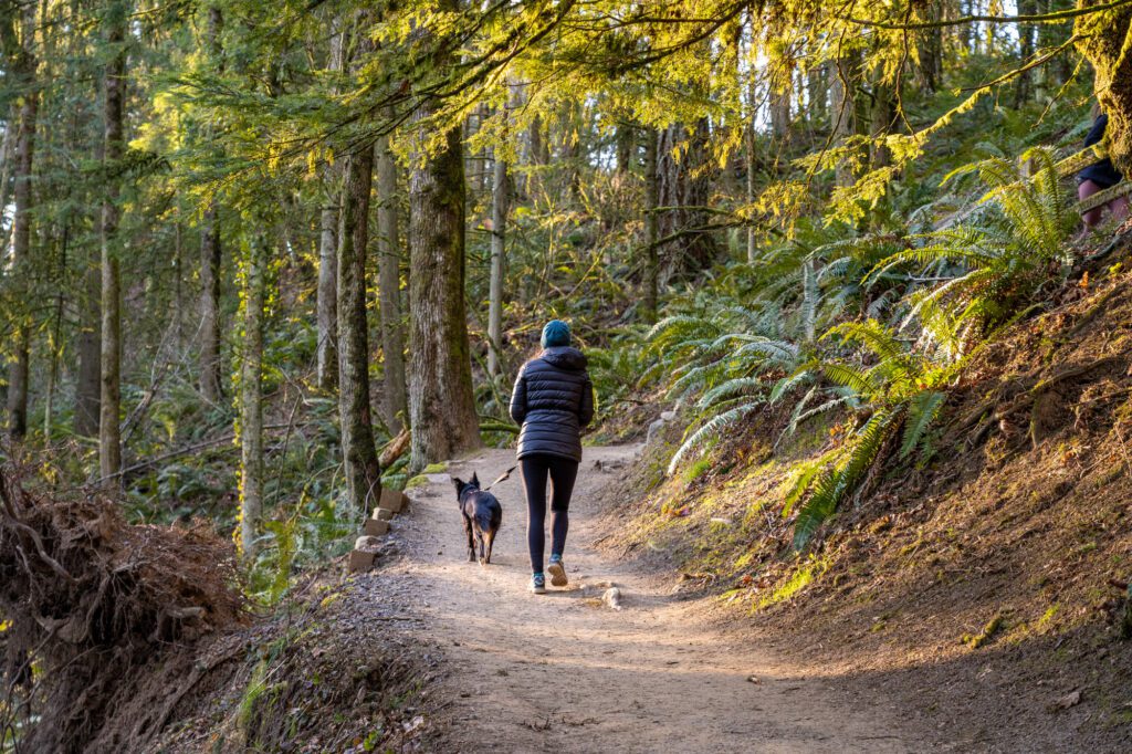
- Dog Friendly: Yes, on a leash.
- Pass Required: None
Is the Hike to Pittock Mansion an Easy Hike?
We would rate the full hike from Lower Macleay Park up to Pittock Mansion on the easy side of moderate. With the full hike, you’ll climb around 900 feet of elevation over 2.5 miles, which is enough to get most people breathing a little hard and sweating, but not enough to ruin your day.
If you’re looking for an easier version, park at the Upper Macleay Trailhead (here on Google Maps) and do the upper half of the hike, which only climbs 550 feet and cuts off two miles.
You can also drive all the way up to Pittock Mansion and park in the small paid parking lot there, but what’s the fun in that?
The Alternative Routes
Pittock Mansion is in Macleay Park, which sits in between two of the best parks in Portland, Forest Park and Washington Park and is one of the oldest parks in the city.
Because of its location, there are a myriad of ways to get up to Pittock Mansion, both from Washington Park and from downtown Portland. Our favorite is the hike from Lower Macleay Park, which passes the Witch’s Castle (actually called the “stone house”) on the way up, which is why we’ve written this guide for that particular route.
It’s also worth noting that you could do just about any of these routes as a one way hike, and either set up a shuttle with a second car, or take a rideshare back to where you parked if you don’t want to hike back the way you came.
Here are a few alternative routes to consider:
- Upper Macleay Trailhead: This is the shortest and easiest hike option. You’ll park at the tiny parking lot here, and then climb up the Wildwood Trail, which you’ll follow to Pittock Mansion. Then, come down the Upper Macleay Trail on the way back, making it a nice little loop. It’s roughly 3 miles and 550 feet of elevation gain.
- From Hoyt Arboretum: This is the best alternative if you’re coming from Washington Park, we think. It’s about 3 miles round trip, and climbs just 300 feet or so. Start near the Hoyt Arboretum Visitor Center (here on Google Maps) and follow the trail past the Redwood Observation Deck, climbing up the other side of the gulch to hook up with the Wildwood Trail. You’ll cross at the Barbara Walker crossing, and then finish the climb on the Wildwood Trail. Map.
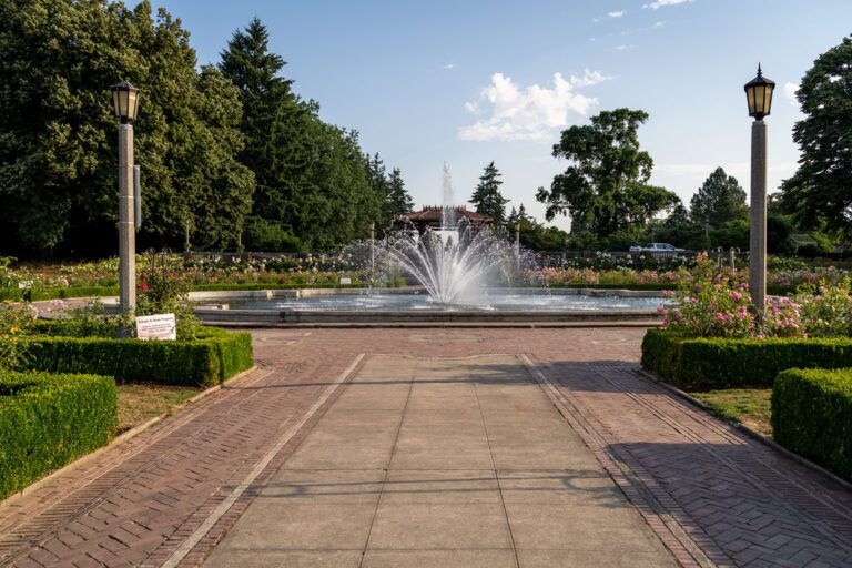
- From the International Rose Test Garden: This version starts (and ends if you do it out and back) from the International Rose Test Garden, which has a paid parking lot. The hike is going to be 3.6 miles roundtrip, with 500 feet of elevation gain along the way. You’ll get to cross the pedestrian bridge over W Burnside Street, which is kind of fun, and then head left to hook up with the Wildwood Trail to finish the climb. Map.
You could also combine the last two – the Rose Garden and Hoyt Arboretum – by doing this slightly longer route (~4.5 miles round trip).
However, we’re going to cover the hike from Lower Macleay Park, because that’s our favorite version of the hike.
The Hike to Pittock Mansion: A Trail Guide Based on Our Experience
If you’re doing the full five mile hike from Lower Macleay Park, you’ll park in either the small parking lot at the trailhead, or along the street just outside the park. Make sure to pay attention to parking signs, because there are some limits in the neighborhood.
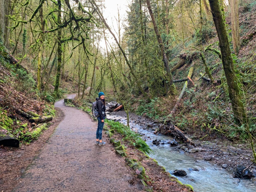
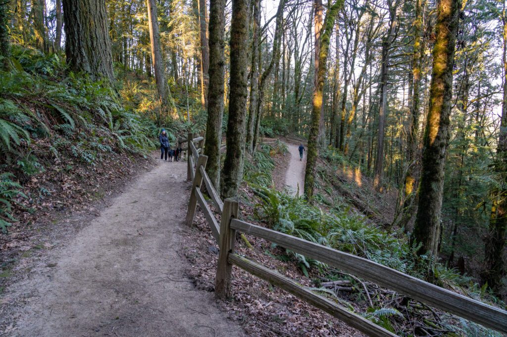
You’ll start out along the Lower Macleay Trail, which passes under a bridge (NW Thurman Street) and then follows Balch Creek. You’ll cross over the creek, then cross back again, following the trail through evergreen trees and their ferny underbelly until you reach the Stone House, colloquially known as the “Witch’s Castle.”
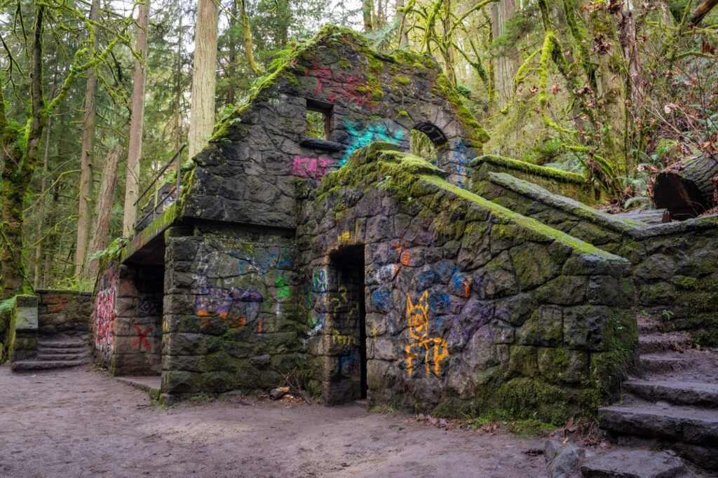
This graffiti–covered stone building might seem creepy, but it’s really just an abandoned restroom that got vandalized so much that the park personnel basically just gave up on maintaining it.
This first stretch of the hike along the Lower Macleay Trail, from the trailhead to the Stone House, feels flat (though it’s a slight incline), and covers a hair under a mile of trail.
From the Stone House, you’ll hop on the famous Wildwood Trail, which runs 29.5 miles from Washington Park all the way up to the northwest end of Forest Park. You’ll just be hiking a portion today, but you’ll get a taste for why hikers in Portland are so in love with this particular trail.
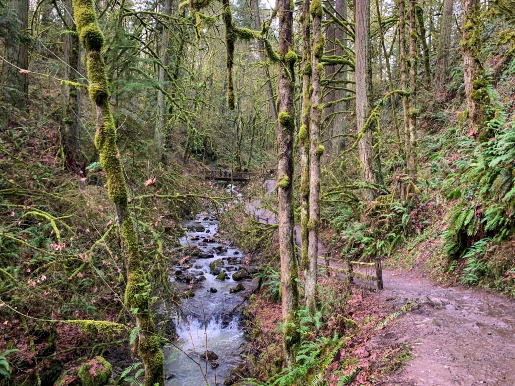
At the 1.1 mile mark (shortly after the Stone House), you’ll hit a bridge over the creek and cross over once again. From here, it’s a climb all the way up to Pittock Mansion.
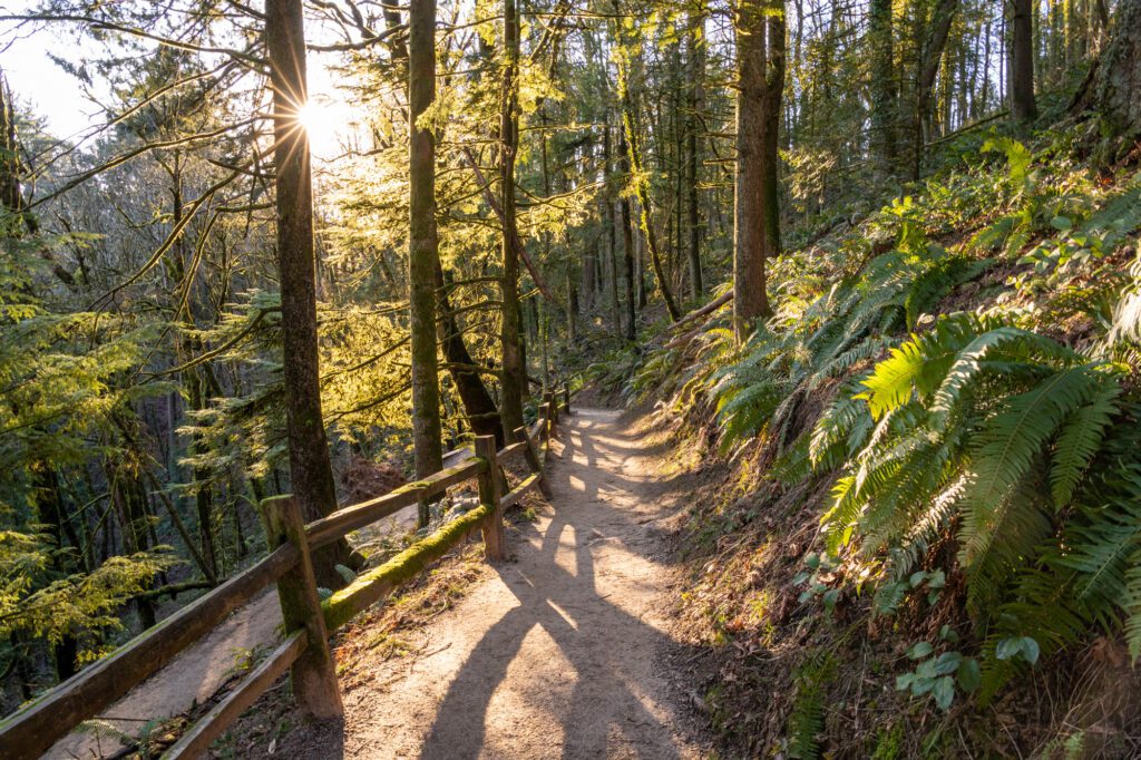
First, you’ll tackle a few switchbacks to get up to NW Cornell Road, which you’ll cross (use the crosswalk!). Here, you hit a fork in the trail. Good news: both trails lead to Pittock Mansion! We’d make this a lollipop, heading up the Wildwood Trail (which means you should head left) and coming down the Upper Macleay Trail because the latter is more direct and steeper, which we’d prefer to come down.
Take a left at the fork here and continue along the Wildwood Trail, which climbs relatively gently parallel to the road for a bit before heading south and starting to climb. At 2.0 miles in, you’ll hit another junction, which is where the Wildwood Trail and the Upper Macleay Trail (the two that converged at the fork just after you crossed the road) meet.
Continue straight on the Wildwood Trail, following signs for Pittock Mansion. From here, you’ll tackle the final climb, which includes a few switchbacks. This stretch of the trail is usually incredibly busy with hikers and trail runners, so be courteous and allow runners to pass!
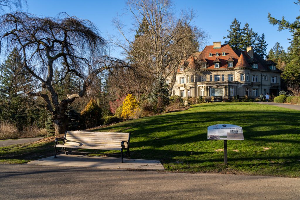
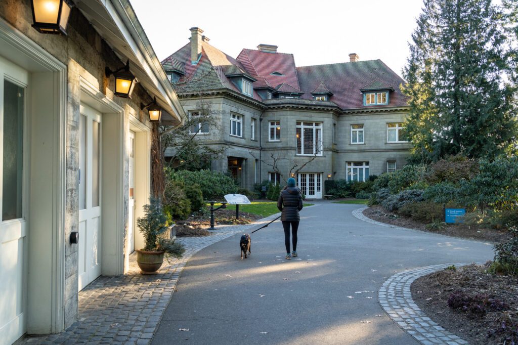
Finally, you’ll emerge from the forest onto the concrete at the parking lot outside of Pittock Mansion, where you’ll be red and sweaty as the people who chose to drive up get out of their cars in their pristine clothes and shoes that aren’t covered in mud and / or dust. But remember this: you earned it!
Continue past the Visitor Center and gift shop past the mansion to find the viewpoint, where you’ll see downtown Portland’s skyline and, on a clear day at least, the snowy peak of Mount Hood.
Pittock Mansion was the home of Henry Pittock, who was a publisher who turned the Oregonian from a weekly publication into the daily newspaper it is today.
You might be wondering how, exactly, he made his fortune in publishing a newspaper, which is a foreign concept today. Well, he didn’t – he really made his money investing in the paper mills that he used to print his newspaper, then using the profits to invest in businesses and industries all over Portland and Oregon.
By the time the 1900’s rolled around, Pittock had a nice little empire going, and that’s when he built Pittock Mansion.
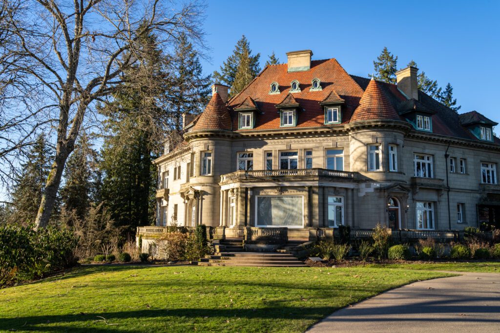
One of our favorite parts about this area is the gardens. We haven’t actually been inside the mansion – we were told by a lifelong local that it’s not worth the $14.50 a person (and we’re generally against the idea of touring old rich people’s houses anyway) – but we LOVE the grounds, which bloom with flowers in the spring, and light up with fall color in October (ish).
It’s worth doing the little loop around the mansion to check out all the plant life.
Once you’re done, head back down the way you came. After you descend the first set of switchbacks, you’ll reach the four-way trail junction. If you want to take a slightly different route and make it a lollipop, head left along the Upper Macleay Trail, which is slightly shorter. Otherwise, head straight and follow the Wildwood Trail, and follow the same route you took to get up here.
YOU MIGHT ALSO LIKE
- PORTLAND: How to Plan an Amazing Portland Itinerary (1, 2, or 3 Days)
- PORTLAND: How to Spend One Action-Packed Day in Portland, Oregon
- PORTLAND: A Perfect Weekend Itinerary for Portland, Oregon
- PORTLAND: This is Where to Stay in Portland According to 2 Locals
- PORTLAND: 12 Incredibly Cool Hotels in Portland to Book ASAP
- PORTLAND: 7 Amazing Day Trips from Portland, Oregon
- PORTLAND: 21 Incredible Hikes near Portland: A Complete Guide to Hiking in Portland