The Incredible Saddle Mountain Trail: Complete Trail Guide
It is no exaggeration to say that, until recently, the Saddle Mountain trail was high on our “to-do” list of Oregon hikes for approximately the entire time we were aware of its existence. Well known for both its proximity to Portland and the stunning views from the top, the only problem with the hike to Saddle Mountain was that it was closed for the better part of three years up until the fall of 2023.
After we tackled this hike – which we did on the second day it opened after a long hiatus – we’re here to tell you that the juice is definitely worth the squeeze.
So much so that it makes it onto our list of the best hikes in Oregon AND the best hikes near Portland (according to us, anyway).
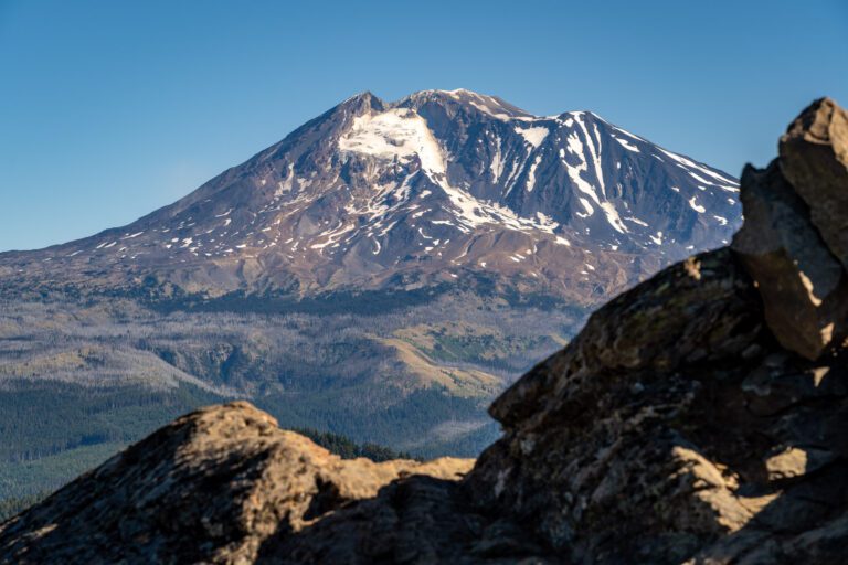
After your climb high into the Oregon Coast Range (the tallest mountain in the northwest corner of Oregon), you’ll be treated to never ending views with Mount Hood, Mount St. Helens, and Mount Rainier to the east, and the Pacific Ocean and mouth of the Columbia River to the west.
On a clear day, anyway, which is the best time to do this hike.
In this guide, we’re going to cover everything you need to know to get out and hike Saddle Mountain yourself.
We’ll start with the logistics – where to park, and other things you need to know for a smooth trip – and then go into a trail report based on our own experiences hiking the trail.
Our intention is to set you up for hiking success by the end of the guide so you can get out on the trail safely and confidently, prepared for the trail and knowing what to expect.
Sound good to you? Let’s get into it.
Disclaimer: Some of the links in this post, like hotel and vacation rental links, are affiliate links, meaning at no additional cost to you we make a little bit of money if you click through and book. That being said, we would absolutely never recommend something to you that we don’t stand behind 100%.
Trail Details for the Hike to Saddle Mountain
- Length: 4.8 miles
- Elevation Gain: 1,800 ft.
- Season: Year Round (unless it has been really cold)
- Trail Type: Out and Back
- Difficulty: Moderate / Difficult
- Dog Friendly? Yes, on a leash (see note on mesh along trail below)
- Pass Required: None (even though it’s in an Oregon State Natural Area)
- Trailhead Location
Getting to the Trailhead for Saddle Mountain
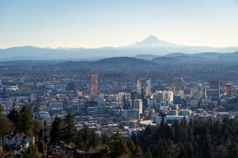
The Saddle Mountain Trailhead is right off of Highway 26, and the exit is about 15 miles east of Cannon Beach. It’s almost exactly 90 minutes from Portland (with no traffic, of course).
You’ll turn off of Highway 26 on Saddle Mountain Park Road (it’s on your right if you’re coming from Portland) and follow the winding, somewhat narrow road for seven miles to the trailhead itself.
The road is paved, but has a few bumps and bruises and is a risk for downed trees and branches in the winter.
Parking for Saddle Mountain
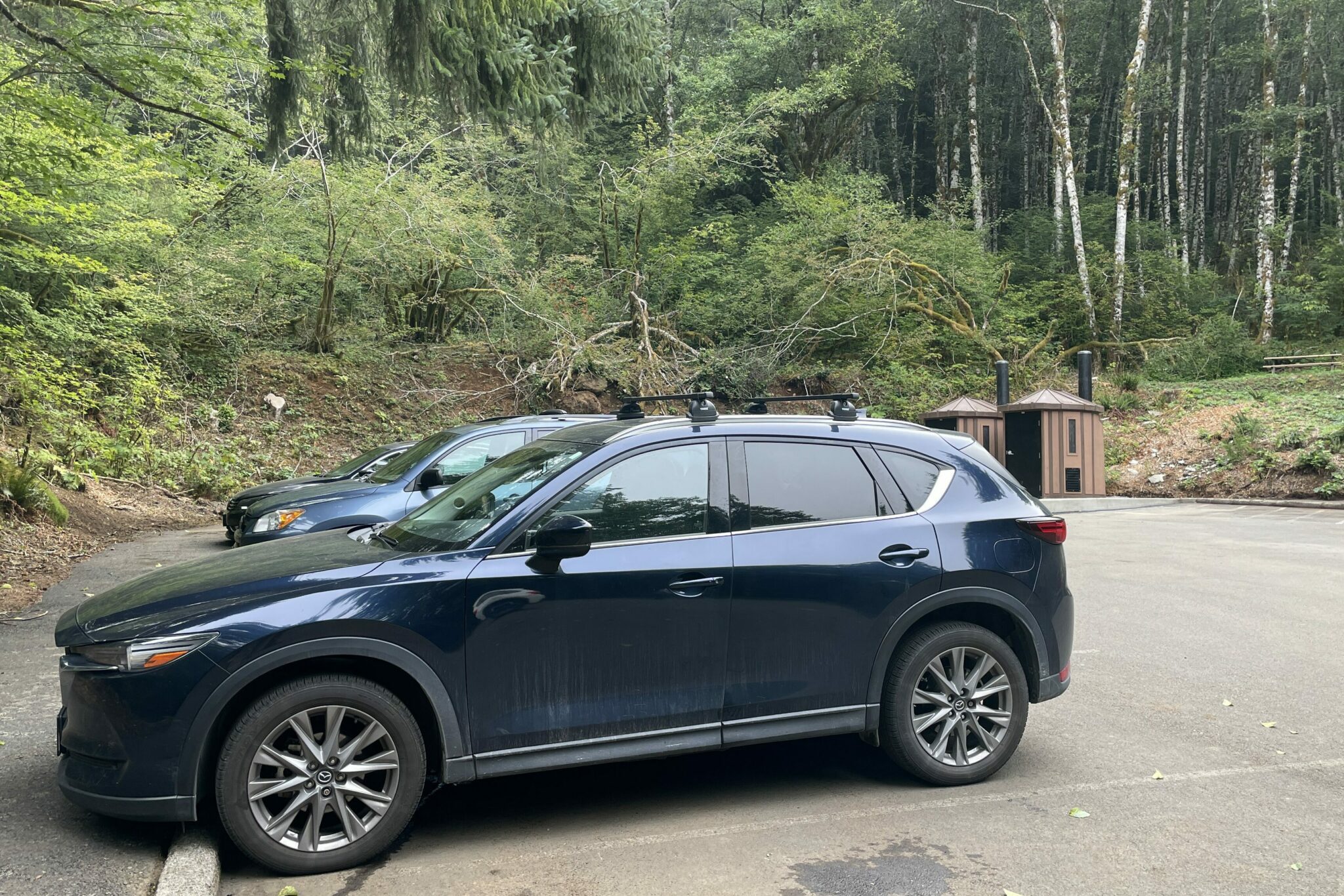
The parking lot here is pretty big, with room for about 25 cars. That said, it’s a popular hike – especially since it reopened after over two years being closed – so you’re going to want to get here relatively early to secure a spot.
Because the road is pretty narrow coming into the parking lot, you really can’t park on the side of the road, so you’ll have to wait for a spot in the lot.
There are two pit toilets at the trailhead which are pretty nice as far as pit toilets go.
The Best Time to Hike Saddle Mountain
Saddle Mountain is a three season hike, though the best time to hike it is between June and October, when the trail is free of snow and ice and you’re more likely to get a clear day where you’ll be able to take in the never ending views from the top.
The wildflowers in May and early June make this an excellent late spring adventure.
Even in September, you could see the evidence of wildflowers along the sides of the trail on the way up, especially when it opens up between the saddle and the summit. We’ll be back next spring to check it out!
The highest point in the hike – the summit of Saddle Mountain – is at about 3,300 feet above sea level, which means that it does get snow in the winter, and can get cold and icy during particularly cold parts of the year.
We would not want to tackle this hike on a cold winter or spring morning where there could be ice on that metal mesh covering the top half of the trail.
It’s steep and difficult enough without the added slipperiness of ice, so we’d probably find a different hike to do in the winter (December through March, roughly).
Are Dogs Allowed on the Hike to Saddle Mountain?
Yes, dogs are allowed at Saddle Mountain provided they’re kept on a leash throughout the hike.
However, it is worth considering that the top half of this trail is covered in a layer of what can only be described as chain link fence, but on the ground. It’s used to improve traction for humans, but the downside is that it can be tough for dogs’ paws.
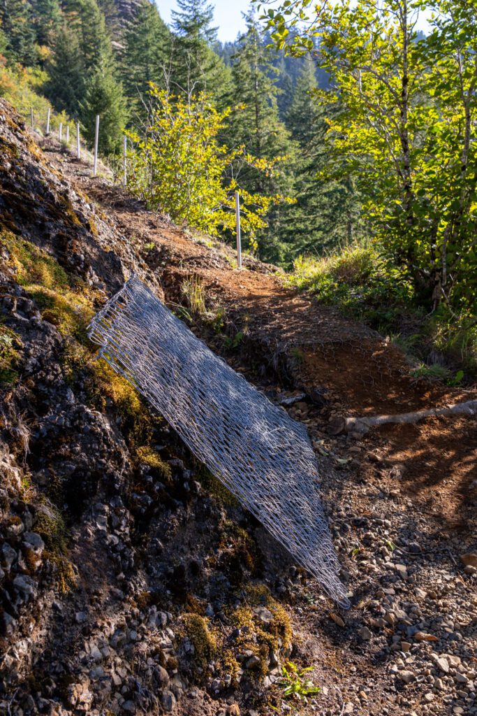
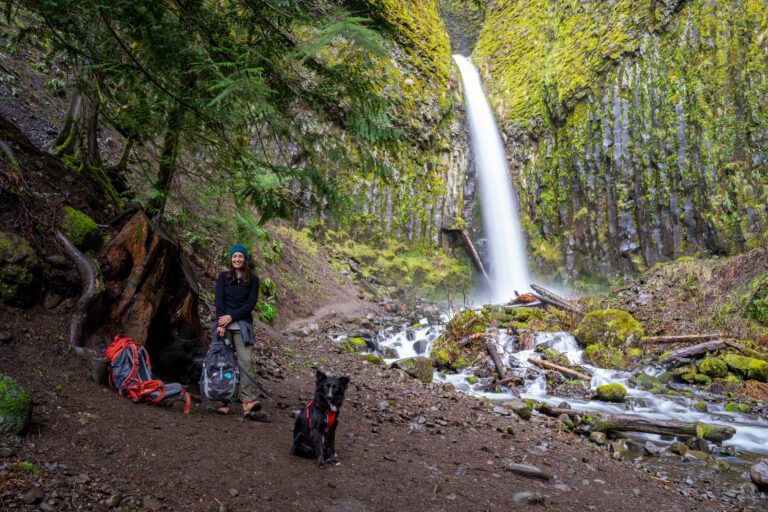
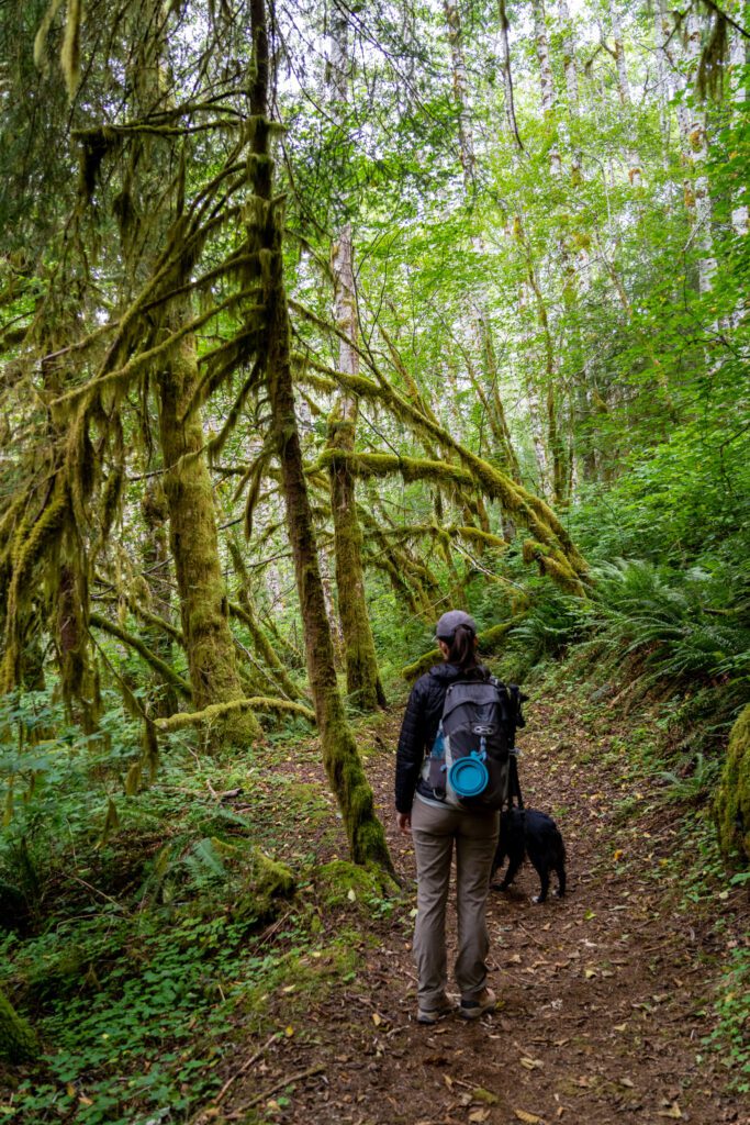
We had Lupine with us on this trail, and while she didn’t end up with any injuries from catching an unfinished edge of wire, she definitely wasn’t enjoying walking on it.
If we were going to do it again, we’d probably choose to leave Lupine at home to avoid the risk of injury (or choose a different hike if we wanted to bring her).
Things to Know Before You Hike Saddle Mountain
Here are a few things you’re going to want to know before you hit the trail that don’t really fit into the sections above.
You’re going to want sturdy hiking shoes or boots. We mentioned the chain link covering on the top half of the trail as a hazard for dogs, but it’s also a hazard for humans. Catching an edge of chain could pretty easily poke a hole in flimsy tennis shoes, which wouldn’t be great (and could involve a post-hike tetanus shot). We’d make sure to have some sturdy boots or shoes for this hike. Alysha loves her Columbia Newton Ridge hiking boots, which are an excellent first pair of hiking boots.
Parking Pass? After scouring the internet and the signs at the trailhead, we’ve determined that you DO NOT need an Oregon State Parks Pass to park here because it’s not an Oregon State Park, but a state natural area. However, you should still get one if you plan on taking advantage of the great network of state parks we have here in Oregon!
Bring layers for the top. The weather at the trailhead is probably going to be very different from the weather at the top, especially if it’s windy up there. Bring layers with you on this hike – we usually hike with a t-shirt (not cotton), lightweight pullover/fleece (big fans of the Outdoor Research Trail Mix series over here!), and a light jacket (we like our Patagonia Nano Puffs as a lightweight packable jacket). Plus, a rain jacket. Because this is the Pacific Northwest after all.
The access road gets closed periodically due to fallen trees in the stormy winter months. Check conditions before you go, which you can do here.
Hiking the Saddle Mountain Trail: A Complete Guide
Now that we’ve covered most of the information we think you need to know before you get out on the trail, let’s talk about the trail itself!
The hike up Saddle Mountain is a pretty straightforward affair, but we’re going to break it into two distinct sections to make it more digestible, and so that you’ll be able to keep track of where you are on the hike when you’re on the trail.
Plus, we think the final ascent to the summit (and the way back down, which is arguably more treacherous) deserves its own section.
Those two sections are:
- The Ascent to the First Real Viewpoint
- The Final Ascent to the Saddle and Summit
For each, we’ll give you the distance and elevation gain you’ll cover, a trail description to help you understand what to expect, and, of course, some pictures we’ve taken.
The Initial Climb to the First Real Viewpoint
Length: 1.8 miles // Elevation Gained: 1,350 feet
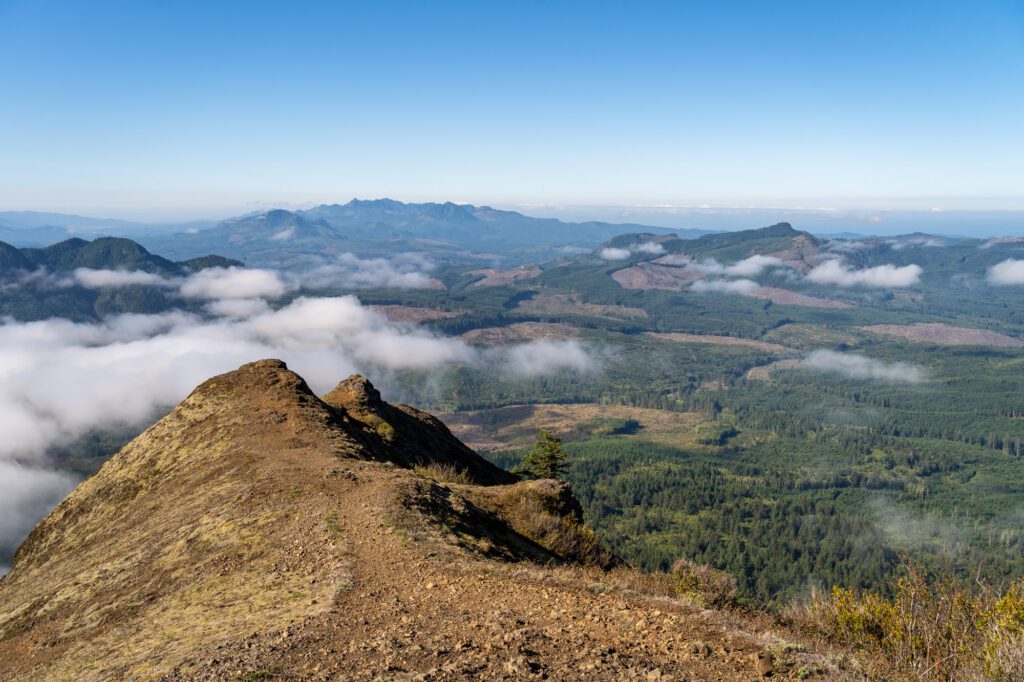
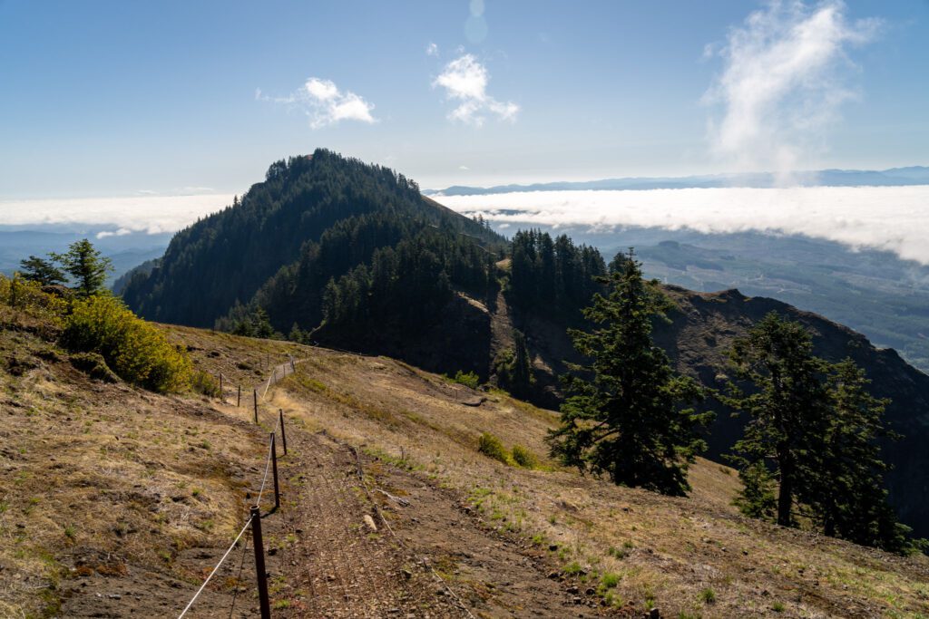
While there are several places where you’ll utter an involuntary “whoa” over the first half of this trail, the first real showstopper comes at ¾ of the way to the top. Which is where we’re ending this first section.
From the parking lot, you’ll start up the trail, passing a trail sign that calls out the fact that you’re going to want sturdy footwear due to the wire along the top half of the trail.
Almost immediately, you’ll pass an offshoot for the Humbug Mountain viewpoint (not to be confused with the Humbug Mountain on the Oregon Coast), but we’d skip it because, well, the views are better from just about every part of the hike.
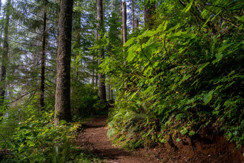
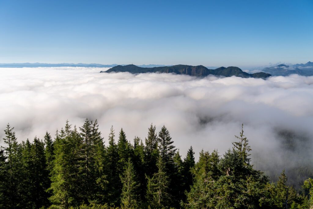
The first half mile or so is a gentle, straightforward climb through a dense forest, thick with moss and ferns even in the height of summer, and then the trail changes and it’s one switchback after the other all the way up to the aforementioned viewpoint.
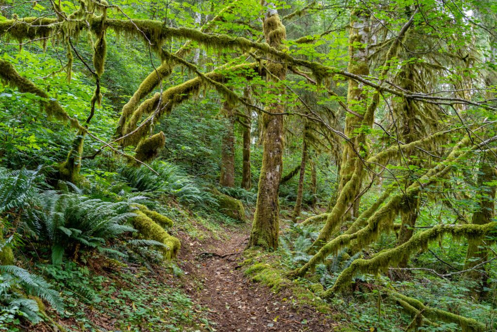
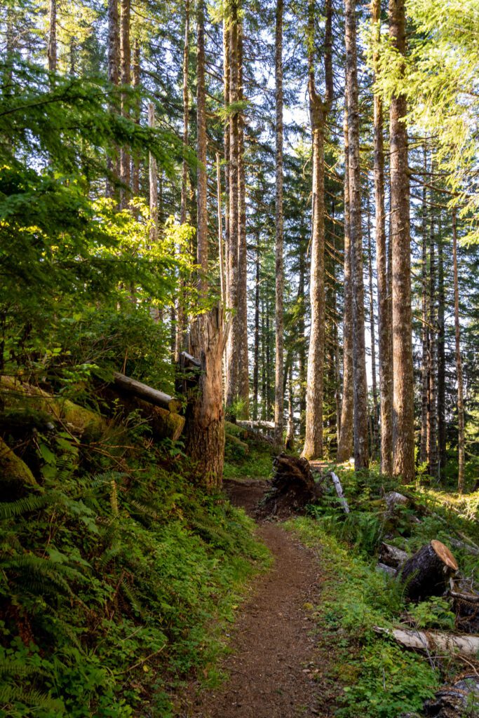
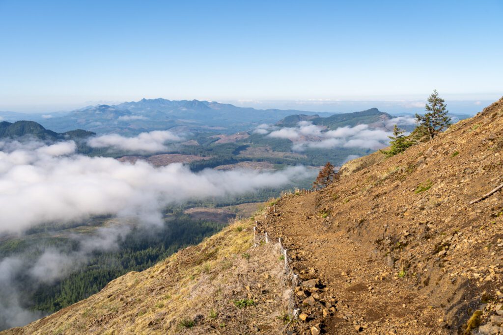
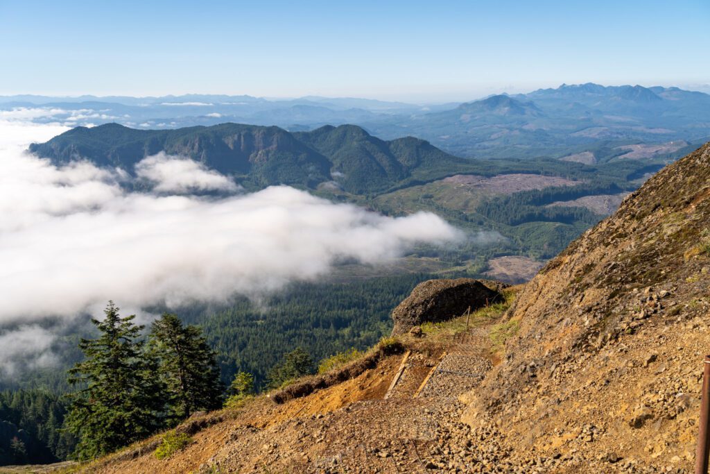
This second section of the trail – the switchbacks – is significantly more difficult than the first half mile. Not only is it steeper, but the footing is less reliable, with rocky sections and places where the trail has clearly been washed out a time or two, then repaired.
At one point, about two thirds of the way into this section, you’ll reach a picnic table as you turn a corner, which makes an excellent place to grab a snack, a drink, and a quick rest before you continue.
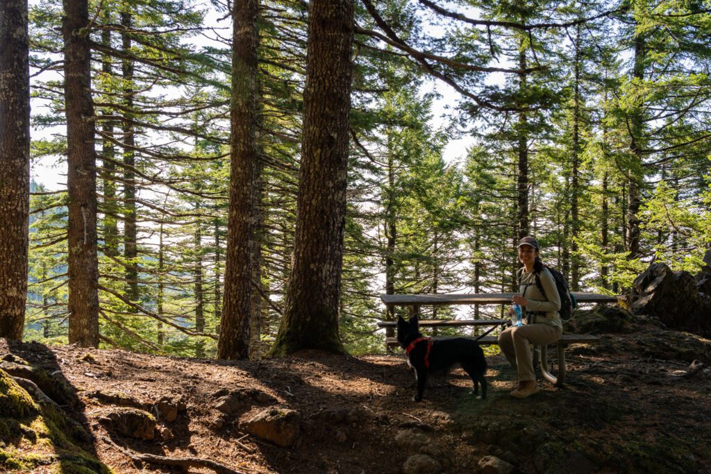
There’s another picnic area tucked into the forest just below the viewpoint.
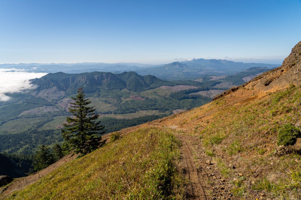
Here are a few pictures from the top half of this first stretch of trail.

Past the Saddle to the Summit… of Saddle Mountain
Length: 0.6 miles // Elevation Gained: 450 feet
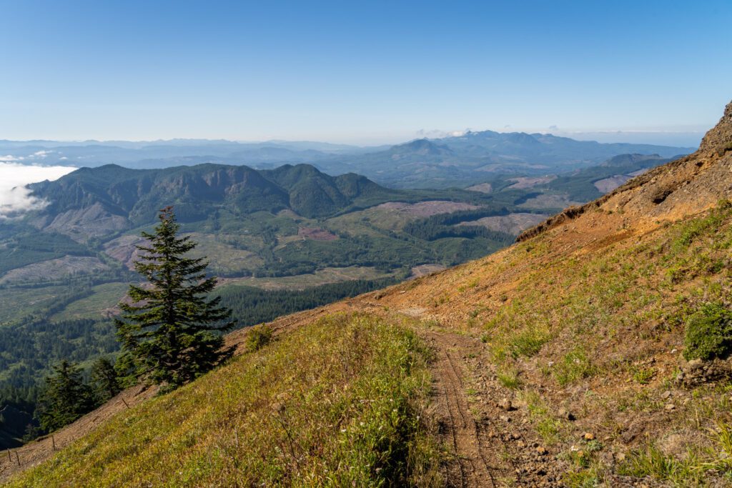
From that viewpoint, you’ll round the corner and tackle a short, steep descent to the actual saddle.
There’s not much to see here considering you’re almost to the summit, if we’re being honest, though the view out to the south is pretty impressive.
Ahead of you, you’ll see the steep trail winding up the side of Saddle Mountain up to the summit, which is your final destination.
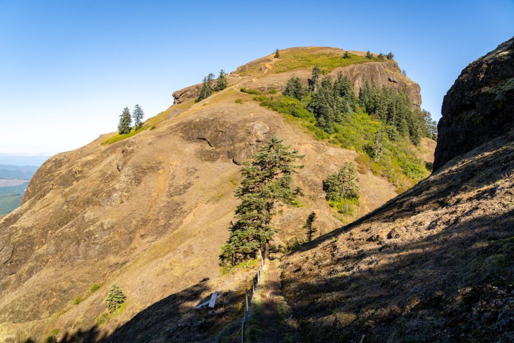
This entire section of trail from the saddle up to the summit is covered in wire, which is good in the sense that it helps with traction, but bad in the sense that your feet can snag on the ends.
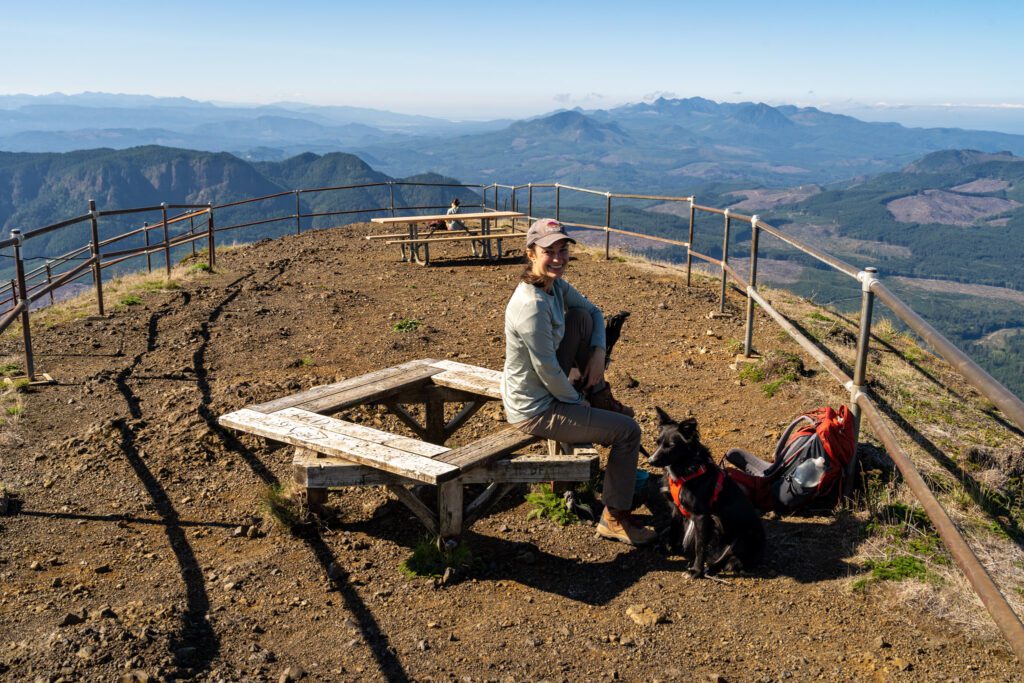
This part of the trail is, by far, the steepest, most difficult, and most treacherous section of the entire hike. It’s a tough climb, but the views from the summit make it all worth it.
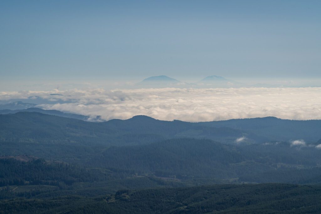
When we arrived at the summit, after climbing up through the fog and ascending above the low fog line, we could see all the way over to Mount Hood, Adams, St. Helens, and even Rainier in the distance.
In the other direction, you can see up to the mouth of the Columbia River and Astoria and down the coast towards Cannon Beach.
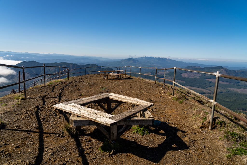
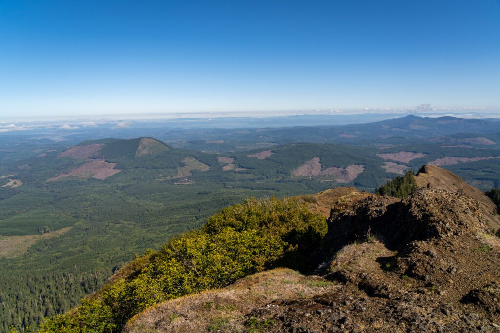
It’s a pretty magnificent view, and we spent 30 minutes or so up at the top catching our breath, eating snacks, and admiring the views in every direction. There are a couple of places to sit, including a picnic table and a little seating ring of benches.
The entire area is enclosed by a metal rail – definitely don’t venture outside that rail for your own safety and for the safety of the ecosystem up there.
Be careful on the way back down because it is very, very steep, and both of us and a hiker in front of us nearly slipped and fell on the way down.