Hiking in Bend, Oregon: A Complete Guide for First Timers
Looking for a comprehensive guide to the best hikes in Bend? You’re in the right place (BONUS: we’ve actually done the vast majority of the hikes on our list!).
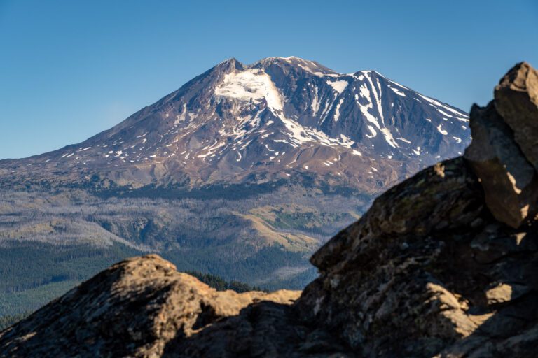
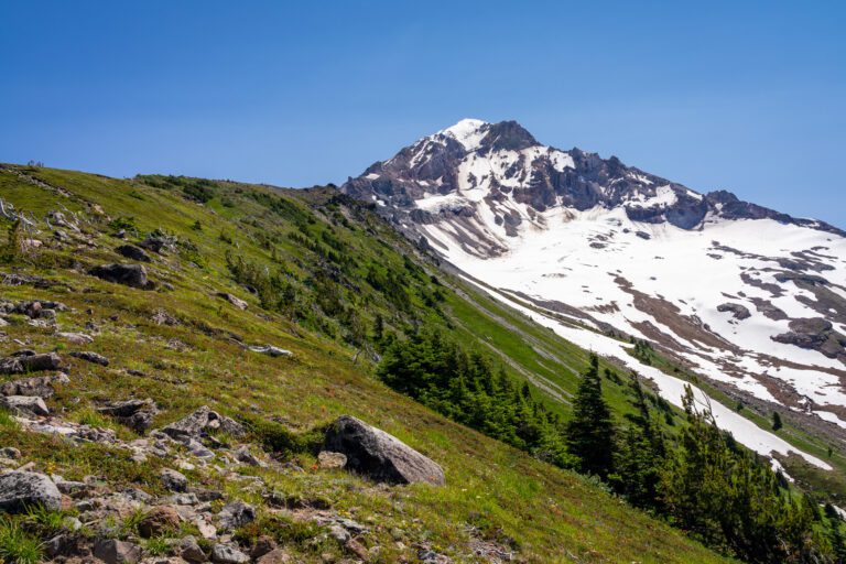
On our last trip to Bend, which took us from our home in Portland up Highway 26 past the base of Mount Hood and into central Oregon, we spent a good chunk of the drive talking about how fast and drastically the landscape changes as soon as you cross over the Cascades. Dense evergreen forests give way to relatively sparse pine forests, with not a lush fern in sight.
The thing we enjoy about hiking in Bend is the diversity of landscapes you have within roughly an hour and a half of the small city that sits on the edge of Oregon’s high desert.
You have the Cascades and all the alpine lakes and snow capped peaks you could possibly want, a surprisingly robust waterfall, tons of riverfront trail, a barren volcanic landscape, and the rocky outcroppings of Smith Rock State Park that feel like they should be somewhere in Utah. All within 90 minutes!
In this guide, we’re going to cover our picks for the best hikes near Bend, Oregon. We’ll start with logistics – namely when to plan your trip if hiking is a priority, and how to navigate the Central Cascades Wilderness Permit system – and then walk through 14 excellent Bend hikes that we love, and think you will too.
Our intention is that, by the end, you’ll have all the information you need to plan an excellent Bend adventure.
Sound good to you? Let’s get into it.
Disclaimer: Some of the links in this post, like hotel and vacation rental links, are affiliate links, meaning at no additional cost to you we make a little bit of money if you click through and book. That being said, we would absolutely never recommend something to you that we don’t stand behind 100%.
The 14 Best Hikes in Bend, Oregon: A Complete Hiking Guide
Now that we’ve got the logistics out of the way – and they’re really important in this case, which is why we led with them – let’s get into the hikes themselves! We’re limiting this list to hikes within 90 minutes of Bend.
There are only two hikes on this main list – Broken Top and the South Sister – that we haven’t personally done from start to finish. Every other hike here is one that we’ve done (sometimes multiple times) and enjoyed enough to include it on this list.
We’re organizing them by Distance / Drive Time from Bend, with the closest trails to Bend appearing at the top.
If you’re making us choose the best of the best, we’d say that the Green Lakes Trail and the trail to Moraine Lake are our favorites (and they leave from adjacent trailheads, so you can actually combine them into one longer hike if you have gas in the tank).
The Newberry Volcanic National Monument trails – Paulina Peak and the Trail of the Molten Land – are also well worth your time, and they don’t require a day use permit either.
The Pilot Butte Trail (In Bend)
- Length: 2.1 miles
- Elevation Gain: 470 ft.
- Trail Type: Out and Back
- Difficulty: Easy
- Dog Friendly? Yes, on a leash
- Pass Required: None
- Wilderness Permit: None
- Trailhead Location
- Distance / Drive Time from Bend: N/A (it’s in Bend!)
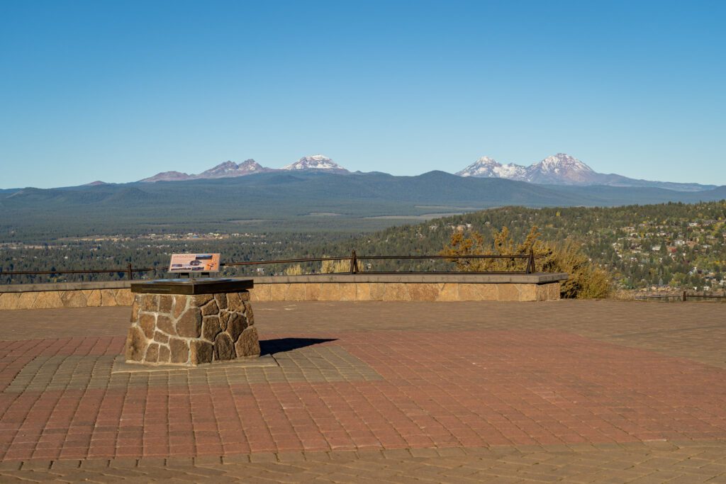
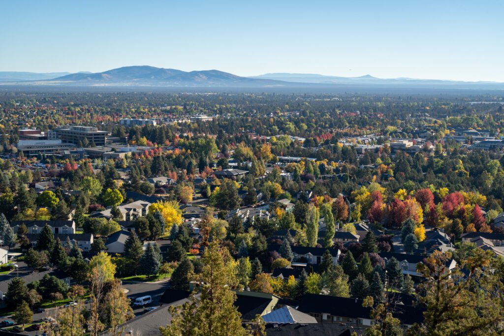
Pilot Butte is Bend’s version of Mount Tabor – an old cinder cone formed by volcanic activity years and years ago – and offers a similar proposition; great views of the surrounding area.
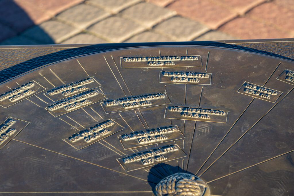
However, we’d say that the views from Pilot Butte are significantly better than Tabor thanks to the views of the peaks of the Cascades you get on a clear day. There’s even a handy map at the top that guides you through the various peaks, buttes, and mountains, helping you figure out what exactly you’re looking at.
As we were driving around Bend, Pilot Butte became something of a beacon for us, helping us orient ourselves no matter what part of town we were in. Which, I’d imagine, is somewhat similar to its role in Bend’s early days when it was a burgeoning timber town.
It’s a popular trail, and it gets dusty in the dry summer months (although I guess most months are dry in Central Oregon). There are a couple of routes, but the most direct is the dirt trail – called the nature trail – that winds its way around the side of the mountain.
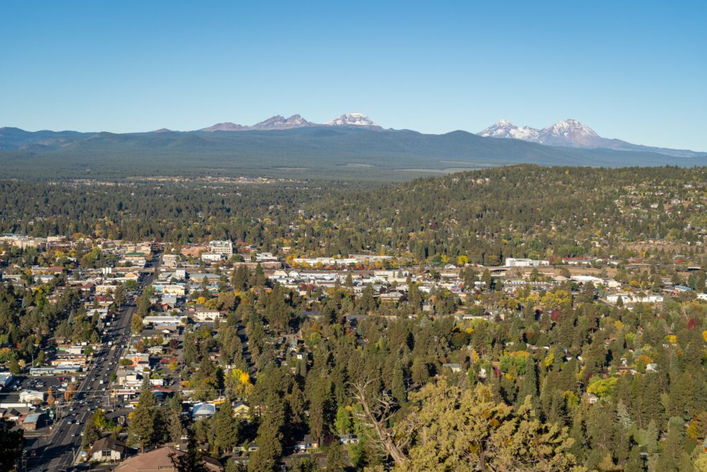
The first half of the trail is relatively uneventful, but as you round the north side of the butte you get a view of Mount Jefferson first, and the views only get better from there.
Pro tip: You can drive up to the summit between 10am and 9pm from April to November, so try to do this hike in the early morning to avoid the noise and congestion from cars driving up to the top.
The Deschutes River Trail (In Bend)
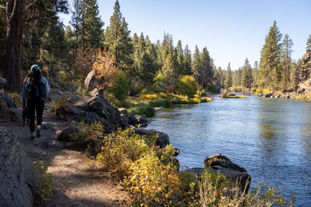
This one is a little different, because the Deschutes River Trail runs for miles, following the path of the river that has shaped Central Oregon’s history.
Instead of separating the hikes along the riverfront path under different headings (to make this list seem artificially longer, you might say), we’re going to talk about three of them here under the same heading.
We love the fact that there is such a well-developed riverfront trail in Bend, and have spent hours meandering along the Deschutes River, enjoying the mostly flat walks with a built in water feature and scents of juniper and cedar keeping us company along the way.
There are three particular sections we’d recommend:
- The Old Mill / Riverbend / Farewell Bend Loop (~4.5 miles): This one leaves right from the Old Mill District, following the river south for a couple of miles before reaching a bridge at the end of the trail, where you’ll cross over and head back the way you came. We will say that we like the eastern side of the river better here if you’re out in the morning because it’s mostly shaded, while the other side of the river is fully exposed. More trail information here.
- Tumalo State Park to Riley Ranch (~7 miles): We did this hike when we camped at Tumalo State Park a few years ago, and it’s another great riverfront walk where we saw a bunch of wildlife and very few humans. It’s relatively easy, with just 400 feet of elevation gain over those 7 miles, but it is fairly exposed so bring sun protection and water (and avoid it midday in the summer). More trail information here.
- Meadow Day Use and Lava Island (~6 miles): For this one, you’ll have to head south out of town to the Meadow Day Use Area, where you’ll find the trail along the western side of the river. Across the river is the Newberry Volcanic National Monument, and there are some interpretive signs along Lava Island that are interesting. Overall, far fewer people than the Old Mill loop, with very similar scenery and vibes. More information here.
The best part about this set of trails is that they’re fairly customizable with no real destination (versus a lake or peak you’re hiking to), so you can do exactly as much as you feel like without missing out on too much.
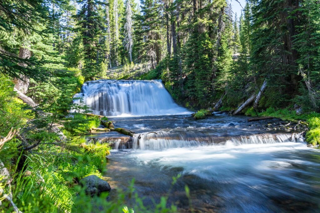
The Tumalo Falls Trail
- Length: 6.4 miles
- Elevation Gain: 557 ft.
- Trail Type: Out and Back
- Difficulty: Moderate
- Dog Friendly? Yes, on a leash
- Pass Required: Northwest Forest Pass or America the Beautiful Pass
- Wilderness Permit: None
- Trailhead Location
- Distance / Drive Time from Bend: 11 miles / 16 minutes
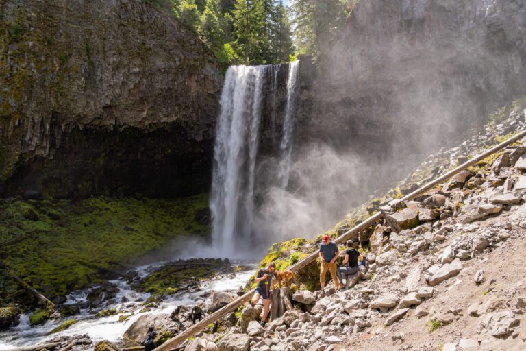
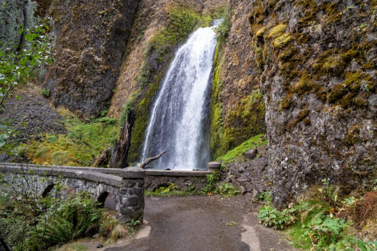
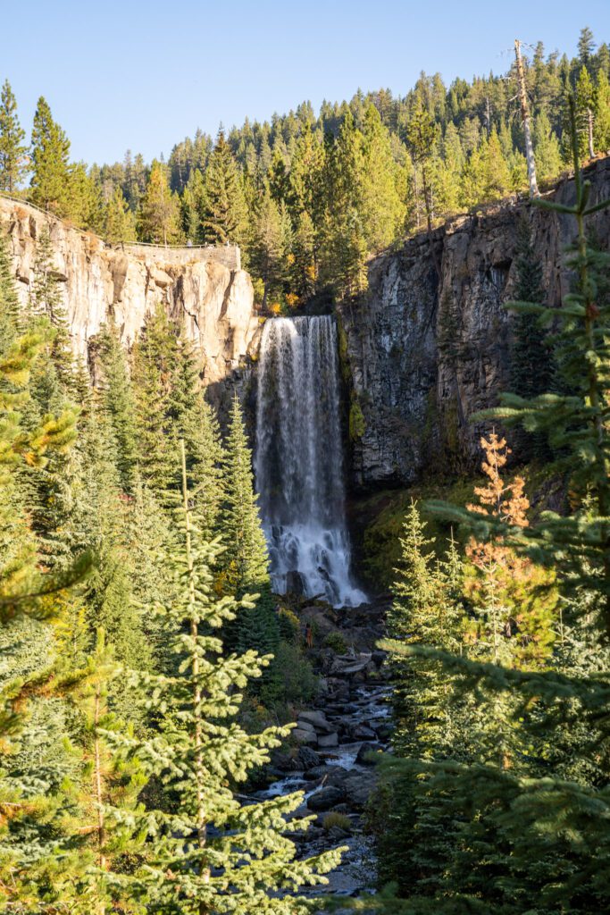
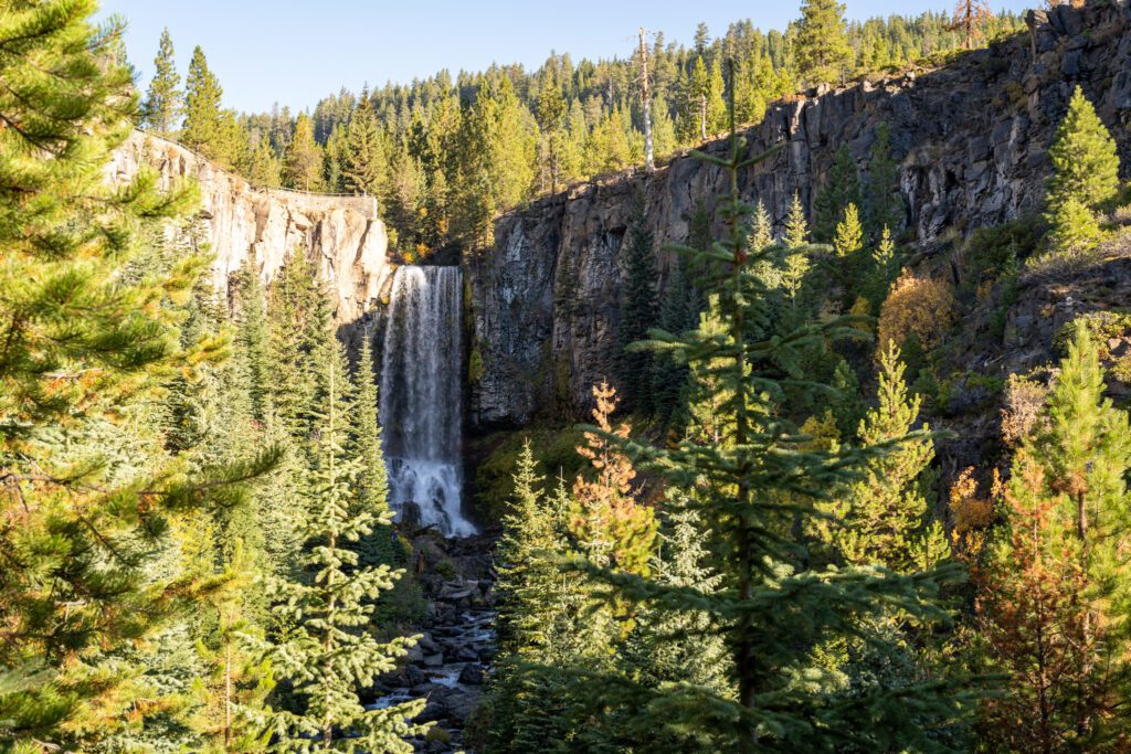
Tumalo Falls is one of our favorite waterfalls in Oregon, which is saying something given the fact that we live 30-45 minutes from both the Columbia River Gorge AND Silver Falls State Park.
The view from the lower viewing platform up the creek to the falls is lovely, and the upper viewpoint gives you a nice top-down view of the falls.
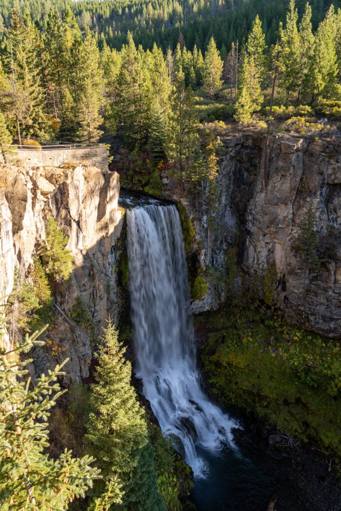
You should know that you can drive right up to the waterfall – there’s a parking lot at the lower viewing platform – but the hike along the creek is nice, and sidesteps the inevitable parking nightmare that unfolds nearly every morning at the main parking lot.
The hike we’re talking about here is a nice, mostly flat hike along Tumalo Creek.
From the top, you can continue along the trail to a bunch of other waterfalls – notably Double Falls – which adds about a mile to the hike distance. Or, park at the main lot at the base of the falls and do this longer loop that takes you away from the crowds along the creek, with numerous waterfalls along the way.
Trail of the Molten Land (Newberry Volcanic National Monument)
- Length: 1.0 miles
- Elevation Gain: 124 ft.
- Trail Type: Lollipop
- Difficulty: Easy
- Dog Friendly? Yes, on a leash
- Pass Required: America the Beautiful Pass
- Wilderness Permit: None
- Trailhead Location
- Distance / Drive Time from Bend: 12 miles / 20 minutes
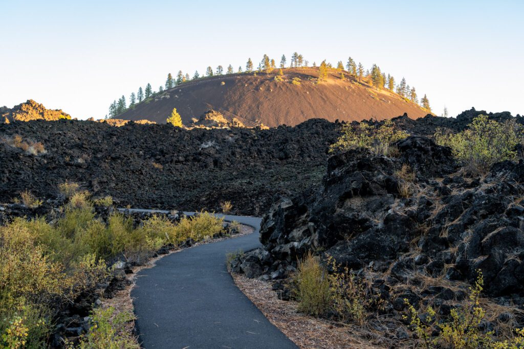
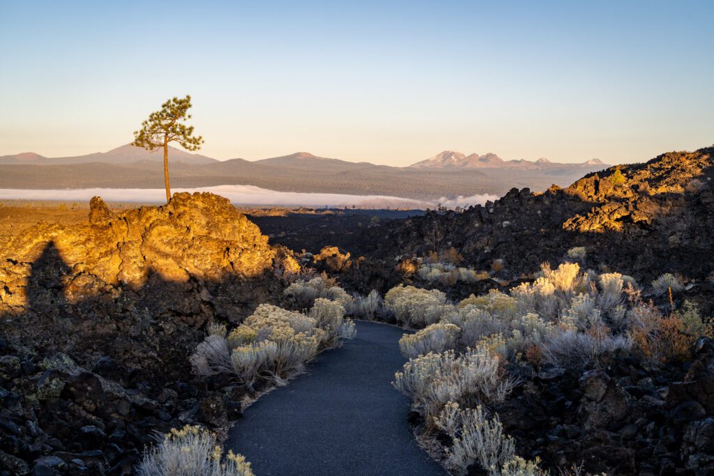
Calling this a hike is a bit of a stretch given that it’s a fully paved path that’s only about a mile long, but this was an unexpected delight for us, so we’re including it!
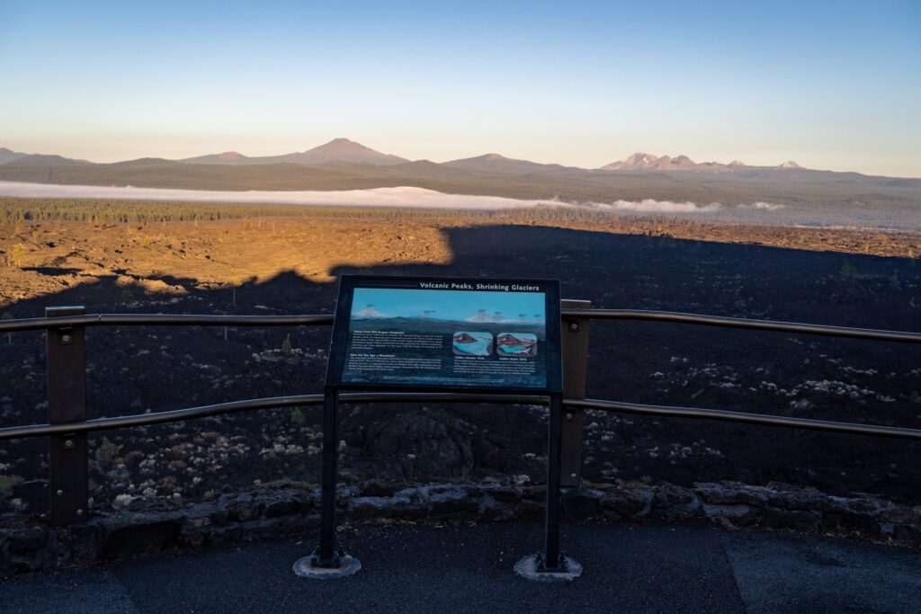
The entirety of Newberry Volcanic National Monument was a delight, really, but this was our first stop of the day and we were lucky to have this lava field all to ourselves. It’s a short double-sided lollipop (meaning a lollipop with a spur trail at the end that takes you to a great viewpoint).
Along the way, there’s a series of interpretive signs that teach you about the history of the volcano and how it has shaped the landscape.
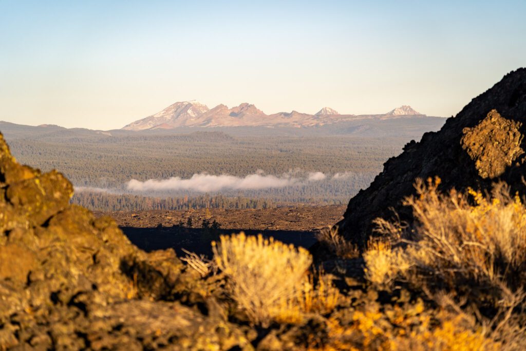
The viewpoint at the end has a great view out over Deschutes National Forest towards the Three Sisters, Broken Top, and Mount Bachelor.
Worth a stop if you’re exploring the national monument! Don’t miss driving up to Lava Butte, the cinder cone formed by volcanic activity.
The Tumalo Mountain Trail (Cascade Lakes National Scenic Byway)
- Length: 4 miles
- Elevation Gain: 1,440 ft.
- Trail Type: Out and Back
- Difficulty: Moderate
- Dog Friendly? Yes, on a leash
- Pass Required: Northwest Forest Pass or America the Beautiful Pass
- Wilderness Permit: None
- Trailhead Location
- Distance / Drive Time from Bend: 21 miles / 26 minutes
This was the surprise superstar of our latest trip to Bend. We headed out to get a quick hike in on our first afternoon in Bend, and neither of us was quite sure what to expect as we hit the trail.
Basically the only thing we knew we’d find was a good workout, because this trail climbs nearly 1,500 feet over two miles en route to the summit of Tumalo Mountain.
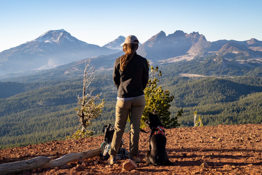
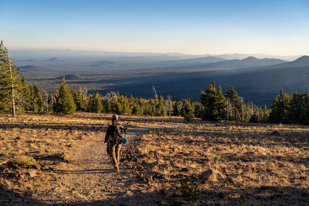
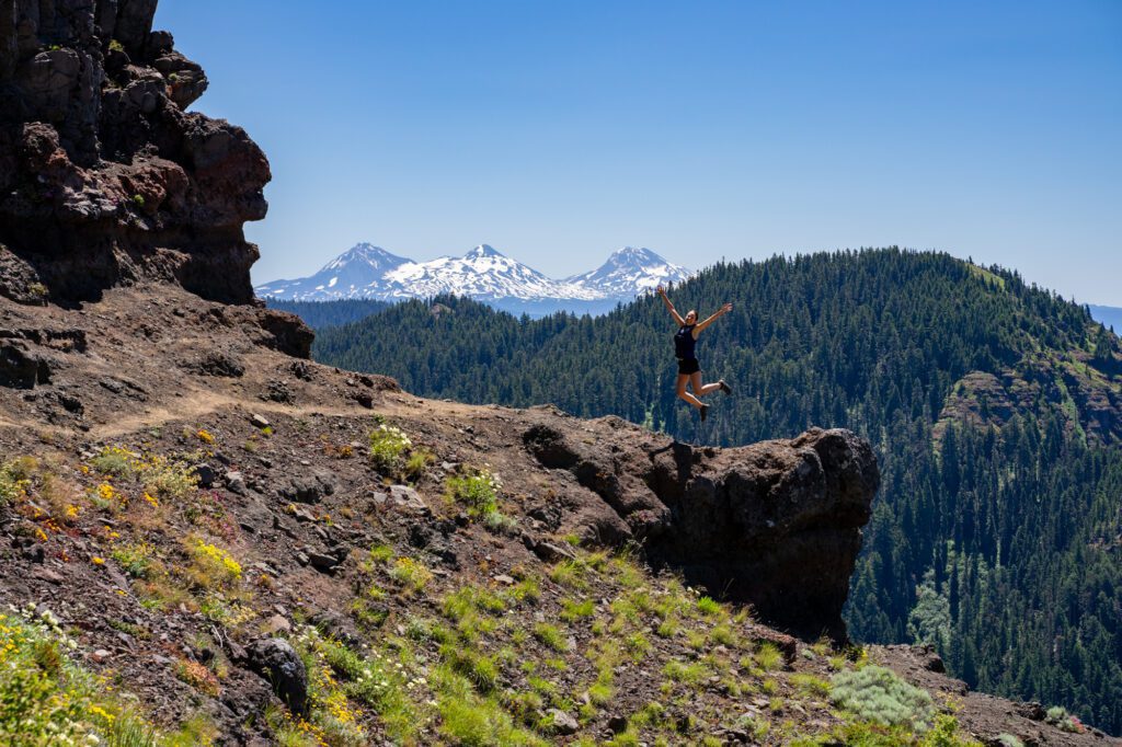
We certainly weren’t wrong about that. It’s a steady, tough climb from start to finish. About half way through the hike, as you’re starting to question if the effort is going to pay off, your morale will be bolstered by the views of Mount Bachelor (which is behind you on the way up).
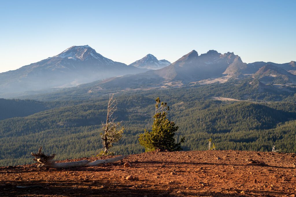
But the end point – the summit of Tumalo Mountain – is worth the effort and sweat you’re going to put in to get there.
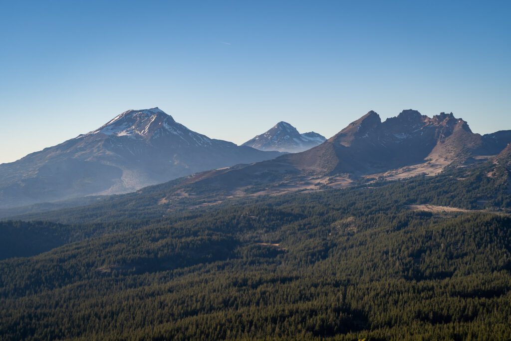
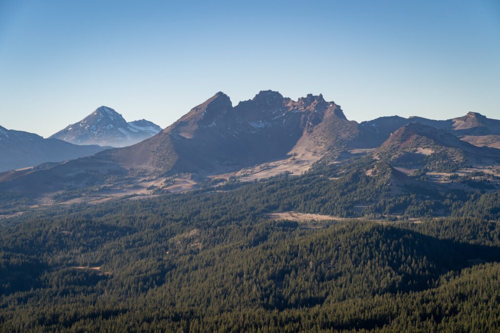
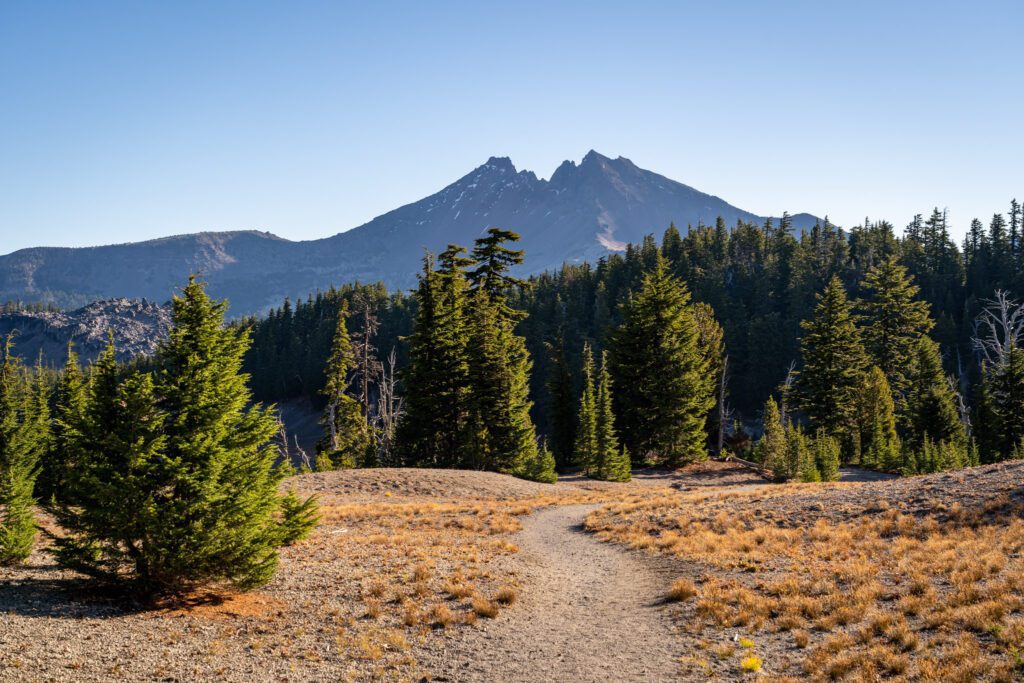
You’ll have an unobstructed view of Broken Top and the South Sister, along with a partial view of the other two sisters and great views out to the east, where you can really see the terrain shift into the high desert of eastern Oregon.
One of the best parts about the Tumalo Mountain Trail is that you don’t need a Central Cascades Wilderness Permit to hike it, which is why we were able to head out and do it on a whim.
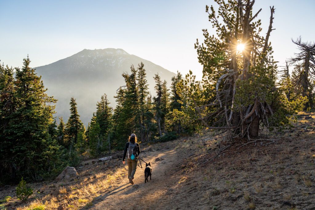
The hike leaves from the Dutchman Sno-Park, where there is a pit toilet, and starts climbing immediately.
It’s forested for the first mile and a half, and you’ll know you’re approaching the summit when you exit the forest, see Mount Bachelor looming behind you, and start to tackle a few switchbacks that get more and more exposed as you go.
Broken Top and No Name Lake (Cascade Lakes National Scenic Byway)
- Length: 13.3 miles
- Elevation Gain: 2,657 ft.
- Trail Type: Out and Back
- Difficulty: Hard
- Dog Friendly? Yes, on a leash
- Pass Required: Northwest Forest Pass or America the Beautiful Pass
- Wilderness Permit: If you are hiking this trail between June 15th and October 15th, you will need a Central Cascades Wilderness Permit for “Three Sisters – Todd Lake.”
- Trailhead Location
- Distance / Drive Time from Bend: 24 miles / 30 minutes
Broken Top and No Name Lake will surely make our list of the best hikes in Oregon, and the only reason it doesn’t show up there just yet is the simple fact that we somehow haven’t been able to do it ourselves.
However, it deserves a spot on this list, so we’re going to give you our take on what you need to know to hike it safely.
I’m currently sitting here in Bend in early October on a day where we had a permit to hike to Broken Top, but it’s foggy and snowing at the top, which means we bailed on it and are going to have to save it for next summer. Instead of hiking, I’m writing this guide, which I suppose is a win for you?
Anyway, Broken Top and No Name Lake have become a bit of an Instagram celebrity over the past few years, and are probably near the top of the list of hikes that really needed a permit system to limit impact on the environment.
There are a few ways to do this hike, and your first choice is going to depend on how comfortable you and your vehicle are navigating truly awful forest roads.
There are three trailheads on the Cascade Lakes National Scenic Byway that serve as an entry point for the hike to Broken Top and No Name Lake, and all require a Central Cascades Wilderness permit for both day and overnight use.
- Broken Top Trailhead: This is the hardest to get to, and requires a high clearance, 4WD/AWD vehicle to reliably reach. The upside is that reaching this trailhead means the hike is very, very manageable at 5.5 miles and 1,400 feet of elevation gain.
- Crater Ditch Trailhead: Slightly easier to reach with a slightly longer hike, this trailhead is also going to require a high clearance vehicle, but the road is slightly better and shorter than going all the way up to the Broken Top Trailhead. The result is a 7.8 mile hike with 1,450 feet of elevation gain.
- Todd Lake Trailhead: This trailhead is right off of the Cascade Lakes National Scenic Byway, and is the most developed trailhead with toilets and lots of parking. Every car can make it to this trailhead, but it makes the hike a long one at 13.3 miles with nearly 2,700 feet of climbing.
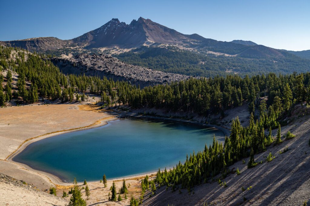
The payoff for the hike is a superb view of Broken Top from up close and personal, with the turquoise water of No Name Lake to keep you company.
This hike is likely to have snow and ice well into July, and it returns again in late September/early October, so the season is very, very short.
The permits are competitive for all three trailheads, and will sell out for summer weekends, so make sure to try to get on right at 7:00am PST 10 days in advance to get a permit (and be prepared to try again two days in advance if you don’t get one).
The Green Lakes Trail (Cascade Lakes National Scenic Byway)
- Length: 9.1 miles
- Elevation Gain: 1,174 ft.
- Trail Type: Out and Back
- Difficulty: Moderate
- Dog Friendly? Yes, on a leash
- Pass Required: Northwest Forest Pass or America the Beautiful Pass
- Wilderness Permit: If you are hiking this trail between June 15th and October 15th, you will need a Central Cascades Wilderness Permit for “Three Sisters – Green Lake/Soda Creek Trailhead.”
- Trailhead Location
- Distance / Drive Time from Bend: 26 miles / 32 minutes
We absolutely love this hike, and the first thing we would say about it is that you should definitely not let the distance scare you away.
For the most part, this is an easy stroll along a babbling creek with a major payoff at the end featuring crystal clear lakes and show-stopping views of both the South Sister and Broken Top.
It’s not hard to see why this trail is one of the most trafficked hikes near Bend.
The hike starts from the Green Lakes Trailhead along the Cascade Lakes National Scenic Byway, where there is a fairly big parking lot that, despite the permit system being instituted, still is full by early morning on summer weekends.
We’d suggest that you plan on arriving at the trailhead, which is 45-60 minutes from Bend, by 8am or so if you’re coming in the summer, even with the permit system in effect.
The trail enters the Three Sisters Wilderness almost immediately, which might be our favorite wilderness area in all of Oregon (though there are SO MANY to choose from, it’s hard to choose just one).
You basically follow Fall Creek all the way from the trailhead up to the lakes, and who doesn’t love a nice water feature as you hike? There are a couple of waterfalls along the way that we stopped to take some photos of as we went.
At the end of the hike, you’ll emerge into a basin that sits between the South Sister and Broken Top with a series of gorgeous lakes to keep you company.
If you continue on past the main lake in the basin, there is another lake to explore.
This would make an excellent backpacking trip for beginners (one or two nights) because it’s not particularly difficult, it’s beautiful, and there are a plethora of nice day hikes you can do from the campsites here, including the South Sister.
Keep in mind that you will need a Central Cascades Overnight Permit for that overnight trip.
We actually had overnight permits for early October in 2023, but we decided to cancel thanks to snow.
Important note for dog owners: This is a fantastic dog-friendly hike because there’s water access from start to finish, but dogs MUST be on a leash in the peak summer months from July 15th to September 15th (unless they are on their way in or out of the water).
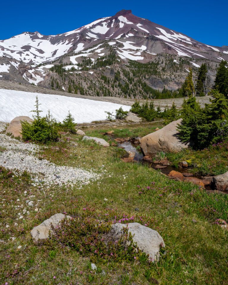
The South Sister (Cascade Lakes National Scenic Byway)
- Length: 11.6 miles
- Elevation Gain: 4,986 ft.
- Trail Type: Out and Back
- Difficulty: Hard
- Dog Friendly? Yes, on a leash
- Pass Required: Northwest Forest Pass or America the Beautiful Pass
- Trailhead Location
- Wilderness Permit: If you are hiking this trail between June 15th and October 15th, you will need a Central Cascades Wilderness Permit for the “Three Sisters – Devils Lake/South Sister (Moraine Lake) Trailhead.”
- Distance / Drive Time from Bend: 28 miles / 35 minutes
The South Sister – the third highest peak in the entire state – is a beast of a hike, and requires some scrambling and route finding near the top. However, it’s truly a once-in-a-lifetime experience that only a tiny fraction of Oregonians (or non-Oregonians) will have.
This hike is no joke, and should only be attempted by experienced hikers who are in shape and acclimated to elevation. It’s long, climbs nearly 5,000 feet, and is very exposed for the second half of the trek.
The hike ends over 10,000 feet, which is HIGH if you’re coming from sea level. To be honest, unless you have a longer trip and have some time to spend acclimating to the elevation, we probably wouldn’t recommend it.
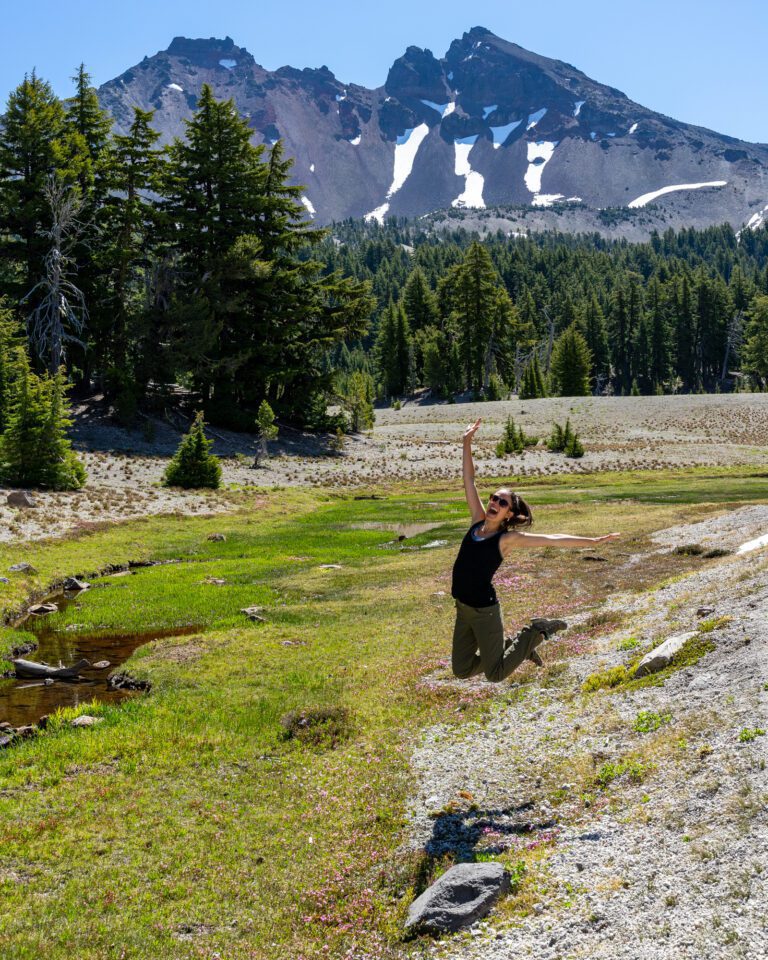
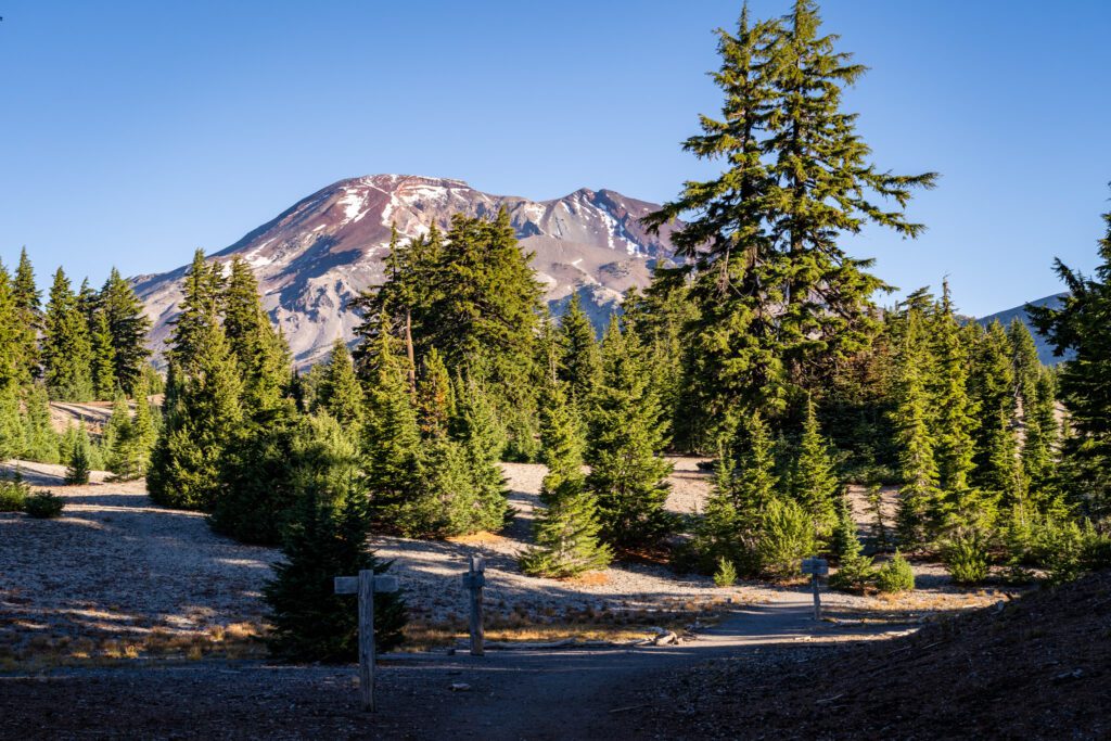
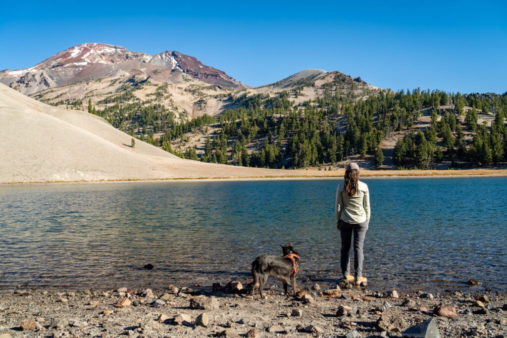
On our latest trip, we hiked up to Moraine Lake, which follows the first half of the trail up to the South Sister.
We had our dog, Lupine, with us, and weren’t super sure about her handling the 5,000 feet of climbing and the scrambling (more accurately, how we would handle doing it with her leash in our hands), so we decided on stopping at Moraine Lake.
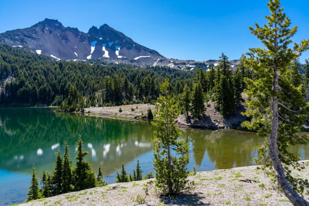
The hike up to Moraine Lake is a nice, relatively gentle climb through the forest to reach the lake, which is beautiful and has great views of both the South Sister and Broken Top from its shores.
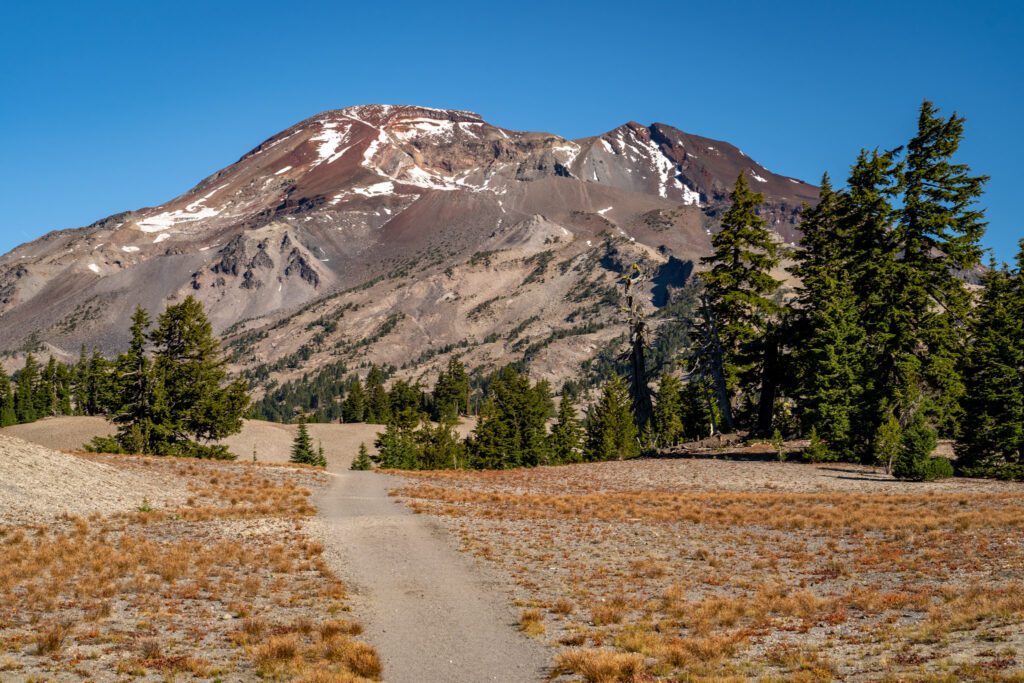
The South Sister trail doesn’t actually go down to the lake, but continues along a ridge above the lake and traverses a flat, sandy section before the climb begins in earnest.
From here, it’s roughly one mile (and a whopping 1,800 feet of climbing) to get up to the saddle and the lake at the base of the Lewis Glacier. There is no shade to be seen, and it is rocky switchbacks all the way up.
The lake is a good rest stop before tackling the last mile, which is difficult both because of the elevation gain and the fact that it’s basically sand, so you’re sliding back every time you take a step.
Like we said, not a hike to take lightly. We’d advise both checking the Alltrails reports before you go to see what conditions are like, and also reading a couple of in-depth trail guides (we like this one).
The Moraine Lake Trail (Cascade Lakes National Scenic Byway)
- Length: 5.2 miles
- Elevation Gain: 1,500 ft.
- Trail Type: Out and Back
- Difficulty: Moderate
- Dog Friendly? Yes, on a leash
- Pass Required: Northwest Forest Pass or America the Beautiful Pass
- Wilderness Permit: If you are hiking this trail between June 15th and October 15th, you will need a Central Cascades Wilderness Permit for the “Three Sisters – Devils Lake/South Sister (Moraine Lake) Trailhead.”
- Trailhead Location
- Distance / Drive Time from Bend: 28 miles / 35 minutes
Having already done the Green Lakes Trail on a previous trip (and the fact that we couldn’t get a permit for it), we decided to tackle a different hike in the same vicinity on our latest trip out to Bend.
After much debate about which trail to do, we landed on Moraine Lake, and we were very glad we did because it’s a great hike.
The hike to Moraine Lake starts at the Devil’s Lake Trailhead (the same trailhead as the South Sister climb) and as of fall 2023, takes a short detour along the Elk Devils Trail and Tye Creek Trail to meet up with the South Sister Climber Trail, which you’ll follow basically the entire way to the lake.
It’s a steady, tough climb through the forest (so plenty of shade!) for the first 1.8 miles.
At that point, you’ll exit the forest and reach a trail junction and head right.
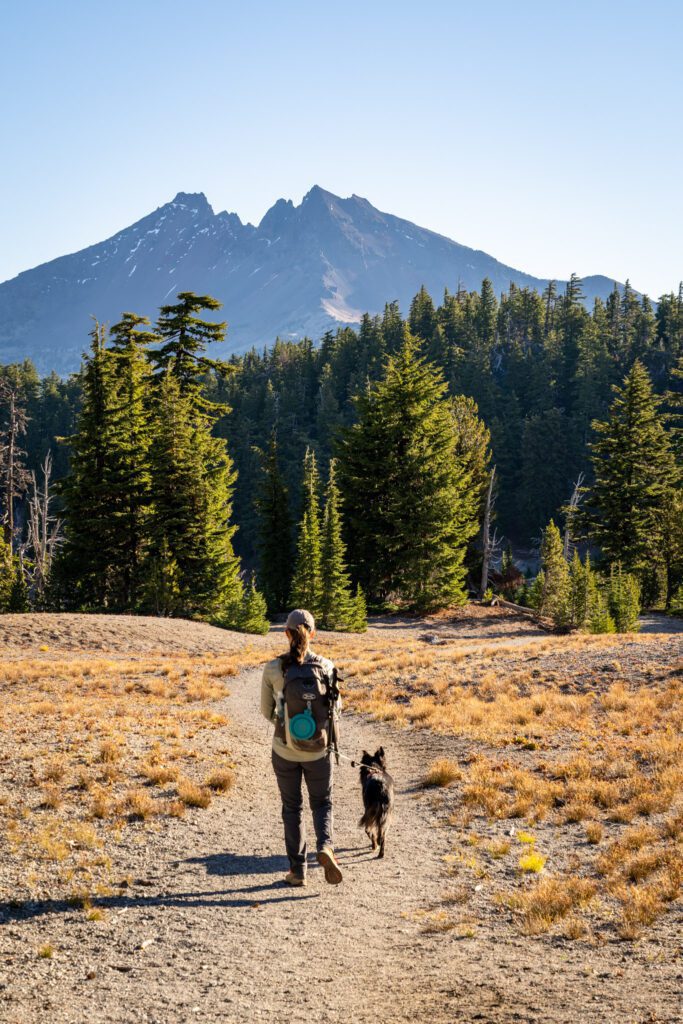
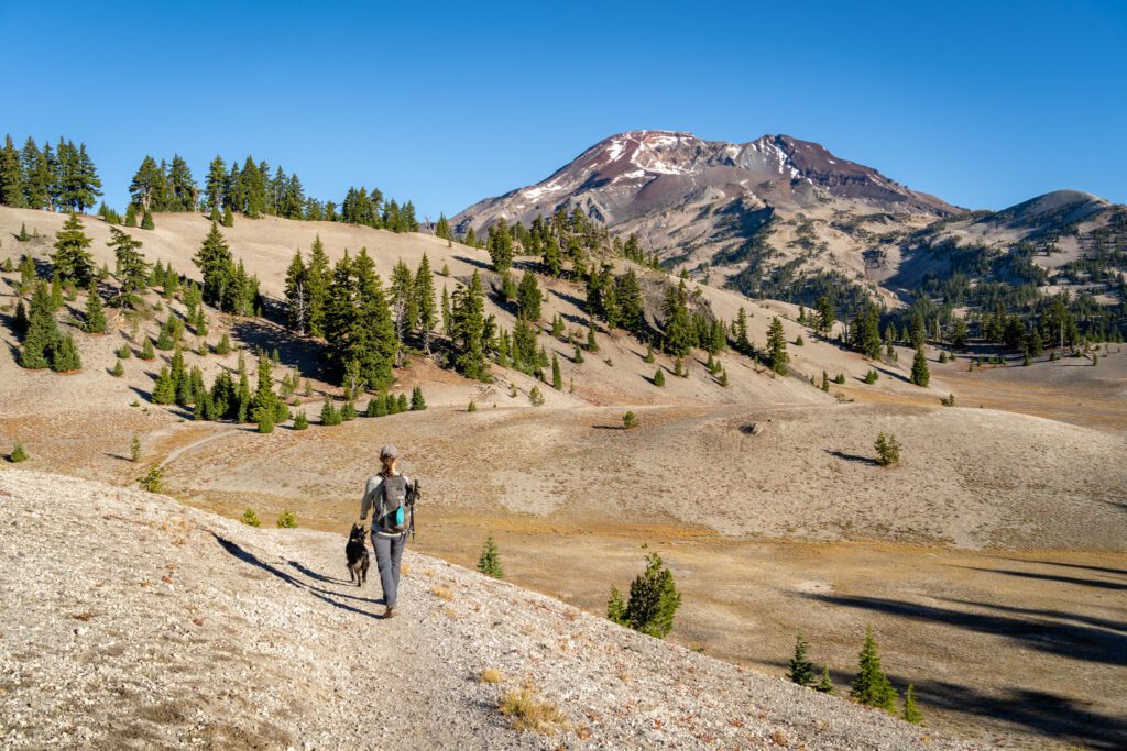
Immediately you’ll have excellent views of Broken Top, and then you’ll round a bend in the trail and be met with equally amazing views of the South Sister. Here are a few photos.
The hike up ends when you make a quick descent that takes you down to the shore of the lake.
We decided to make this a lollipop loop to make it a little more interesting. We’re glad we did because the best views of the South Sister, we think, are from the South Sister Trail immediately after the junction where you veer off to the right to head down to the lake.
To make it a lollipop, which adds a tiny bit of distance and climbing, we’d recommend heading straight at that trail junction for the South Sister views, and then taking a right at the first trail junction (which has a sign for camping at Moraine Lake).
That trail descends the hillside aggressively, and meets up with the main trail to Moraine Lake to head down to the lake.
Important note for dog owners: This is a very dog-friendly hike (we brought Lupine with us) but dogs MUST be on a leash in the peak summer months from July 15th to September 15th (unless they are on their way in or out of the water).
The Misery Ridge Trail (Smith Rock State Park)
- Length: 6 miles
- Elevation Gain: 1,761 ft.
- Trail Type: Loop
- Difficulty: Moderate / Hard
- Dog Friendly? Yes, on a leash
- Pass Required: Oregon State Park Pass
- Wilderness Permit: None
- Trailhead Location
- Distance / Drive Time from Bend: 26 miles / 38 minutes
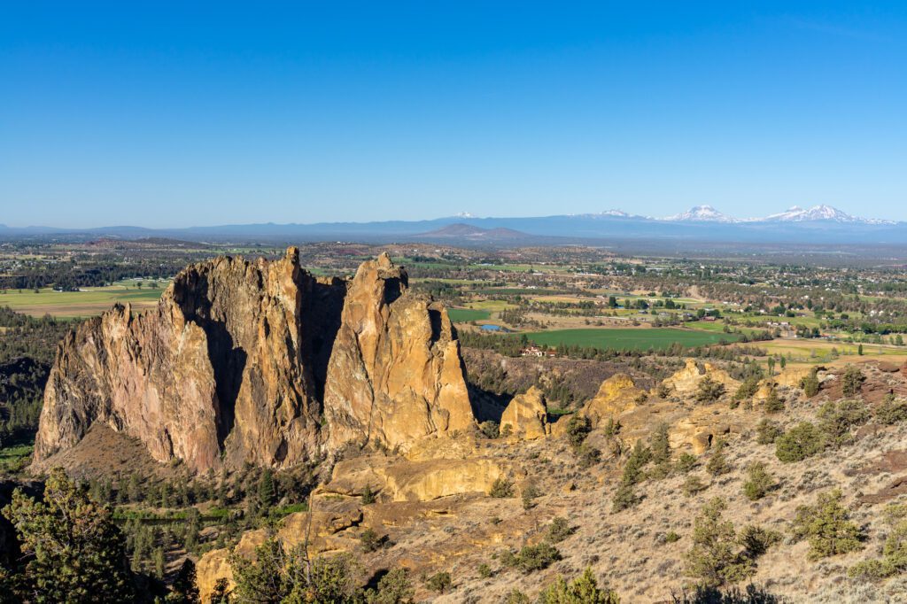
Misery Ridge is iconic, and if you’ve spent any time at all in the high desert of Central Oregon, you’ve likely heard of it. Smith Rock State Park is 15 minutes east of Redmond, which makes it an easy excursion from Bend.
Smith Rock is a great example of just how different the landscapes in Central Oregon are from the wetter, greener area of western Oregon that we’re from.
The rocky landscape in Smith Rock State Park seems like it came straight out of Utah rather than anywhere in the Pacific Northwest, and is a good reminder that the Pacific Northwest is more diverse than the neverending evergreen forests on the west side of the Cascade range.
The Misery Ridge trail – which we’d say is aptly named – starts with a steep ascent up a gully that is fully exposed and brutal if you tackle it later in the day. This is a good reminder to get an early start on this hike!
Once you’re up on the ridge, you’ll traverse the ridge to the opposite side, where you’ll get your first view of Monkey Face, a very popular destination for climbers that, well, looks kind of like the face of a monkey.
If you’re here in the early morning, you’ll very likely see climbers either making their way up, or sitting atop Monkey Face having already conquered it. It’s a very popular, very famous climbing spot.
Hence the name. It’s also a great view out to the west across the flatlands and over to the Cascades in the distance.
Then it’s a steep descent down a set of switchbacks that bring you to a trail junction, which is the point where you’ll need to choose what kind of adventure you’re in the mood for.
To the left is the riverfront loop, which is a shorter, flatter, easier hike that follows the path of the river back to the parking lot.
To the right is the summit loop which, as you might guess, is longer, more difficult, and does a lot more climbing to take you up above the rocky features of the park for some mesmerizing views.
If you’re up for it, that’s the version we’d recommend. It’s exposed and can get very hot, so make sure to bring sun protection and plenty of water.
One important note here: This is prime rattlesnake territory, and this is the first place Matt saw a rattlesnake in person (we’ve since seen a couple more). Keep an eye out and pay attention to where you put your hands and feet, and keep your dogs on a leash to avoid any unpleasant encounters. They’re way more afraid of you than you are of them, so give them plenty of space and let them slither away before continuing if you encounter one on the trail.
The Paulina Peak Trail (Newberry Volcanic National Monument)
- Length: 6 miles (4 miles with shortcut – see below)
- Elevation Gain: 1,607 ft. (1,400 ft. with shortcut – see below)
- Trail Type: Out and Back
- Difficulty: Moderate / Hard
- Dog Friendly? Yes, on a leash
- Pass Required: America the Beautiful Pass
- Wilderness Permit: None
- Trailhead Location
- Distance / Drive Time from Bend: 36 miles / 42 minutes
The entirety of Newberry National Volcanic Monument is a highlight of any trip to Bend, we think, and we had been to Bend several times before we had ever even heard of it.
After a day spent exploring the area, we were sitting on a bench overlooking nearby Paulina Falls talking about the highlights, and both of us put this hike at the top.
Paulina Peak sits at a hair below 8,000 feet above sea level, so the elevation is going to make this hike feel even harder if you’re sea-level dwellers like us.
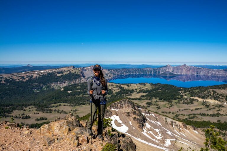
If you’ve ever been to Crater Lake and hiked to Mount Scott (the highest point in Crater Lake National Park), this hike gave us MAJOR Mount Scott vibes.
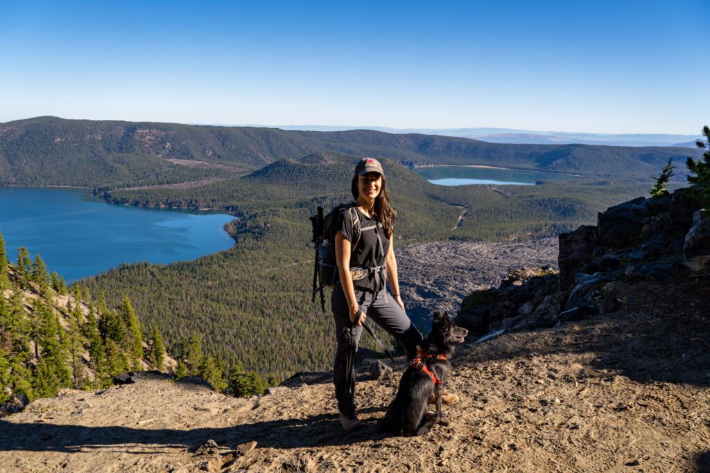
The end point is the highest point on the Newberry Volcano, and from the top you have sweeping views of Central Oregon, including the Three Sisters, Bachelor, Mount Jefferson, and even Mount Hood in the distance (on a clear, smoke-free day anyway).
The first thing you should know about this hike is that you can drive all the way up to the final viewpoint of the hike, but it’s a washboard gravel road with lots of switchbacks.
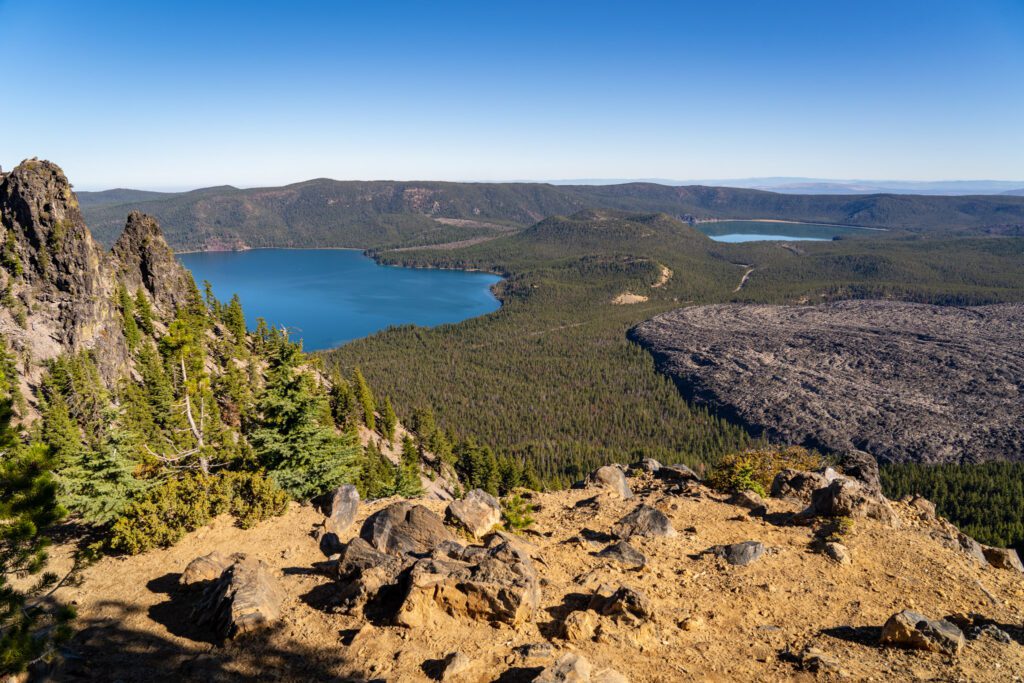
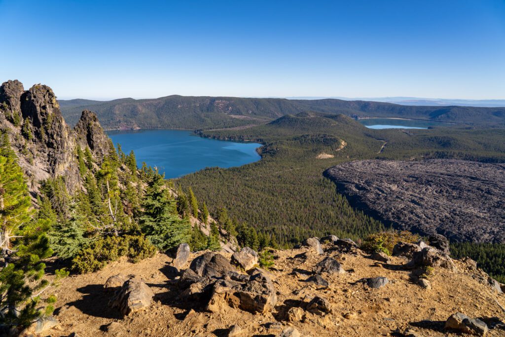
The other thing to know is that the best views of the hike are from the trail just before the top, where you have a view out over the two lakes, the vast lava field, all with the Three Sisters and Broken Top looming in the distance. Which makes this hike worth it, we think.
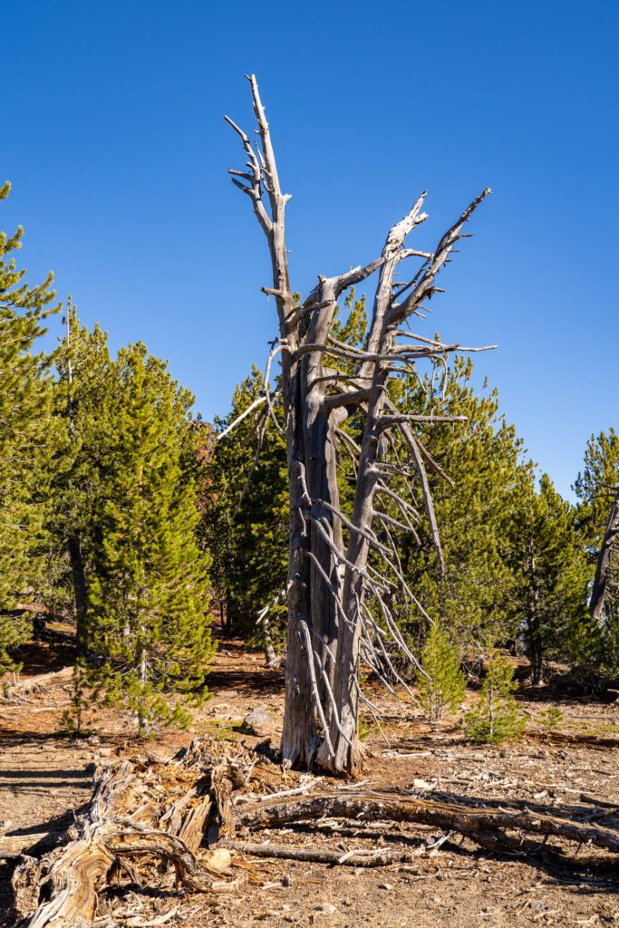
There are some cool Whitebark Pine on the way up too, which are facing some serious danger and honestly haven’t been able to catch a break over the past hundred or so years, with all sorts of fungi and killer beetles taking a crack at them (not to mention climate change).
There is a series of interpretive signs about them along the last quarter mile of the trail.
It’s not an easy hike by any definition. In fact, the middle mile of the climb up is straight up HARD. We rounded a corner and remarked “oh, here’s the first switchback,” expecting to find many, many more.
Instead, it was just a long, brutal, steep climb with no switchbacks in sight for the next stretch of trail.
However, by the time you make it up to the rim of the caldera, the views of the two lakes – Paulina Lake and East Lake – make the effort worth it.
Pro-tip: You can cut two miles off of the hike – two boring miles, if we’re being honest – by parking at the small gravel lot about a mile up the forest road towards the peak. It’s roughly here on Google Maps.
The West Metolius River Trail (Deschutes National Forest)
- Length: 7.3 miles
- Elevation Gain: 262 ft.
- Trail Type: Out and Back
- Difficulty: Easy
- Dog Friendly? Yes, on a leash
- Pass Required: None
- Wilderness Permit: None
- Trailhead Location
- Distance / Drive Time from Bend: 37 miles / 1 hour
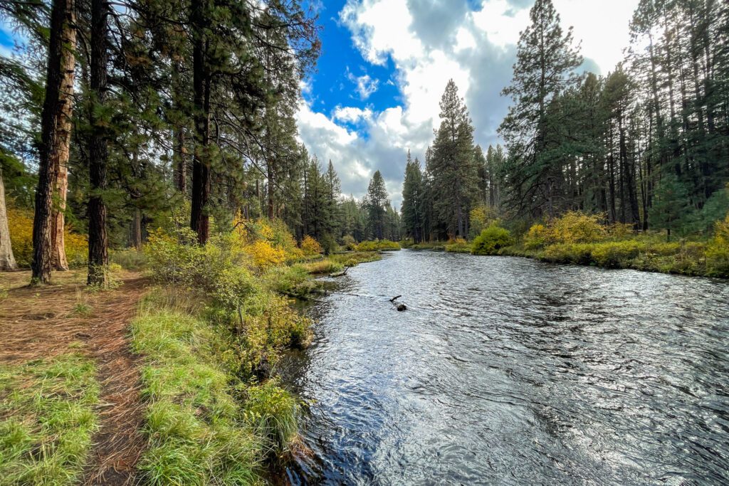
Similar to the Deschutes in Bend itself, the Metolius River – one of the largest spring fed rivers in the country (you can see where it originates here) makes for a nice easy stroll with friendly fly fishermen and massive Ponderosa Pines to keep you company. We really enjoyed this “hike,” and it left us wanting more.
Our hike along the Metolius River came on a day where it had been pouring rain for nearly 24 hours, and Alysha, myself, and the dog were all going stir a little stir crazy being cooped up inside.
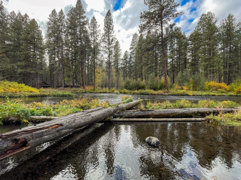
At the first sign of a break in the rain, we headed up from our cabin at the Suttle Lake Lodge to do some exploring along the banks of the Metolius River.
After some time spent wandering along the banks of the river, interacting with cheerful fly fishermen who, despite limited success so far, were still optimistic about their chances of catching a big one, and admiring the towering Ponderosa pine trees lining the river, I think we’re in love.
“How do we get one of these cabins?” Alysha asked as we walked the river (spoiler: the answer is to either have bought them many years ago, or be far more wealthy than we are).
A couple of things to know here.
First of all, the Metolius Preserve IS NOT where you find the Metolius River (though it is a lovely bird watching area). We know because we accidentally headed here, only to find no Metolius River in sight.
Instead, head to Camp Sherman and either park at the fish viewing platform, which is what we did, or continue up to the West Metolius Trailhead (here on Google Maps) which takes you to a less-trafficked, more wild stretch of the river.
This trail is very customizable, and you can basically do as much or as little of it as you want. However, there are only a few crossing points, which means you will have to go a certain distance if you want to make it a loop versus an out-and-back.
There are a whopping ELEVEN forest service campgrounds along the river, and this will be a prime spot for us to come back to in the future to use as a home base.
Canyon Meadows to Three Fingered Jack (Mount Jefferson Wilderness)
- Length: 7.5 miles
- Elevation Gain: 1,253 ft.
- Trail Type: Loop
- Difficulty: Moderate
- Dog Friendly? Yes, on a leash
- Pass Required: Northwest Forest Pass or America the Beautiful Pass
- Wilderness Permit: If you are hiking this trail between June 15th and October 15th, you will need a Central Cascades Wilderness Permit for the “Mt. Jefferson – Jack Lake Trailhead (Canyon Creek Meadows).”
- Trailhead Location
- Distance / Drive Time from Bend: 47 miles / 1 hour 15 minutes
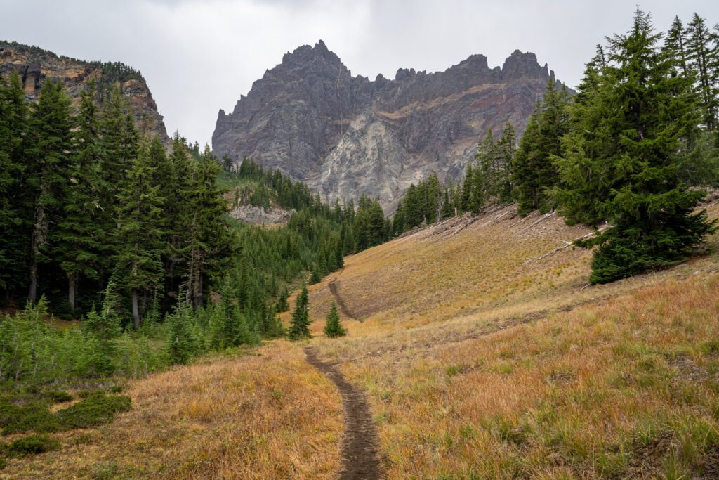
We did this hike on a drizzly Monday morning in early October, and we saw less than 15 other people on the trail along with four mountain goats, which is a pretty solid ratio, we’d say.
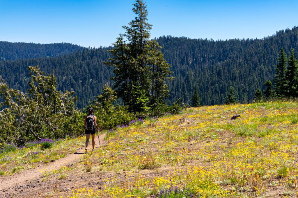
What we noticed as we hiked was the fact that this hike would be excellent in late July / early August thanks to the plethora of wildflowers lining the vast meadows near the top.
Obviously they were well past their peak in October (read: very, very dead), but on the way down we made tentative plans to return next summer to see them in full bloom.
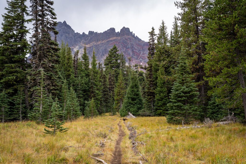
This hike starts from the Jack Lake Trailhead and winds its way up through a pine forest, ending with a steep ascent that takes you to the base of Three Fingered Jack.
The road to the trailhead is gravel, but was recently re-graded (as of fall 2023) and was one of the better forest roads we’ve ever driven on. In fact, the gravel parts of the road were better than the deteriorating paved section in the middle.
The hike itself is a little confusing. It’s essentially two lollipops put together.
The first lollipop is from the trailhead up to the meadows (and back), and the second lollipop takes you from the high meadow up into the basin of Cirque Lake at the base of Three Fingered Jack, and then up and around a saddle for great views of the peaks of the Cascades to the north.
The vast majority of this hike is a nice, easy stroll through the forest, with a very moderate (bordering on easy) ascent up through the forest and meadows.
The only difficult part of this hike is the ascent from the meadows up to the lake and saddle, which climbs roughly 1,000 feet over the course of a mile on a steep, rocky, slippery trail. Be very careful here, especially on the way down.
Keep an eye out for mountain goats on the way up to the lake! We saw a group of four hanging out here. And by “we” I mean Alysha and I, because despite smelling them, Lupine had no idea they were there.
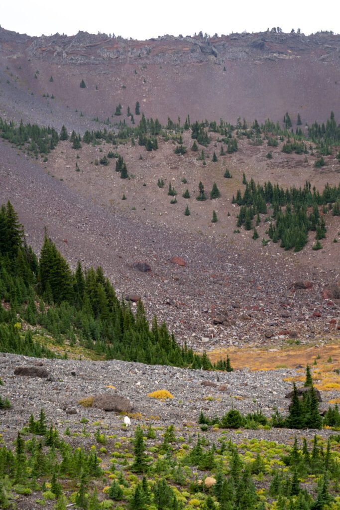
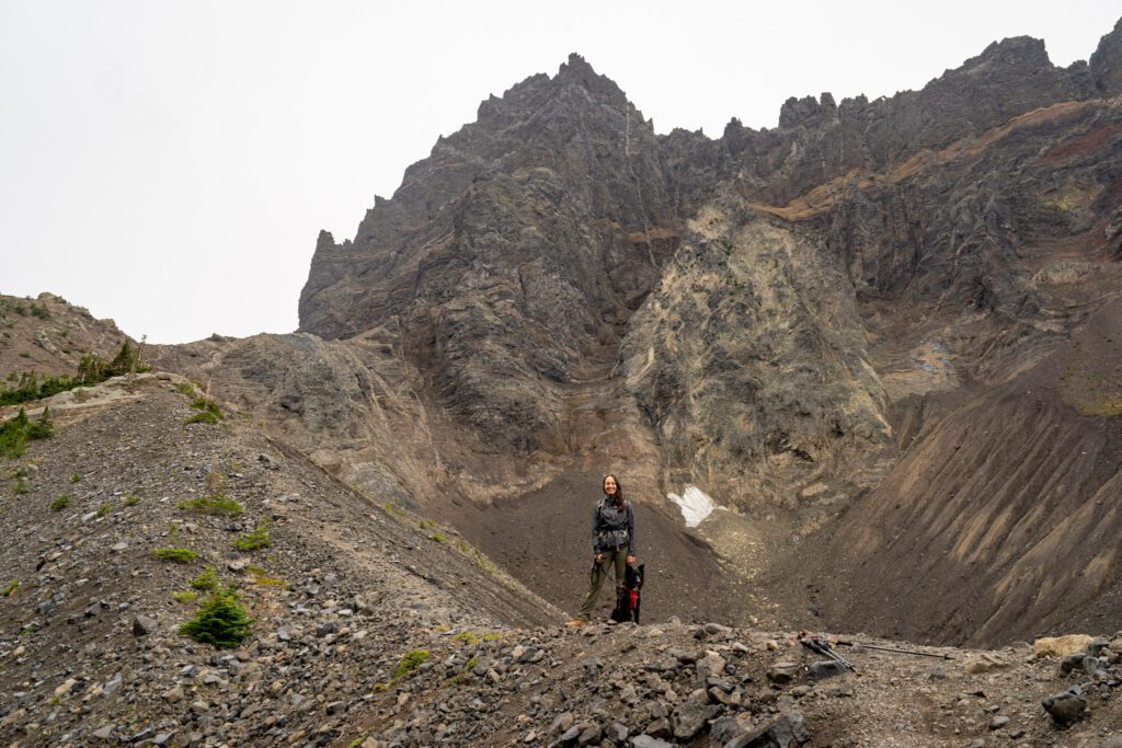
The first half of the tough ascent takes you up a gully to the rim above Cirque Lake, with Three Fingered Jack’s rugged, rocky (and, surprisingly, red) crags towering above you.
It was raining on the day we hiked it, so the lake was a muddy mess, but during clear dry weather it’s a beautiful turquoise color.
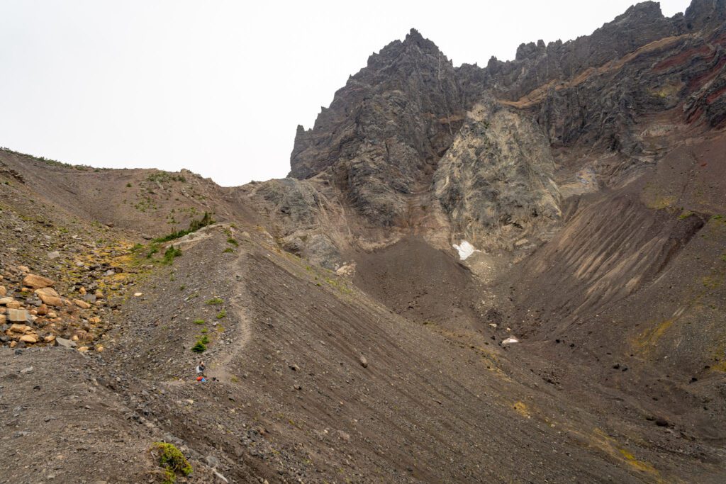
The second half of the ascent up to the saddle follows an unmaintained trail up a rocky spine.
We decided to skip this section on account of the rain, which made both climbing and descending tricky with a leashed dog in tow, but we would have absolutely made the climb on a dry, clear day.
From the top, you have nice views to the north of the Sisters.
Overall, it was a lovely hike. Both Matt and the dog got stung by yellowjackets at the very end of the hike, which was a bit of a sour note to end on (Matt here, currently typing with a very swollen, itchy middle finger), so keep an eye and ear out as you hike.
Iron Mountain / Cone Peak Loop (Willamette National Forest)
- Length: 7.1 miles
- Elevation Gain: 1,740 ft.
- Trail Type: Loop
- Difficulty: Moderate
- Dog Friendly? Yes, on a leash
- Pass Required: Northwest Forest Pass or America the Beautiful Pass
- Wilderness Permit: None
- Trailhead Location
- Distance / Drive Time from Bend: 60 miles / 1 hour 15 minutes
Though it’s a bit of a drive from Bend, if you’re in Bend in early-to-mid July and you’re on the hunt for some of the best wildflowers in the state, it’s worth driving out on Highway 20 to Iron Mountain and Cone Peak.
We stumbled upon this trail on our first true exploration of Oregon, where we spent two months in our Honda Odyssey camping our way around the state, and this trail blew our socks off with both the views of Mount Washington and the Three Sisters and the wildflowers on display.
The hike starts (if you’re going clockwise, which is what we’d do) with a climb up to the Iron Mountain summit, which is a series of steep, tight switchbacks. But the view from the summit makes the sweat here worth it, especially on a clear smoke-free day.
From there, it’s essentially all downhill back to the trailhead, which is part of the reason why we like this hike so much. You get the vast majority of the climbing done early, then you coast all the way back down with wildflowers and views to keep you company.
The other reason we like it is that you’re unlikely to see more than ten other people while you’re out there. It’s pretty far from every major metro area (at least an hour from both Bend and Eugene), so not many people make it out here.
But you should because we truly think this hike is among the best hikes in Oregon, especially in the summer when the wildflowers are blanketing the hills and switchbacks.
BONUS: Other Hikes that are on Our List
When it comes to hiking near Bend, it seems like the options are nearly limitless between the national forests, national monument, and state parks nearby.
We haven’t done every hike on our list yet, so we’re going to use this section to include a few other hikes that we haven’t personally done yet, but have on our list for future trips.
The intention here is to give you the full picture, even if we haven’t gotten to every single potential hike just yet (we’ll get there!).
Black Butte Trail: We loved staying at the Suttle Lodge along Highway 20 near Sisters, which is essentially across the road from Black Butte. This is a thigh burner, climbing 1,500 feet in about two miles, but has some excellent views of the surrounding peaks. The day we were planning to do it was drizzly and foggy, so we decided against it since the payoff is great, sweeping views. Head to Alltrails for more trail information.
Proxy Falls: This hike is at the beginning of our favorite scenic drive in the state, the McKenzie River Scenic Byway. It’s a cascading waterfall (similar to Ramona Falls, one of our favorite hikes near Mount Hood), and the hike to reach it is short and sweet. Head to Alltrails for more trail information.
Tam McArthur Rim: The reason we know about this trail is because it’s an alternate way to get to Broken Top and No Name Lake. The hike takes you up to the Tam Mcarthur Rim (which you might have guessed based on the name, I suppose) where you’ll have sweeping views to the north, including Three Creek Lake below and the peaks of the Cascades in the distance. We had a permit to do the hike to Broken Top from here, but it was foggy and snowing up at the top on the day we were supposed to do it, so we opted to skip it. Head to Alltrails for more trail information.
Our Favorite Bend Hikes, Mapped
As promised, here are the hikes mentioned above plotted on a map so that you can visualize the geography.
Central Cascades Wilderness Permits: What You Need to Know
The most important thing to know about hiking in and around Bend is that you will need to reserve a day use permit for most of the popular hiking trails near Bend between June 15th and October 15th.
We were talking about this approach on one of our hikes. Bend has seen pretty continuous population growth, particularly over the past few years with the rise of remote work.
Combine that growth with a rise in interest from tourists seeking the plethora of outdoor recreation opportunities and high number of breweries per capita (among other amenities in the city itself) and you’ve got a recipe for overwhelmed infrastructure, particularly at the most popular trailheads.
This permit system is the first iteration in Bend’s journey to attempt to minimize the human impact on these beautiful places, which will cease to be beautiful and wild if humans are allowed to run roughshod over them with no regulations.
We’ve experienced many, many versions of this system over the course of living in a Honda Odyssey and visiting all of the national parks in the western United States over the course of a few years.
Honestly, Bend’s system is among the most efficient and user-friendly we’ve seen (ever tried to make a national park reservation six months in advance? It’s a nightmare).
Does it mean a little extra planning in order to do the hikes you want to do? Yes.
Does it mean that you might miss out on a hike because you couldn’t get a permit? Potentially. We missed out on Broken Top on our latest trip for that reason.
However, we think it’s ultimately worth it in the long run to protect the places we play. There are also plenty of great hikes near Bend that don’t require a permit at all, which we’ll cover in this guide.
With that preamble out of the way, here’s what you need to know.
Keep in mind that this information is based on the 2023 season, which is when we experienced it last. Things may change for 2024 and we’ll do our best to update it as soon as we know what next year will bring, but it’s always best to go directly to the source (which we will link to several times below).
What Trailheads Require a Central Cascades Day Use Permit?
There are 19 trailheads that require a day use permit, and they are concentrated in the Mount Jefferson, Mount Washington, and Three Sisters Wilderness Areas.
Most of the most popular hikes in the central Cascades are represented in the list of trailheads that require a permit. You can find a full list here.
How Do You Reserve a Central Cascades Day Use Permit?
You will need to know a couple of things before you can reserve a permit; the date you want to hike, the trailhead you want to leave from, and the number of people in your group (each person needs a permit, but they can be grouped together and all reserved at once).
Once you know all of that, you’ll head to Recreation.gov to make your reservation.
Permits are released in multiple stages on a rolling basis, which is much, much better than releasing them all at once six months in advance (like campsites in national parks).
The first batch is released 10 days in advance at 7:00am PST, and the rest are released two days in advance at 7:00am PST.
A day use permit costs $1 per person, and it is nonrefundable.
Here’s a helpful video from the Forest Service that walks through the process.
What About Overnight Permits?
In addition to the day hike options, there are some great overnight trips near Bend too. If you want to spend a night in the backcountry, you’ll need a Central Cascades Overnight Permit, which works slightly differently from the day use permits.
First of all, roughly 40% of permits are released on the first Tuesday in April at 7:00am PST. The rest are released on a rolling basis seven days in advance of the start date at 7:00am PST.
Second, they cost $6 per group.
You need to reserve an overnight permit for ALL overnight trips into the Mount Jefferson, Mount Washington, and Three Sisters Wilderness.
You can reserve your overnight permits on Recreation.gov (you’ll need to make an account), and find more information on the Forest Service website.
The Best Time to Visit Bend for Hiking
The best time to hike near Bend is going to be from mid-July through mid-October, which is when all of the roads and trails are most likely to be snow-free and accessible.
Remember that many of these hikes are at higher elevations than us sea level dwellers are used to, so the season is going to be noticeably shorter.
That’s not to say that there aren’t a few trails that are easily accessible outside of that window, OR that there aren’t some good snowshoeing routes in the winter and early spring.
But if your intent is to come to Bend to tackle some of the best hikes in Oregon, then you’ll want to time your trip for the summer and early fall.
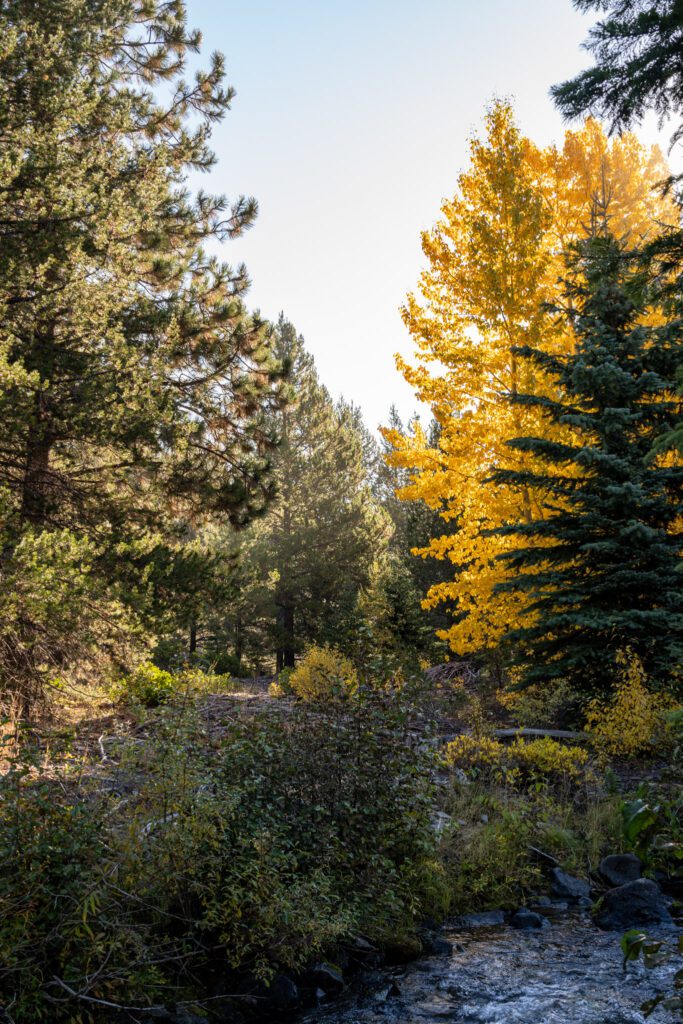
Within that short period, there are smaller windows to consider for things like wildflowers and fall color.
Late July and early August are the best times for wildflowers, and late September into early October is generally the best time for fall color, though the period for each shifts by a few weeks each year depending on the weather patterns in the spring and summer.
With all that being said, there is one last thing we need to talk about: forest fires. Over the past several summers, there is usually at least one big fire that affects the area near Bend.
The result is a dense layer of smoke that lingers for weeks at a time, obstructing views and making it somewhat unhealthy to be spending too much time outside.
There’s no way to know if or when that will happen, but it’s something that you’ll want to keep an eye on, especially as fire season becomes longer and longer as things get hotter and drier.