
Hiking the Amazing Tamanawas Falls Trail: A Complete Guide
The Tamanawas Falls trail had been on our list for a little while before we actually hiked it, but the location on the far side of Hood from Portland made it a little hard to reach. When we found ourselves planning a trip to Mt. Hood in early July to do some hiking, we realized that we’d be camping just 20 minutes away from the trailhead and jumped at the opportunity to see one of the best waterfalls in Oregon.
Let me just say it up front: the hike to Tamanawas Falls blew our expectations out of the water and earned itself a spot on our list of the best hikes near Mt. Hood (and the best hikes in Oregon, too).
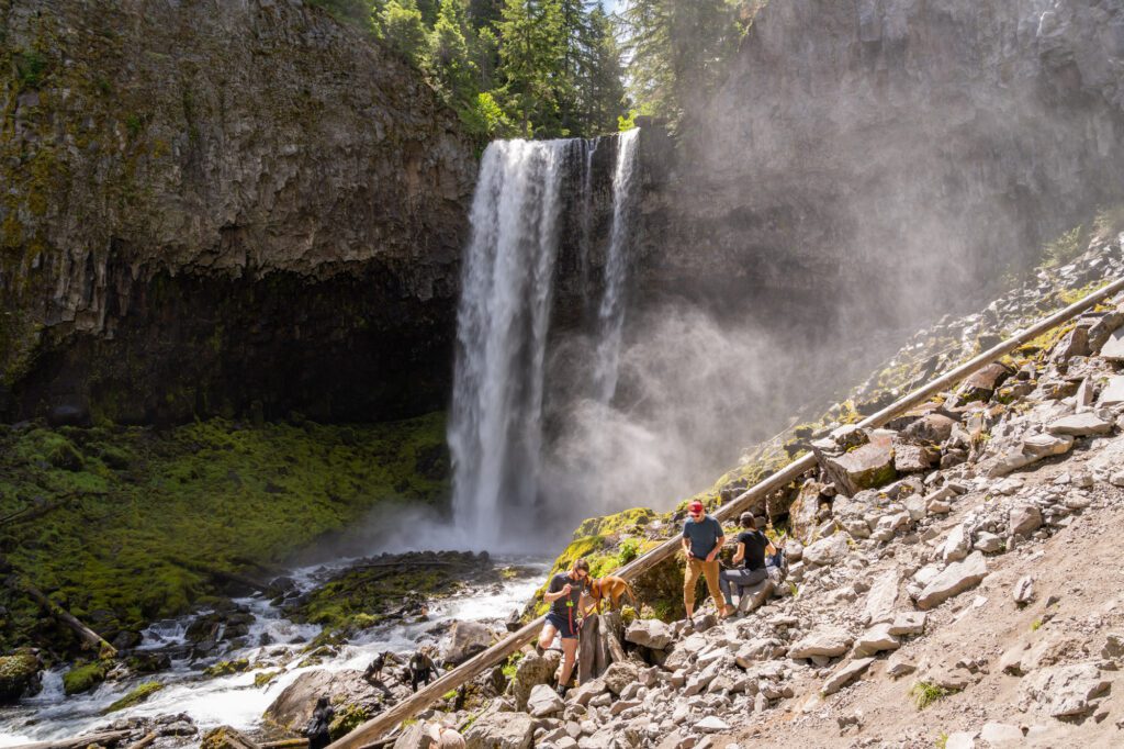
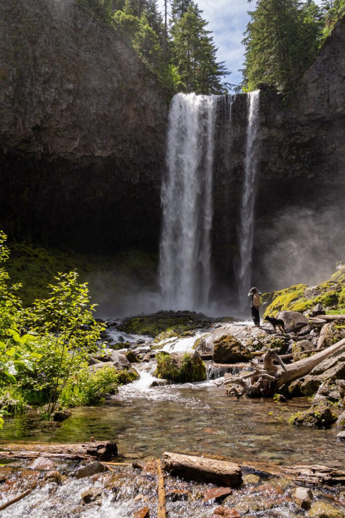
The reward for the relatively small effort is a towering waterfall plunging off of a rocky shelf and into Cold Spring Creek 110 feet below. On the hottest summer days – remember, you’re on Hood’s eastern flank here, which is decidedly warmer than western Oregon – the mist from the falls is a lovely respite.
The trail itself is nice too. Most of the trail follows either the river or a smaller creek, which will surround you with the comforting sound of a babbling brook. Plus, there are a couple of cool wooden bridges to cross along the way.
In this guide, we’re going to give you all of the information you need to hike the Tamanawas Falls Trail, including details on parking (spoiler: avoid a ticket by parking in the marked parking lot!), bathrooms at the trailhead, and a trail report from our hike, so that you’re prepared when you hit the trail.
Disclaimer: Some of the links in this post, like hotel and vacation rental links, are affiliate links, meaning at no additional cost to you we make a little bit of money if you click through and book. That being said, we would absolutely never recommend something to you that we don’t stand behind 100%.
Tamanawas Falls: Trail Details
- Length: 3.4 miles
- Elevation Gain: 600 feet
- Season: April – November/December
- Trail Type: Out and Back
- Difficulty: Moderate
- Trailhead Location
- Dog Friendly: Yes, on a leash
- Pass Required: Northwest Forest Pass ($5 day pass envelopes available at trailhead) or America the Beautiful Interagency Pass
The Route
In this guide, we’re going to cover the direct route from the Tamanawas Falls Trailhead (right on Highway 35) up to the falls and back, which is an out-and-back hike.
However, that’s not the only way to reach the falls.
You can make this hike a loop by connecting with the Elk Meadows Trail (after you’ve done the falls) and heading north to the Polallie Trailhead before following the river back to the main trailhead.
Here’s a guide to that loop hike, which ends up being 4.2 miles and 850 feet of elevation gain when it’s all said and done.
Is This an Easy Hike?
I’ve seen a lot of reviews of this trail that call it an easy hike, and I’m not quite sure that I completely agree with that assessment.
We hiked this trail with two friends, and I asked them to rate the difficulty on a scale of 1-10.
The consensus was that it was generally a 3/10, firmly in the easy category, EXCEPT for the short but steep climb through the rocky boulder field just before you reach the falls, which makes it a 4/10.
This hike is on the easier side of moderate. It’s doable for most people, including families with kids, but you’ll want to be careful on that rocky section.
You shouldn’t avoid doing this hike because of that section, but you’ll want to be sure you know it’s coming and prepare accordingly. Take it slow, wear proper footwear (no flip-flops!), and you’ll likely be fine.
If you’re on the fence, the reward is well worth braving that short section, at least in our opinion.
When to Hike to Tamanawas Falls
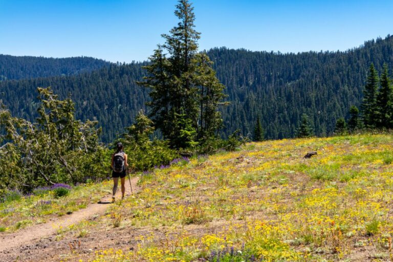
One of the nice parts about this trail is that it is largely accessible for three seasons, spring to fall. Even in winter, the trail makes a good snowshoe outing.
In the spring and early summer, the waterfall is raging. If we had to pick a “best” time to hike it, we’d go with late May through June.
Getting to the Tamanawas Falls Trailhead
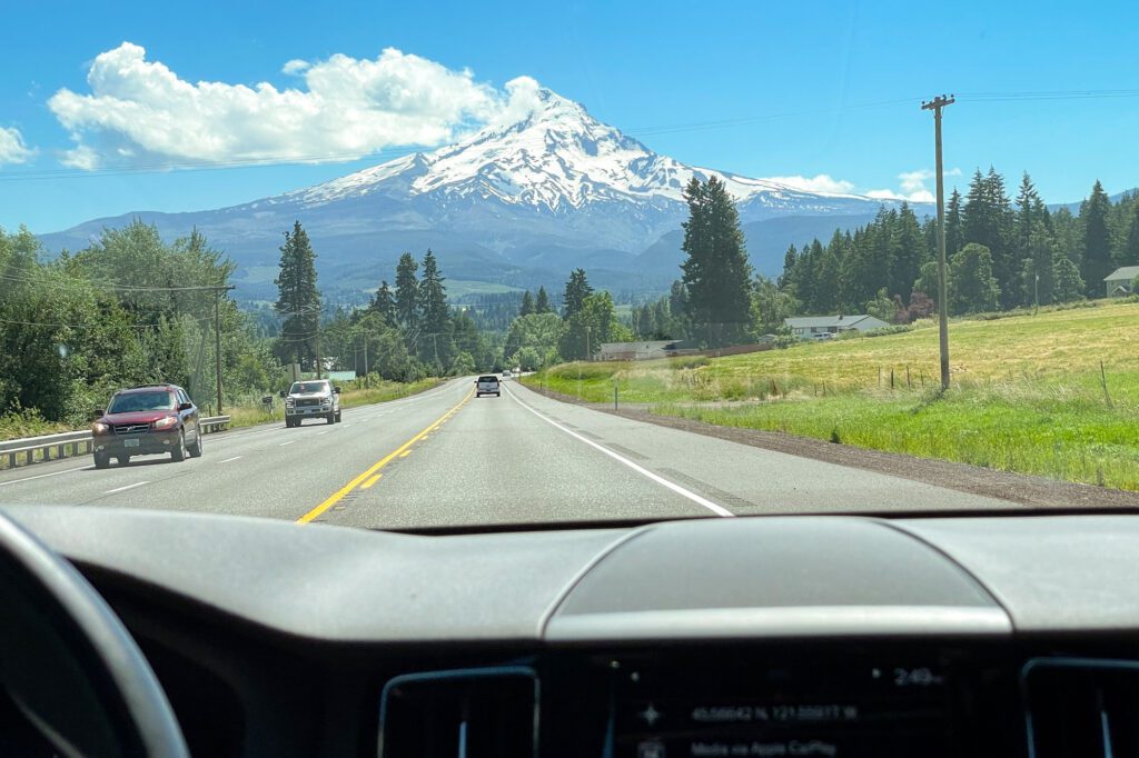
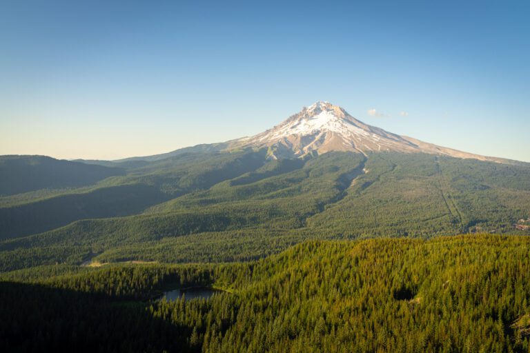
This hike is in Mt. Hood National Forest, on the eastern side of the iconic mountain. The Tamanawas Falls trailhead is right on Highway 35, which runs along the eastern flank of Mt. Hood between Hood River and the junction with Highway 26 near Government Camp.
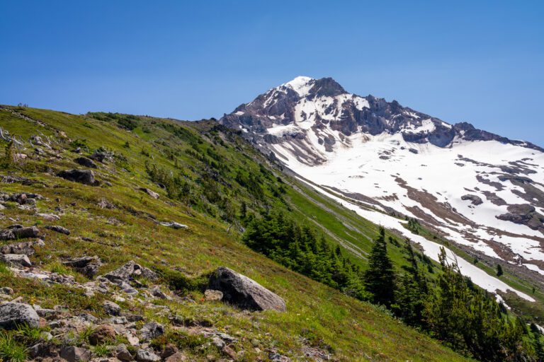
From Hood River, hop on Highway 35 south and follow it for 25 miles (about 30 minutes, depending on traffic). There are some truly spectacular views of Mt. Hood along this drive, especially as you hit the south end of the Hood River Valley.
From Government Camp, on the southern side of Mt. Hood, follow Highway 26 East to the junction with Highway 35, and follow Highway 35 to the North towards Hood River. You’ll climb up to Barlow Pass, pass Mt. Hood Meadows (one of the state’s best ski resorts), and descend down to the trailhead. All-in, it’s an 18 mile drive. We’d recommend a stop at Mt. Hood Meadows to check out Umbrella Falls on the way back, if you have the time!
There are two pit toilets at the trailhead, along with a nice shaded picnic area with a couple of (surprisingly big) picnic tables.
Parking at the Trailhead
When we arrived, there were exactly zero parking spots in the main lot just off of the highway. So we turned around and started looking for parking along the road south of the trailhead.
We found a section that was half full of other cars with the same idea, but paused when we saw that there were pretty clear no parking signs along that section of the highway. We decided it wasn’t worth the risk of a ticket, and headed back to the parking lot. We ended up waiting about three minutes before we were able to snag a spot.
Good thing we didn’t park on the side of the highway, too, because on our way back towards Government Camp we saw a Forest Service truck making the rounds and handing out tickets.
The moral of the story? Only park at the main Tamanawas Falls trailhead, or you’ll risk a ticket (or a tow, if the ranger is feeling really cranky, though that’s pretty unlikely).
Trail Report: Hiking the Tamanawas Falls Trail
We hiked this trail at around 11:00 am on a Saturday in early July. Usually, we’d opt for an earlier start, but we were moving slowly and coming from near Government Camp, so we got a little bit of a late start.
When we do it again, we’ll try to start by 9:00 am at the latest for the best light and conditions at the falls, and for the relative solitude that comes with an early start.
We’re going to split this trail into three distinct parts to make it easier to understand what to expect. We’ll start with the initial ascent, then move on to the part of the trail that follows the river, and end with the final ascent to the falls.
For each, we’ll give you mileage, elevation gain, and a description of that section of the trail so that you’re prepared and know exactly what to expect on your hike.
The Initial Ascent
Length: 0.6 miles // Elevation Gained: 100 feet
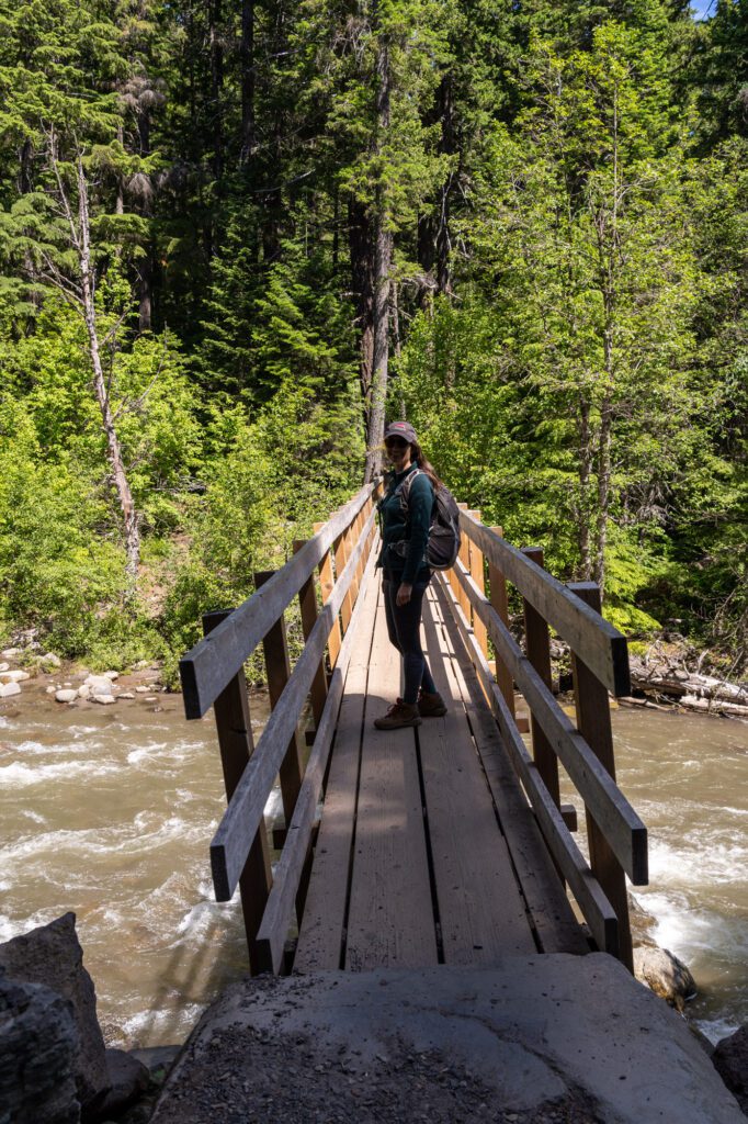
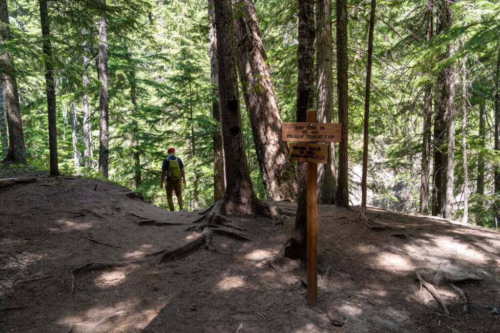
This initial section starts and ends with a wooden bridge suspended over a river. From the parking lot, cross over the bridge to get to the other side of the East Fork of the Hood River. You’ll reach a fork on the other side of the bridge – head right and follow the East Fork trail into the forest.
This section of trail has a few short uphill sections, but by the end of the first half mile you’ll basically be at the same elevation as when you started. You’ll hit a fork in the trail – head left to continue onwards to the falls. If you go right here, it takes you along the river towards the Polallie Trailhead, which is the section you’d hike if you wanted to make this a loop.
To end this section, you’ll briefly head downhill to get to the river level, where you’ll cross over a picturesque wooden footbridge.
The Middle Section: Following the River
Length: 0.6 miles // Elevation Gained: 250 feet
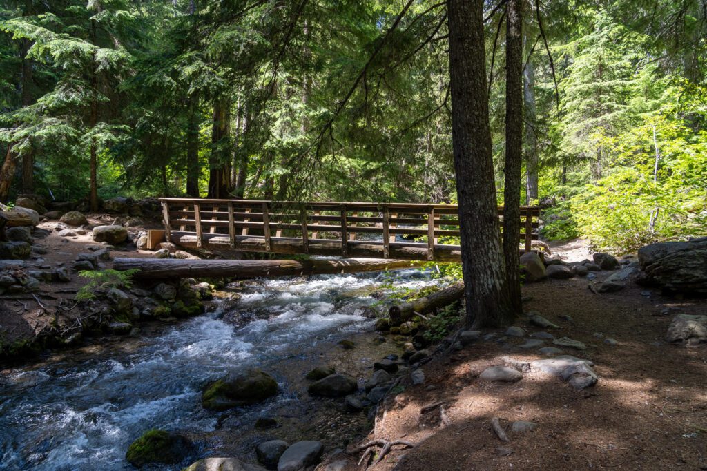
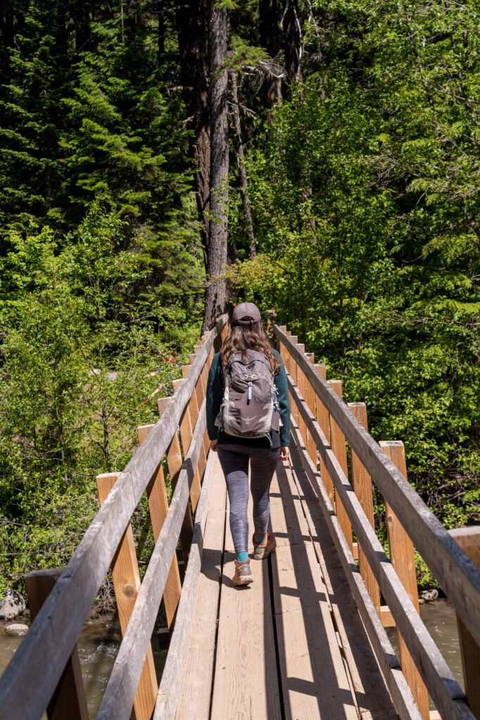
The middle section of this hike begins with a wooden footbridge that crosses the North Fork of Cold Spring Creek. From there, it’s a pretty steady uphill grade. However, this part of the hike is nice because it’s shaded and right along the creek.
There’s something inherently relaxing about the sound of running water while you’re hiking, the only downside being the fact that it makes you have to pee.
You’ll hike through a dense forest of various types of pine trees, including some Douglas Firs.
You’ll know you’ve hit the end of this section when you reach the base of a relatively steep and rocky uphill section.
The Final Ascent: A Tricky Rocky Section
Length: 0.5 miles // Elevation Gained: 250 feet
There’s no getting around it: the closer you get to the falls, the harder this hike gets.
At the beginning of this section, you’ll tackle the hardest part of the hike; a short, relatively steep climb through a boulder field.
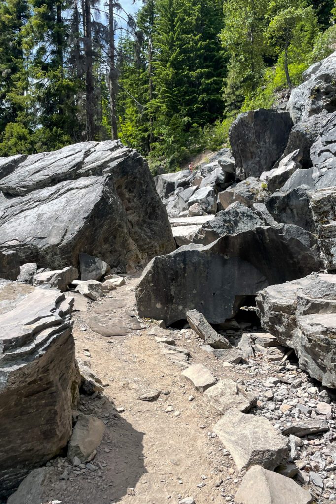
Alysha, a very experienced hiker wearing hiking boots, actually slipped on the slick rocks on the way back down. Luckily, she walked away with just a sore butt (and a gnarly purple bruise), but it could have been much worse.
Be careful, and make sure you’re wearing proper footwear (hiking shoes or boots are best, trail runners are doable, flip flops are a no-go). I wouldn’t let this part of the trail scare you off, but I would be prepared for it and take it slow.
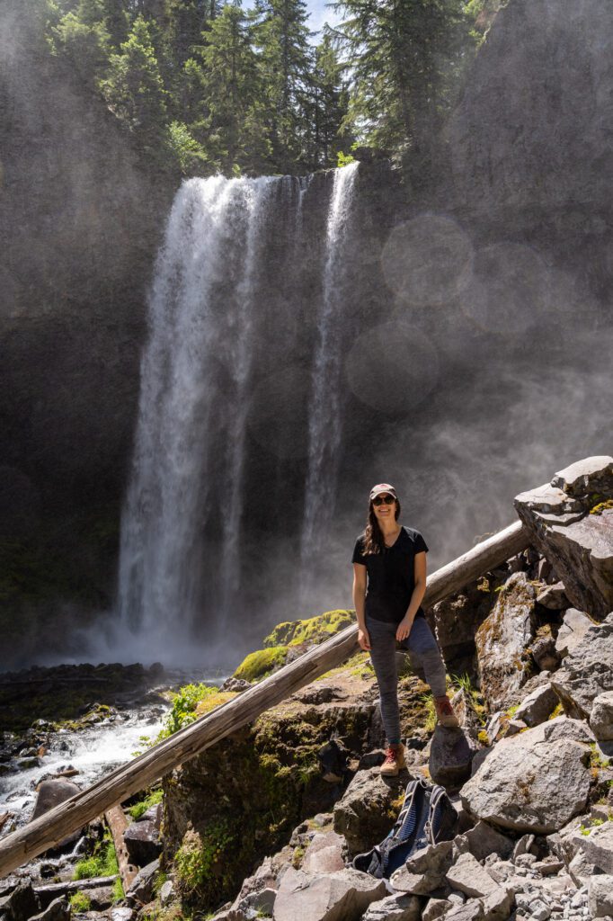
Follow the trail up through that boulder field, and you’ll round the corner and start to hear your first echoes of the falls tumbling 110 feet down into the creek below. Just before you reach the falls themselves, there’s an excellent view of the falls from afar. It looks like this!
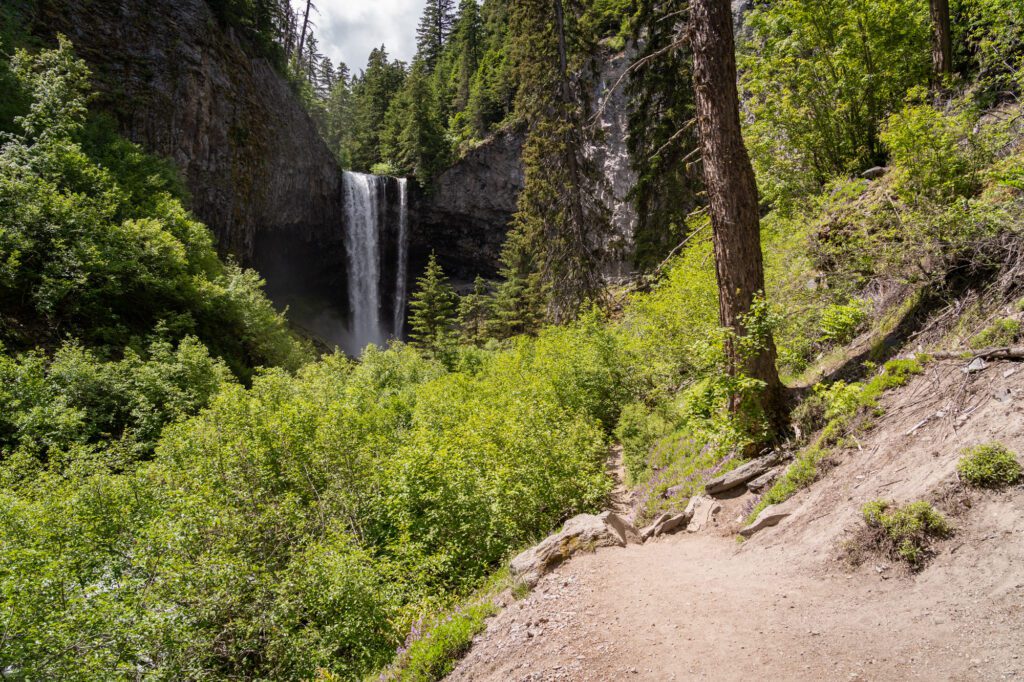
From there, you’ll climb down to the base of the falls. If you’re brave and sure-footed, you can head up the hill to the right side of the falls to get a better view.

Typo. I noticed: In your directions from Hood River, you stated Hwy 30, when it’s actually Hwy 35.
Whoops – you’re totally right! Thanks for the heads up – fixed.